 |
|
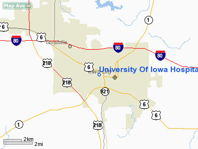
University Of Iowa Hospitals And Clinic Heliport |
|
|
Location &
QuickFacts
|
FAA
Information Effective: |
2007-07-05 |
|
Airport
Identifier: |
1IA7 |
|
Airport
Status: |
Operational |
|
Longitude/Latitude: |
091-32-51.6060W/41-39-36.0580N
-91.547668/41.660016 (Estimated) |
|
Elevation: |
840 ft / 256.03 m (Estimated) |
|
Land: |
20 acres |
|
From
nearest city: |
0 nautical miles W of Iowa City, IA |
|
Location: |
Johnson County, IA |
|
Magnetic Variation: |
02E (1985) |
Owner & Manager
|
Ownership: |
Publicly owned |
|
Owner: |
U Of Ia Hospitals & Clinics |
|
Address: |
1088 Carver Pavilion
Iowa City, IA 52242 |
|
Phone
number: |
319-353-6440 |
|
Manager: |
Jeffry W. Gauthier |
|
Address: |
U Of Ia Hospitals & Clinics
Iowa City, IA 52242 |
|
Phone number: |
319-356-4736 |
Airport Operations and Facilities
|
Airport
Use: |
Private
MEDICAL. |
|
Wind
indicator: |
Yes |
|
Segmented Circle: |
No |
|
Control
Tower: |
No |
|
Lighting
Schedule: |
PHONE REQ
FOR PERIMETER AND FLOOD LIGHTS CALL 319-353-6440. |
|
Landing fee charge: |
No |
|
Sectional chart: |
Chicago |
|
Region: |
ACE - Central |
|
Boundary ARTCC: |
ZAU - Chicago |
|
Tie-in FSS: |
FOD - Fort Dodge |
|
FSS on Airport: |
No |
|
FSS Phone: |
515-955-8114 |
|
FSS Toll Free: |
1-800-WX-BRIEF |
Airport
Communications
|
Runway Information
Helipad H1
|
Dimension: |
48 x 48 ft / 14.6 x 14.6 m |
|
Surface: |
CONC, Good Condition |
|
|
Runway H1
|
Runway
|
|
Traffic
Pattern: |
Left |
Left |
|
Helipad H2
|
Dimension: |
30 x 60 ft / 9.1 x 18.3 m |
|
Surface: |
CONC, |
|
|
Runway H2
|
Runway
|
|
Traffic
Pattern: |
Left |
Left |
|
Radio Navigation Aids
|
ID |
Type |
Name |
Ch |
Freq |
Var |
Dist |
|
AWG |
NDB |
Washington |
|
219.00 |
02E |
23.5 nm |
|
TZT |
NDB |
Belle Plaine |
|
371.00 |
02E |
35.6 nm |
|
MXO |
NDB |
Monticello |
|
397.00 |
01E |
37.3 nm |
|
VTI |
NDB |
Garrison |
|
338.00 |
03E |
39.8 nm |
|
OQW |
NDB |
Maquoketa |
|
386.00 |
02E |
43.1 nm |
|
MPZ |
NDB |
Mount Pleasant |
|
212.00 |
02E |
43.1 nm |
|
FFL |
NDB |
Fairfield |
|
332.00 |
03E |
43.8 nm |
|
OOA |
NDB |
Oskaloosa |
|
414.00 |
03E |
49.7 nm |
|
CID |
VOR/DME |
Cedar Rapids |
088X |
114.10 |
05E |
17.3 nm |
|
DDD |
VOR/DME |
Port City |
112X |
116.50 |
01E |
25.2 nm |
|
IOW |
VORTAC |
Iowa City |
109X |
116.20 |
05E |
9.0 nm |
|
MZV |
VORTAC |
Moline |
091X |
114.40 |
05E |
45.7 nm |
|
CVA |
VORTAC |
Davenport |
085X |
113.80 |
04E |
47.9 nm |
|
DVN |
VOT |
Davenport Municipal |
|
111.80 |
|
43.3 nm |
Remarks
-
PRVDD THAT
INGRESS/EGRESS RTES FOR HELI ARE SOUTH EAST OR WEST; THAT APCH/DEP PATHS TO
THE LNDG AREA ARE MAINTD FOR A MIN 8:1 GLIDE SLOPE; ALSO THAT THE TRSNL SFC BE
MAINTD FOR A MIN 2:1 SLOPE.
Based
Aircraft
|
Aircraft based
on field: |
1 |
|
Helicopters: |
1 |
University Of Iowa Hospitals And Clinic
Heliport
Address:
Johnson County, IA
Tel:
319-353-6440,
319-356-4736
Images
and information placed above are from
http://www.airport-data.com/airport/1IA7/
We
thank them for the data!
|
General Info |
| Country |
United
States |
| State |
IOWA
|
| FAA ID |
1IA7
|
| Latitude |
41-39-36.058N |
|
Longitude |
091-32-51.606W |
|
Elevation |
840 feet
|
| Near
City |
IOWA
CITY |
We don't guarantee the information is fresh and accurate. The data may
be wrong or outdated.
For more up-to-date information please refer to other sources.
|
|


