 |
|
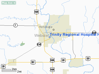
Trinity Regional Hospital Heliport |
|
|
Location &
QuickFacts
|
FAA
Information Effective: |
2007-07-05 |
|
Airport
Identifier: |
IA74 |
|
Airport
Status: |
Operational |
|
Longitude/Latitude: |
094-11-30.8610W/42-29-32.8900N
-94.191906/42.492469 (Estimated) |
|
Elevation: |
1000 ft / 304.80 m (Estimated) |
|
Land: |
0 acres |
|
From
nearest city: |
0 nautical miles N of Fort Dodge, IA |
|
Location: |
Webster County, IA |
|
Magnetic Variation: |
05E (1985) |
Owner & Manager
|
Ownership: |
Privately owned |
|
Owner: |
Trinity Regional Hospital |
|
Address: |
802 Kenyon Road
Fort Dodge, IA 50501 |
|
Phone
number: |
515-573-3101 |
|
Manager: |
Dick Rhiner |
|
Address: |
802 Kenyon Road
Fort Dodge, IA 50501 |
|
Phone number: |
515-574-6602 |
Airport Operations and Facilities
|
Airport
Use: |
Private
MEDICAL USE. |
|
Wind
indicator: |
Yes |
|
Segmented Circle: |
No |
|
Control
Tower: |
No |
|
Lighting
Schedule: |
PHONE REQ
FOR ROTG BCN AND PERIMETER LGTS CALL 515-573-3101. |
|
Beacon
Color: |
Clear-Green-Yellow (heliport) |
|
Sectional chart: |
Omaha |
|
Region: |
ACE - Central |
|
Boundary
ARTCC: |
ZMP - Minneapolis |
|
Tie-in
FSS: |
FOD - Fort Dodge |
|
FSS
Phone: |
515-955-8114 |
|
FSS Toll
Free: |
1-800-WX-BRIEF |
|
Runway Information
Helipad H1
|
Dimension: |
50 x 50 ft / 15.2 x 15.2 m |
|
Surface: |
CONC, |
|
|
Runway H1
|
Runway
|
|
Traffic
Pattern: |
Left |
Left |
|
Radio Navigation Aids
|
ID |
Type |
Name |
Ch |
Freq |
Var |
Dist |
|
EBS |
NDB |
Webster City |
|
323.00 |
03E |
14.6 nm |
|
EAG |
NDB |
Eagle Grove |
|
302.00 |
03E |
18.0 nm |
|
CAV |
NDB |
Clarion |
|
387.00 |
03E |
24.5 nm |
|
POH |
NDB |
Pocahontas |
|
428.00 |
06E |
25.3 nm |
|
EFW |
NDB |
Jefferson |
|
391.00 |
03E |
29.6 nm |
|
BNW |
NDB |
Boone |
|
407.00 |
03E |
30.3 nm |
|
AXA |
NDB |
Algona |
|
403.00 |
03E |
35.6 nm |
|
SKI |
NDB |
Sac City |
|
356.00 |
04E |
35.7 nm |
|
CIN |
NDB |
Carroll |
|
397.00 |
04E |
37.7 nm |
|
PRO |
NDB |
Perry |
|
251.00 |
06E |
39.8 nm |
|
IFA |
NDB |
Iowa Falls |
|
368.00 |
03E |
41.1 nm |
|
EGQ |
NDB |
Emmetsburg |
|
410.00 |
04E |
43.1 nm |
|
HPT |
NDB |
Hampton |
|
230.00 |
03E |
45.0 nm |
|
SLB |
NDB |
Storm Lake |
|
434.00 |
04E |
47.1 nm |
|
GCT |
NDB |
Guthrie Center |
|
518.00 |
05E |
49.9 nm |
|
FOD |
VORTAC |
Fort Dodge |
082X |
113.50 |
07E |
8.5 nm |
Remarks
-
PRVDD APCH/DEP
PATHS ARE CLEAR FOR A MINIMUM 8:1 GLIDE SLOPE; CLEAR TRANSITIONAL SURFACE TO A
2:1 SLOPE.
Trinity Regional Hospital
Heliport
Address:
Webster County, IA
Tel:
515-573-3101,
515-574-6602
Images
and information placed above are from
http://www.airport-data.com/airport/IA74/
We
thank them for the data!
|
General Info |
| Country |
United
States |
| State |
IOWA
|
| FAA ID |
IA74
|
| Latitude |
42-29-32.890N |
|
Longitude |
094-11-30.861W |
|
Elevation |
1000
feet |
| Near
City |
FORT
DODGE |
We don't guarantee the information is fresh and accurate. The data may
be wrong or outdated.
For more up-to-date information please refer to other sources.
|
|


