 |
|
|
|
|
|
Location &
QuickFacts
|
FAA
Information Effective: |
2007-07-05 |
|
Airport
Identifier: |
8C2 |
|
Airport
Status: |
Operational |
|
Longitude/Latitude: |
092-50-47.7600W/41-34-26.7600N
-92.846600/41.574100 (Estimated) |
|
Elevation: |
922 ft / 281.03 m (Surveyed) |
|
Land: |
9 acres |
|
From
nearest city: |
0 nautical miles S of Sully, IA |
|
Location: |
Jasper County, IA |
|
Magnetic Variation: |
03E (1985) |
Owner & Manager
|
Ownership: |
Publicly owned |
|
Owner: |
City Of Sully |
|
Address: |
318 - 6th Ave
Sully, IA 50251 |
|
Phone number: |
641-594-3493 |
|
Manager: |
Ken Van Soelen |
|
Address: |
Po Box 272
Sully, IA 50251 |
|
Phone number: |
641-594-3734 |
Airport
Operations and Facilities
|
Airport
Use: |
Open to public |
|
Wind
indicator: |
Yes |
|
Segmented Circle: |
No |
|
Control
Tower: |
No |
|
Landing
fee charge: |
No |
|
Sectional chart: |
Chicago |
|
Region: |
ACE - Central |
|
Boundary
ARTCC: |
ZAU - Chicago |
|
Tie-in
FSS: |
FOD - Fort Dodge |
|
FSS on
Airport: |
No |
|
FSS
Phone: |
515-955-8114 |
|
FSS Toll
Free: |
1-800-WX-BRIEF |
|
NOTAMs
Facility: |
FOD (NOTAM-d service avaliable) |
Airport Communications
Airport Services
|
Airframe
Repair: |
NONE |
|
Power
Plant Repair: |
NONE |
|
Bottled
Oxygen: |
NONE |
|
Bulk
Oxygen: |
NONE |
|
Runway Information
Runway 08/26
|
Dimension: |
2130 x 120 ft / 649.2 x 36.6 m |
|
Surface: |
TURF, Good Condition |
|
|
Runway 08
|
Runway 26
|
|
Traffic
Pattern: |
Left |
Left |
|
Displaced
threshold: |
195.00 ft |
915.00 ft |
|
Obstruction: |
58 ft tree, 1002.0 ft from runway, 133 ft right of
centerline, 17:1 slope to clear
RY 08 APCH SLOPE 20:1 TO DSPLCD THLD. |
59 ft tree, 294.0 ft from runway, 120 ft right of
centerline, 5:1 slope to clear
RWY 26 APCH SLOPE 20:1 TO DSPLCD THLD. |
|
Radio Navigation Aids
|
ID |
Type |
Name |
Ch |
Freq |
Var |
Dist |
|
GGI |
NDB |
Grinnell |
|
248.00 |
02E |
9.7 nm |
|
PEA |
NDB |
Pella |
|
257.00 |
02E |
11.0 nm |
|
OXV |
NDB |
Knoxville |
|
284.00 |
03E |
20.6 nm |
|
OOA |
NDB |
Oskaloosa |
|
414.00 |
03E |
26.5 nm |
|
TZT |
NDB |
Belle Plaine |
|
371.00 |
02E |
31.5 nm |
|
MIW |
NDB |
Marshalltown |
|
239.00 |
03E |
32.4 nm |
|
IKV |
NDB |
Ankeny |
|
275.00 |
03E |
33.1 nm |
|
CNC |
NDB |
Chariton |
|
335.00 |
05E |
40.8 nm |
|
TNU |
VOR/DME |
Newton |
072X |
112.50 |
03E |
17.3 nm |
|
JWJ |
VOR/DME |
Elmwood |
031X |
109.40 |
03E |
32.4 nm |
|
OTM |
VOR/DME |
Ottumwa |
053X |
111.60 |
06E |
40.3 nm |
|
DSM |
VORTAC |
Des Moines |
122X |
117.50 |
07E |
37.0 nm |
|
DSM |
VOT |
Des Moines |
|
109.20 |
|
37.3 nm |
Remarks
-
CLOSED WINTER
MONTHS DUE TO SNOW.
Operational Statistics
Time Period:
2006-05-24 -
2007-05-23
|
Aircraft
Operations: |
12/Week |
|
General
Aviation Itinerant: |
100.0% |
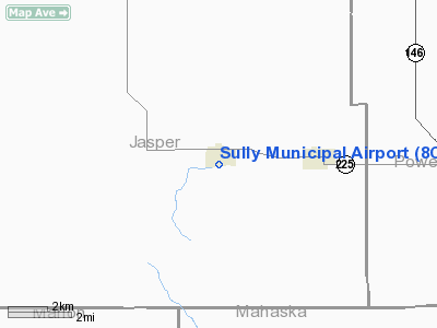
Sully Municipal Airport
Address:
Jasper County, IA
Tel:
641-594-3493, 641-594-3734
Images
and information placed above are from
http://www.airport-data.com/airport/8C2/
We
thank them for the data!
|
General Info |
| Country |
United
States |
| State |
IOWA
|
| FAA ID |
8C2
|
| Latitude |
41-34-19.984N |
|
Longitude |
092-50-50.699W |
|
Elevation |
922 feet
|
| Near
City |
SULLY
|
We don't guarantee the information is fresh and accurate. The data may
be wrong or outdated.
For more up-to-date information please refer to other sources.
|
|


