 |
|
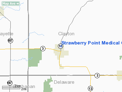
Strawberry Point Medical Center Heliport |
|
|
Location &
QuickFacts
|
FAA
Information Effective: |
2007-07-05 |
|
Airport
Identifier: |
IA43 |
|
Airport
Status: |
Operational |
|
Longitude/Latitude: |
091-31-59.5240W/42-41-30.9430N
-91.533201/42.691929 (Estimated) |
|
Elevation: |
1100 ft / 335.28 m (Estimated) |
|
Land: |
0 acres |
|
From
nearest city: |
0 nautical miles N of Strawberry Point, IA |
|
Location: |
Clayton County, IA |
|
Magnetic Variation: |
02E (1985) |
Owner & Manager
|
Ownership: |
Privately owned |
|
Owner: |
Stl Health Resources |
|
Address: |
1026 A. Ave Ne
Cedar Rapids, IA 52402 |
|
Phone
number: |
319-369-8021 |
|
Manager: |
Craig B. Thompson, D.o. |
|
Address: |
111 E. Mission St
Strawberry Point, IA 52076 |
|
Phone number: |
319-933-6277 |
Airport Operations and Facilities
|
Airport
Use: |
Private
MEDICAL USE. |
|
Wind
indicator: |
Yes |
|
Segmented Circle: |
No |
|
Control
Tower: |
No |
|
Lighting
Schedule: |
PHONE REQ
FOR PERIMETER LGTS CALL 319-933-6277. |
|
Sectional chart: |
Green Bay |
|
Region: |
ACE - Central |
|
Boundary
ARTCC: |
ZAU - Chicago |
|
Tie-in
FSS: |
FOD - Fort Dodge |
|
FSS on
Airport: |
No |
|
FSS
Phone: |
515-955-8114 |
|
FSS Toll
Free: |
1-800-WX-BRIEF |
|
Runway Information
Helipad H1
|
Dimension: |
60 x 60 ft / 18.3 x 18.3 m |
|
Surface: |
CONC, |
|
|
Runway H1
|
Runway
|
|
Traffic
Pattern: |
Left |
Left |
|
Radio Navigation Aids
|
ID |
Type |
Name |
Ch |
Freq |
Var |
Dist |
|
XWY |
NDB |
West Union |
|
278.00 |
02E |
18.7 nm |
|
OLZ |
NDB |
Oelwein |
|
260.00 |
02E |
19.6 nm |
|
IIB |
NDB |
Wapsie |
|
206.00 |
02E |
23.4 nm |
|
MXO |
NDB |
Monticello |
|
397.00 |
01E |
34.4 nm |
|
VTI |
NDB |
Garrison |
|
338.00 |
03E |
35.6 nm |
|
DEH |
NDB |
Decorah |
|
236.00 |
01E |
36.2 nm |
|
CJJ |
NDB |
Cresco |
|
293.00 |
02E |
48.3 nm |
|
PVB |
NDB |
Platteville |
|
203.00 |
01E |
48.5 nm |
|
CID |
VOR/DME |
Cedar Rapids |
088X |
114.10 |
05E |
49.6 nm |
|
UKN |
VORTAC |
Waukon |
113X |
116.60 |
05E |
35.4 nm |
|
ALO |
VORTAC |
Waterloo |
059X |
112.20 |
06E |
39.1 nm |
|
DBQ |
VORTAC |
Dubuque |
105X |
115.80 |
04E |
40.5 nm |
Remarks
-
PROVIDED APCH/DEP
PATHS HAVE 8:1 GLIDE SLOPE CLNC & TRANSITIONAL SFCS HAVE 2:1 SLOPE.
Strawberry Point Medical Center Heliport
Address:
Clayton County, IA
Tel:
319-369-8021,
319-933-6277
Images
and information placed above are from
http://www.airport-data.com/airport/IA43/
We
thank them for the data!
|
General Info |
| Country |
United
States |
| State |
IOWA
|
| FAA ID |
IA43
|
| Latitude |
42-41-30.943N |
|
Longitude |
091-31-59.524W |
|
Elevation |
1100
feet |
| Near
City |
STRAWBERRY POINT |
We don't guarantee the information is fresh and accurate. The data may
be wrong or outdated.
For more up-to-date information please refer to other sources.
|
|


