 |
|
|
|
|
|
Location &
QuickFacts
|
FAA
Information Effective: |
2007-07-05 |
|
Airport
Identifier: |
01IA |
|
Airport
Status: |
Operational |
|
Longitude/Latitude: |
090-44-28.5160W/41-39-40.1030N
-90.741254/41.661140 (Estimated) |
|
Elevation: |
725 ft / 220.98 m (Estimated) |
|
Land: |
10 acres |
|
From
nearest city: |
2 nautical miles NW of Maysville, IA |
|
Location: |
Scott County, IA |
|
Magnetic Variation: |
02E (1985) |
Owner & Manager
|
Ownership: |
Privately owned |
|
Owner: |
Otto Stender |
|
Address: |
9120 New Liberty Road
Walcott, IA 52773 |
|
Phone
number: |
319-282-4613 |
|
Manager: |
Otto Stender |
|
Address: |
9120 New Liberty Road
Walcott, IA 52773 |
|
Phone number: |
319-386-1775 |
Airport Operations and Facilities
|
Airport
Use: |
Private |
|
Wind
indicator: |
Yes |
|
Segmented Circle: |
No |
|
Control
Tower: |
No |
|
Lighting
Schedule: |
PHONE REQ
FOR RWY LGTS CALL - 319-282-4613. |
|
Landing fee charge: |
No |
|
Sectional chart: |
Chicago |
|
Region: |
ACE - Central |
|
Boundary ARTCC: |
ZAU - Chicago |
|
Tie-in FSS: |
FOD - Fort Dodge |
|
FSS on Airport: |
No |
|
FSS Phone: |
515-955-8114 |
|
FSS Toll Free: |
1-800-WX-BRIEF |
Airport Services
|
Airframe
Repair: |
MINOR |
|
Power
Plant Repair: |
MINOR |
|
Bottled
Oxygen: |
NONE |
|
Bulk
Oxygen: |
NONE |
|
Runway Information
Runway 17/35
|
Dimension: |
2575 x 50 ft / 784.9 x 15.2 m |
|
Surface: |
TURF, Fair Condition |
|
Edge Lights: |
Low |
|
|
Runway 17
|
Runway 35
|
|
Traffic
Pattern: |
Left |
Left |
|
Displaced
threshold: |
275.00 ft |
0.00 ft |
|
Runway End
Identifier: |
No |
No |
|
Centerline
Lights: |
No |
No |
|
Touchdown
Lights: |
No |
No |
|
Obstruction: |
47 ft pole, 600.0 ft from runway, 160 ft right of
centerline, 12:1 slope to clear
APPR.
RATIO FROM DISP. THR 23:1 |
20 ft trees, 20.0 ft from runway, 1:1 slope to clear |
|
Radio Navigation Aids
|
ID |
Type |
Name |
Ch |
Freq |
Var |
Dist |
|
CWI |
NDB |
Clinton |
|
377.00 |
01E |
21.1 nm |
|
OQW |
NDB |
Maquoketa |
|
386.00 |
02E |
23.5 nm |
|
MXO |
NDB |
Monticello |
|
397.00 |
01E |
36.9 nm |
|
BOZ |
NDB |
Whiteside |
|
254.00 |
01E |
43.0 nm |
|
EZI |
NDB |
Kewanee |
|
245.00 |
01E |
44.8 nm |
|
AWG |
NDB |
Washington |
|
219.00 |
02E |
47.8 nm |
|
DDD |
VOR/DME |
Port City |
112X |
116.50 |
01E |
25.5 nm |
|
GBG |
VOR/DME |
Galesburg |
035X |
109.80 |
03E |
45.7 nm |
|
CID |
VOR/DME |
Cedar Rapids |
088X |
114.10 |
05E |
48.8 nm |
|
CVA |
VORTAC |
Davenport |
085X |
113.80 |
04E |
11.9 nm |
|
MZV |
VORTAC |
Moline |
091X |
114.40 |
05E |
21.0 nm |
|
IOW |
VORTAC |
Iowa City |
109X |
116.20 |
05E |
40.1 nm |
|
DBQ |
VORTAC |
Dubuque |
105X |
115.80 |
04E |
44.5 nm |
|
DVN |
VOT |
Davenport Municipal |
|
111.80 |
|
7.6 nm |
Remarks
-
RWY SURFACE ROUGH
-
ULTRALIGHT ACTVT ON ARPT.
-
WINTER MONTHS
CALL 319-282-4613 FOR ARPT CONDITIONS.
Based
Aircraft
|
Aircraft based
on field: |
7 |
|
Single Engine
Airplanes: |
6 |
|
Ultralights: |
1 |
Operational Statistics
Time Period:
1984-11-21 -
1985-11-20
|
Aircraft
Operations: |
12/Week |
|
General
Aviation Local: |
83.3% |
|
General
Aviation Itinerant: |
16.7% |
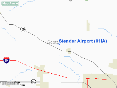
Stender Airport
Address:
Scott County, IA
Tel:
319-282-4613,
319-386-1775
Images
and information placed above are from
http://www.airport-data.com/airport/01IA/
We
thank them for the data!
|
General Info |
| Country |
United
States |
| State |
IOWA
|
| FAA ID |
01IA
|
| Latitude |
41-39-40.103N |
|
Longitude |
090-44-28.516W |
|
Elevation |
725 feet
|
| Near
City |
MAYSVILLE |
We don't guarantee the information is fresh and accurate. The data may
be wrong or outdated.
For more up-to-date information please refer to other sources.
|
|


