 |
|
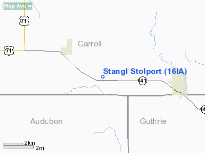
Location &
QuickFacts
|
FAA
Information Effective: |
2007-07-05 |
|
Airport
Identifier: |
16IA |
|
Airport
Status: |
Operational |
|
Longitude/Latitude: |
094-46-38.0200W/41-52-50.9500N
-94.777228/41.880819 (Estimated) |
|
Elevation: |
1230 ft / 374.90 m (Estimated) |
|
Land: |
0 acres |
|
From
nearest city: |
5 nautical miles W of Coon Rapids, IA |
|
Location: |
Carroll County, IA |
|
Magnetic Variation: |
04E (2000) |
Owner & Manager
|
Ownership: |
Privately owned |
|
Owner: |
Royce Stangl |
|
Address: |
26321 Hwy 141
Coon Rapids, IA 50058 |
|
Phone number: |
712-683-5752 |
|
Manager: |
Royce Stangl |
|
Address: |
26321 Hwy 141
Coon Rapids, IA 50058 |
|
Phone number: |
712-683-5752 |
Airport Operations and Facilities
|
Airport Use: |
Private |
|
Wind indicator: |
Yes |
|
Segmented Circle: |
No |
|
Control Tower: |
No |
|
Sectional chart: |
Omaha |
|
Region: |
ACE - Central |
|
Boundary ARTCC: |
ZMP - Minneapolis |
|
Tie-in FSS: |
FOD - Fort Dodge |
|
FSS Phone: |
515-955-8114 |
|
FSS Toll Free: |
1-800-WX-BRIEF |
Airport
Communications
|
Runway Information
Runway 18/36
|
Dimension: |
2400 x 60 ft / 731.5 x 18.3 m |
|
Surface: |
TURF, |
|
|
Runway 18
|
Runway 36
|
|
Traffic
Pattern: |
Left |
Left |
|
Radio Navigation Aids
|
ID |
Type |
Name |
Ch |
Freq |
Var |
Dist |
|
CIN |
NDB |
Carroll |
|
397.00 |
04E |
9.9 nm |
|
ADU |
NDB |
Audubon |
|
266.00 |
04E |
12.9 nm |
|
GCT |
NDB |
Guthrie Center |
|
518.00 |
05E |
19.5 nm |
|
EFW |
NDB |
Jefferson |
|
391.00 |
03E |
21.0 nm |
|
DNS |
NDB |
Denison |
|
350.00 |
04E |
27.6 nm |
|
PRO |
NDB |
Perry |
|
251.00 |
06E |
27.8 nm |
|
AIO |
NDB |
Atlantic |
|
365.00 |
04E |
31.1 nm |
|
HNR |
NDB |
Harlan |
|
272.00 |
05E |
31.1 nm |
|
SKI |
NDB |
Sac City |
|
356.00 |
04E |
31.4 nm |
|
GFZ |
NDB |
Greenfield |
|
338.00 |
04E |
36.6 nm |
|
BNW |
NDB |
Boone |
|
407.00 |
03E |
42.6 nm |
|
SLB |
NDB |
Storm Lake |
|
434.00 |
04E |
48.0 nm |
|
MEY |
NDB |
Mapleton |
|
335.00 |
05E |
48.9 nm |
|
FOD |
VORTAC |
Fort Dodge |
082X |
113.50 |
07E |
48.9 nm |
Remarks
-
PRVDD A CLEAR
APCH TO EA RY FOR A MINIMUM 20:1 GLIDE SLOPE AND A CLEAR TRANSITIONAL SFC FOR
A 7:1 SLOPE.
Based
Aircraft
|
Aircraft based
on field: |
1 |
|
Single Engine
Airplanes: |
1 |
Stangl Stolport
Address:
Carroll County, IA
Tel:
712-683-5752
Images
and information placed above are from
http://www.airport-data.com/airport/16IA/
We
thank them for the data!
|
General Info |
| Country |
United
States |
| State |
IOWA
|
| FAA ID |
16IA
|
| Latitude |
41-52-50.950N |
|
Longitude |
094-46-38.020W |
|
Elevation |
1230
feet |
| Near
City |
COON
RAPIDS |
We don't guarantee the information is fresh and accurate. The data may
be wrong or outdated.
For more up-to-date information please refer to other sources.
|
|


