 |
|
Southeast Iowa Regional Airport |
Coordinates: 40°47â²0â³N 91°7â²32â³W / 40.783333°N 91.12556°W / 40.783333; -91.12556
| Southeast Iowa Regional Airport |
 |
| IATA: BRL â ICAO: KBRL â FAA LID: BRL
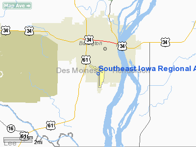
Location of Southeast Iowa Regional Airport
|
| Summary |
| Airport type |
Public |
| Owner |
Southeast Iowa Regional Airport Authority |
| Serves |
Burlington, Iowa |
| Elevation AMSL |
698 ft / 213 m |
| Website |
www.BRLairport.com |
| Runways |
| Direction |
Length |
Surface |
| ft |
m |
| 18/36 |
6,702 |
2,043 |
Asphalt |
| 12/30 |
5,350 |
1,631 |
Concrete |
| Statistics (2007) |
| Aircraft operations |
20,172 |
| Based aircraft |
56 |
| Source: Federal Aviation Administration |
Southeast Iowa Regional Airport (IATA: BRL, ICAO: KBRL, FAA LID: BRL) is a public airport located two miles (3 km) southwest of the central business district of Burlington, a city in Des Moines County, Iowa, United States. It is owned by the Southeast Iowa Regional Airport Authority. The airport is mostly used for general aviation, but is also served by one commercial airline. Service is subsidized by the Essential Air Service program. Airlines and destinations
| Airlines |
Destinations |
| Air Choice One |
Chicago-O'Hare, St. Louis |
Facilities and aircraft
Southeast Iowa Regional Airport covers an area of 537 acres (217 ha) which contains two runways: 12/30 with a concrete pavement measuring 5,350 x 100 ft (1,631 x 30 m) and 18/36 with an asphalt surface measuring 6,702 x 150 ft (2,043 x 46 m).
For the 12-month period ending April 30, 2007, the airport had 20,172 aircraft operations, an average of 55 per day: 74% general aviation, 16% air taxi, 9% scheduled commercial and <1% military. There are 56 aircraft based at this airport: 89% single engine, 9% multi-engine and 2% ultralight.
The above content comes from Wikipedia and is published under free licenses – click here to read more.
|
 |
(Click on the photo to enlarge) |
Location &
QuickFacts
|
FAA
Information Effective: |
2007-07-05 |
|
Airport
Identifier: |
BRL |
|
Airport
Status: |
Operational |
|
Longitude/Latitude: |
091-07-31.8200W/40-46-59.6100N
-91.125506/40.783225 (Estimated) |
|
Elevation: |
698 ft / 212.75 m (Surveyed) |
|
Land: |
537 acres |
|
From
nearest city: |
2 nautical miles SW of Burlington, IA |
|
Location: |
Des Moines County, IA |
|
Magnetic Variation: |
01E (1995) |
Owner & Manager
|
Ownership: |
Publicly owned |
|
Owner: |
Se Iowa Reg Arpt Authority |
|
Address: |
2515 Summer Street
Burlington, IA 52601-3330 |
|
Phone number: |
319-754-1414
FAX 319-754-1424. |
|
Manager: |
Sharon Leeper |
|
Address: |
2515 Summer St
Burlington, IA 52601 |
|
Phone number: |
319-754-1414 |
Airport
Operations and Facilities
|
Airport
Use: |
Open to public |
|
Wind
indicator: |
Yes |
|
Segmented Circle: |
Yes |
|
Control
Tower: |
No |
|
Lighting
Schedule: |
DUSK-DAWN
ACTVT MIRL RY 12/30; HIRL RY 18/36; VASI RY 12; PAPI RY 30; REIL RYS
12 & 30 & MALSR RY 36 - CTAF. |
|
Beacon
Color: |
Clear-Green (lighted land airport) |
|
Landing
fee charge: |
No |
|
Sectional chart: |
Chicago |
|
Region: |
ACE - Central |
|
Boundary
ARTCC: |
ZAU - Chicago |
|
Tie-in
FSS: |
FOD - Fort Dodge |
|
FSS on
Airport: |
No |
|
FSS
Phone: |
515-955-8114 |
|
FSS Toll
Free: |
1-800-WX-BRIEF |
|
NOTAMs
Facility: |
BRL (NOTAM-d service avaliable) |
|
Certification type/date: |
II A S 05/197
PPR 24 HRS FOR UNSKED ACR OPNS WITH MORE THAN 30 PSGR SEATS; CALL AMGR
(319) 754-1414. ARFF INDEX B EQUIPMENT PROVIDED. ACR OPNS WITH MORE
THAN 9 PSGR SEATS NOT AUTHORIZED IN EXCESS OF 15 MINUTES OF SCHEDULED
FLIGHT TIMES WITHOUT PRIOR COORDINATION WITH AMGR OR DISP CTR (319)
753-8371. |
|
Federal Agreements: |
NGY3 |
Airport Communications
|
CTAF: |
123.000 |
|
Unicom: |
123.000 |
Airport Services
|
Fuel
available: |
100LLA |
|
Airframe
Repair: |
MAJOR |
|
Power
Plant Repair: |
MAJOR |
|
Bottled
Oxygen: |
NONE |
|
Bulk
Oxygen: |
NONE |
|
Runway Information
Runway 12/30
|
Dimension: |
5350 x 100 ft / 1630.7 x 30.5 m |
|
Surface: |
CONC, |
|
Surface
Treatment: |
Saw-cut or plastic Grooved |
|
Weight Limit: |
Single wheel: 37000 lbs.
Dual wheel: 58000 lbs. |
|
Edge Lights: |
Medium |
|
|
Runway 12
|
Runway 30
|
|
Longitude: |
091-08-09.5450W |
091-07-09.0470W |
|
Latitude: |
40-47-29.0650N |
40-47-02.9920N |
|
Elevation: |
692.00 ft |
698.00 ft |
|
Alignment: |
120 |
127 |
|
Traffic
Pattern: |
Right |
Left |
|
Markings: |
Non-precision instrument, Good Condition |
Non-precision instrument, Good Condition |
|
Crossing
Height: |
39.00 ft |
45.00 ft |
|
Displaced
threshold: |
0.00 ft |
500.00 ft |
|
VASI: |
4-box on left side |
4-light PAPI on left side |
|
Visual
Glide Angle: |
3.00° |
3.00° |
|
Runway End
Identifier: |
Yes |
Yes |
|
Obstruction: |
, 50:1 slope to clear |
16 ft road, 600.0 ft from runway, 300 ft right of
centerline, 25:1 slope to clear |
|
Decleard
distances: |
Take off run available 4850.00 ft
Take off distance available 5350.00 ft
Actual stop distance available 4850.00 ft
Landing distance available 5350.00 ft |
Take off run available 5350.00 ft
Take off distance available 5350.00 ft
Actual stop distance available 5350.00 ft
Landing distance available 4850.00 ft |
|
Runway 18/36
|
Dimension: |
6702 x 150 ft / 2042.8 x 45.7 m |
|
Surface: |
ASPH, |
|
Surface
Treatment: |
Saw-cut or plastic Grooved |
|
Weight Limit: |
Single wheel: 65000 lbs.
Dual wheel: 90000 lbs. |
|
Edge Lights: |
High |
|
|
Runway 18
|
Runway 36
|
|
Longitude: |
091-07-26.1970W |
091-07-25.5110W |
|
Latitude: |
40-47-19.6130N |
40-46-13.3950N |
|
Elevation: |
691.00 ft |
677.00 ft |
|
Alignment: |
127 |
127 |
|
ILS Type: |
|
ILS |
|
Traffic
Pattern: |
Right |
Left |
|
Markings: |
Non-precision instrument, Good Condition |
Precision instrument, Good Condition |
|
Displaced
threshold: |
600.00 ft |
0.00 ft |
|
Approach
lights: |
|
MALSR |
|
Obstruction: |
85 ft trees, 1500.0 ft from runway, 15:1 slope to clear
RWY 18 APCH RATIO 25:1 FM DSPLCD THR. |
40 ft tree, 2000.0 ft from runway, 575 ft left of
centerline, 45:1 slope to clear |
|
Decleard
distances: |
Take off run available 6702.00 ft
Take off distance available 6702.00 ft
Actual stop distance available 6702.00 ft
Landing distance available 6102.00 ft |
Take off run available 6702.00 ft
Take off distance available 6702.00 ft
Actual stop distance available 6102.00 ft
Landing distance available 6102.00 ft |
|
Radio Navigation Aids
|
ID |
Type |
Name |
Ch |
Freq |
Var |
Dist |
|
MPZ |
NDB |
Mount Pleasant |
|
212.00 |
02E |
19.9 nm |
|
EOK |
NDB |
Keokuk |
|
366.00 |
02E |
23.8 nm |
|
JZY |
NDB |
Macomb |
|
251.00 |
01E |
30.3 nm |
|
AWG |
NDB |
Washington |
|
219.00 |
02E |
38.8 nm |
|
FFL |
NDB |
Fairfield |
|
332.00 |
03E |
41.5 nm |
|
CTK |
NDB |
Canton |
|
236.00 |
02E |
49.5 nm |
|
GBG |
VOR/DME |
Galesburg |
035X |
109.80 |
03E |
32.8 nm |
|
DDD |
VOR/DME |
Port City |
112X |
116.50 |
01E |
35.1 nm |
|
BRL |
VORTAC |
Burlington |
051X |
111.40 |
05E |
9.8 nm |
|
MZV |
VORTAC |
Moline |
091X |
114.40 |
05E |
39.2 nm |
|
IOW |
VORTAC |
Iowa City |
109X |
116.20 |
05E |
49.4 nm |
Remarks
-
LINE OF SIGHT
VISION BLOCKED BETWEEN RYS 36 & 12.
-
RY 36 IS CALM
WIND RY.
Based
Aircraft
|
Aircraft based
on field: |
56 |
|
Single Engine
Airplanes: |
50 |
|
Multi Engine
Airplanes: |
5 |
|
Ultralights: |
1 |
Operational Statistics
Time Period:
2006-05-01 -
2007-04-30
|
Aircraft
Operations: |
56/Day |
|
Commerical: |
9.3% |
|
Air Taxi: |
15.9% |
|
General
Aviation Local: |
29.7% |
|
General
Aviation Itinerant: |
44.6% |
|
Military: |
0.5% |
Southeast Iowa Regional Airport
Address:
Des Moines County, IA
Tel:
319-754-1414
Fax:
319-754-1424
Images
and information placed above are from
http://www.airport-data.com/airport/BRL/
We
thank them for the data!
|
General Info |
| Country |
United
States |
| State |
IOWA
|
| FAA ID |
BRL
|
| Latitude |
40-46-59.610N |
|
Longitude |
091-07-31.820W |
|
Elevation |
698 feet
|
| Near
City |
BURLINGTON |
We don't guarantee the information is fresh and accurate. The data may
be wrong or outdated.
For more up-to-date information please refer to other sources.
|
|


