 |
|
|
|
|
|
Location &
QuickFacts
|
FAA
Information Effective: |
2007-07-05 |
|
Airport
Identifier: |
09IA |
|
Airport
Status: |
Operational |
|
Longitude/Latitude: |
092-24-33.6650W/41-44-44.9940N
-92.409351/41.745832 (Estimated) |
|
Elevation: |
820 ft / 249.94 m (Surveyed) |
|
Land: |
0 acres |
|
From
nearest city: |
2 nautical miles NE of Brooklyn, IA |
|
Location: |
Poweshiek County, IA |
|
Magnetic Variation: |
03E (1985) |
Owner & Manager
|
Ownership: |
Privately owned |
|
Owner: |
Bruce Kennedy |
|
Address: |
919 Sw Creston
Des Moines, IA 50315 |
|
Phone
number: |
515-282-1788 |
|
Manager: |
Bruce Kennedy |
|
Address: |
919 Sw Creston
Des Moines, IA 50315 |
|
Phone number: |
515-282-1788 |
Airport Operations and Facilities
|
Airport Use: |
Private |
|
Wind indicator: |
Yes |
|
Segmented Circle: |
No |
|
Control Tower: |
No |
|
Landing fee charge: |
Yes |
|
Sectional chart: |
Chicago |
|
Region: |
ACE - Central |
|
Boundary ARTCC: |
ZAU - Chicago |
|
Tie-in FSS: |
FOD - Fort Dodge |
|
FSS on Airport: |
No |
|
FSS Phone: |
515-955-8114 |
|
FSS Toll Free: |
1-800-WX-BRIEF |
Airport Services
|
Airframe
Repair: |
NONE |
|
Power
Plant Repair: |
NONE |
|
Bottled
Oxygen: |
NONE |
|
Bulk
Oxygen: |
NONE |
|
Runway Information
Runway 09/27
|
Dimension: |
2700 x 80 ft / 823.0 x 24.4 m |
|
Surface: |
ASPH-TURF,
2600' X 20' ASPH. |
|
|
Runway 09
|
Runway 27
|
|
Traffic
Pattern: |
Left |
Left |
|
Runway End
Identifier: |
No |
No |
|
Centerline
Lights: |
No |
No |
|
Touchdown
Lights: |
No |
No |
|
Radio Navigation Aids
|
ID |
Type |
Name |
Ch |
Freq |
Var |
Dist |
|
TZT |
NDB |
Belle Plaine |
|
371.00 |
02E |
10.1 nm |
|
GGI |
NDB |
Grinnell |
|
248.00 |
02E |
14.5 nm |
|
OOA |
NDB |
Oskaloosa |
|
414.00 |
03E |
31.5 nm |
|
MIW |
NDB |
Marshalltown |
|
239.00 |
03E |
31.5 nm |
|
PEA |
NDB |
Pella |
|
257.00 |
02E |
31.5 nm |
|
VTI |
NDB |
Garrison |
|
338.00 |
03E |
33.5 nm |
|
OXV |
NDB |
Knoxville |
|
284.00 |
03E |
41.7 nm |
|
AWG |
NDB |
Washington |
|
219.00 |
02E |
43.4 nm |
|
IIB |
NDB |
Wapsie |
|
206.00 |
02E |
47.1 nm |
|
FFL |
NDB |
Fairfield |
|
332.00 |
03E |
48.1 nm |
|
CID |
VOR/DME |
Cedar Rapids |
088X |
114.10 |
05E |
29.2 nm |
|
JWJ |
VOR/DME |
Elmwood |
031X |
109.40 |
03E |
31.3 nm |
|
TNU |
VOR/DME |
Newton |
072X |
112.50 |
03E |
31.4 nm |
|
OTM |
VOR/DME |
Ottumwa |
053X |
111.60 |
06E |
43.2 nm |
|
IOW |
VORTAC |
Iowa City |
109X |
116.20 |
05E |
38.3 nm |
|
ALO |
VORTAC |
Waterloo |
059X |
112.20 |
06E |
48.7 nm |
Remarks
-
PROVIDED APCH TO
EACH RWY IS MAINTAINED FOR A MIN 20:1 GLIDE SLOPE AND THE TRANSITIONAL SURFACE
BE MAINTAINED FOR A 7:1 SLOPE.
Based
Aircraft
|
Aircraft based
on field: |
4 |
|
Single Engine
Airplanes: |
4 |
Operational Statistics
Time Period:
2000-01-19 -
2001-01-17
|
Aircraft
Operations: |
9/Month |
|
Air Taxi: |
100.0% |
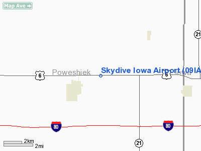
Skydive Iowa Airport
Address:
Poweshiek County, IA
Tel:
515-282-1788
Images
and information placed above are from
http://www.airport-data.com/airport/09IA/
We
thank them for the data!
|
General Info |
| Country |
United
States |
| State |
IOWA
|
| FAA ID |
09IA
|
| Latitude |
41-44-44.994N |
|
Longitude |
092-24-33.665W |
|
Elevation |
820 feet
|
| Near
City |
BROOKLYN
|
We don't guarantee the information is fresh and accurate. The data may
be wrong or outdated.
For more up-to-date information please refer to other sources.
|
|


