 |
|
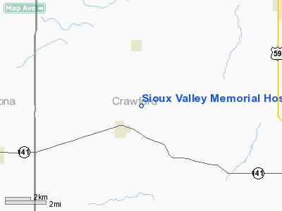
Sioux Valley Memorial Hospital Heliport |
|
|
Location & QuickFacts
|
FAA Information Effective: |
2007-07-05 |
|
Airport Identifier: |
IA13 |
|
Airport Status: |
Operational |
|
Longitude/Latitude: |
095-34-12.0070W/42-05-06.9590N
-95.570002/42.085266 (Estimated) |
|
Elevation: |
900 ft / 274.32 m (Estimated) |
|
Land: |
0
acres |
|
From nearest city: |
1 nautical miles N of Cherokee, IA |
|
Location: |
Cherokee County, IA |
|
Magnetic Variation: |
06E (1985) |
Owner & Manager
|
Ownership: |
Privately owned |
|
Owner: |
Sioux Valley Memorial Hosp |
|
Address: |
300 Sioux Valley Dr
Cherokee Ia,51012 |
|
Phone number: |
712-225-5101 |
|
Manager: |
John Comstock, Ceo |
|
Address: |
300 Sioux Valley Dr
Cherokee Ia,51012 |
|
Phone number: |
712-225-5101 |
Airport Operations and
Facilities
|
Airport Use: |
Private
MEDICAL |
|
Wind indicator: |
Yes |
|
Segmented Circle: |
No |
|
Control Tower: |
No |
|
Lighting Schedule: |
PHONE REQ
FOR PERIMETER LGTS CALL 712-225-5101. |
|
Sectional chart: |
Omaha |
|
Region: |
ACE - Central |
|
Boundary ARTCC: |
ZMP - Minneapolis |
|
Tie-in FSS: |
FOD - Fort Dodge |
|
FSS Phone: |
515-955-8114 |
|
FSS Toll Free: |
1-800-WX-BRIEF |
|
Runway Information
Helipad H1
|
Dimension: |
43 x 43 ft / 13.1 x 13.1
m |
|
Surface: |
CONC, |
|
|
Runway H1
|
Runway
|
|
Traffic
Pattern: |
Left |
Left |
|
Radio Navigation Aids
|
ID |
Type |
Name |
Ch |
Freq |
Var |
Dist |
|
DNS |
NDB |
Denison |
|
350.00 |
04E |
10.5 nm |
|
MEY |
NDB |
Mapleton |
|
335.00 |
05E |
11.5 nm |
|
SKI |
NDB |
Sac City |
|
356.00 |
04E |
31.6 nm |
|
HNR |
NDB |
Harlan |
|
272.00 |
05E |
32.1 nm |
|
SLB |
NDB |
Storm Lake |
|
434.00 |
04E |
34.2 nm |
|
CIN |
NDB |
Carroll |
|
397.00 |
04E |
35.1 nm |
|
SU |
NDB |
Salix |
|
414.00 |
07E |
35.2 nm |
|
ADU |
NDB |
Audubon |
|
266.00 |
04E |
37.9 nm |
|
CKP |
NDB |
Pilot Rock |
|
423.00 |
05E |
38.9 nm |
|
GAK |
NDB |
Sioux Gateway |
|
233.00 |
06E |
41.2 nm |
|
OI |
NDB |
Tommi |
|
305.00 |
07E |
45.6 nm |
|
OM |
NDB |
Gerfi |
|
320.00 |
05E |
46.5 nm |
|
AIO |
NDB |
Atlantic |
|
365.00 |
04E |
47.2 nm |
|
TQE |
VOR |
Tekamah |
|
108.40 |
07E |
33.5 nm |
|
SUX |
VORTAC |
Sioux City |
112X |
116.50 |
09E |
37.0 nm |
|
OMA |
VOT |
Omaha |
|
109.00 |
|
49.6 nm |
Remarks
-
PRVDD CLEAR
APCH/DEP PATHS TO LDG AREA FOR A 8:1 GLIDE SLOPE AND A CLEAR TRANSITIONAL
SURFACE FOR A MINIUM 2:1 SLOPE
Sioux Valley Memorial Hospital Heliport
Address:
Cherokee County, IA
Tel:
712-225-5101
Images
and information placed above are from
http://www.airport-data.com/airport/IA13/
We
thank them for the data!
| General Info
|
| Country |
United States
|
| State |
IOWA
|
| FAA ID |
IA13
|
| Latitude |
42-05-06.959N
|
| Longitude |
095-34-12.007W
|
| Elevation |
900 feet
|
| Near City |
CHEROKEE
|
We don't guarantee the information is fresh and accurate. The data may
be wrong or outdated.
For more up-to-date information please refer to other sources.
|
|


