 |
|
|
|
Location &
QuickFacts
|
FAA
Information Effective: |
2007-07-05 |
|
Airport
Identifier: |
7C5 |
|
Airport
Status: |
Operational |
|
Longitude/Latitude: |
092-32-04.5000W/41-32-53.8400N
-92.534583/41.548289 (Estimated) |
|
Elevation: |
929 ft / 283.16 m (Estimated) |
|
Land: |
12 acres |
|
From
nearest city: |
3 nautical miles S of Montezuma, IA |
|
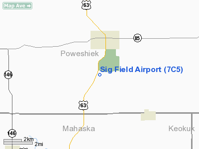
Location: |
Poweshiek County, IA |
|
Magnetic Variation: |
03E (1990) |
Owner & Manager
|
Ownership: |
Privately owned |
|
Owner: |
Hazel Sig-hester |
|
Address: |
Box 639 Hwy 63 S 5119
Montezuma, IA 50171-0639 |
|
Phone
number: |
641-623-5179 |
|
Manager: |
Hazel Sig-hester |
|
Address: |
Box 639 Hwy 63 S 5119
Montezuma, IA 50171-0639 |
|
Phone number: |
641-623-5179 |
Airport Operations and Facilities
|
Airport
Use: |
Open to public |
|
Wind
indicator: |
Yes |
|
Segmented Circle: |
No |
|
Control
Tower: |
No |
|
Sectional chart: |
Chicago |
|
Region: |
ACE - Central |
|
Boundary
ARTCC: |
ZAU - Chicago |
|
Tie-in
FSS: |
FOD - Fort Dodge |
|
FSS on
Airport: |
No |
|
FSS
Phone: |
515-955-8114 |
|
FSS Toll
Free: |
1-800-WX-BRIEF |
|
NOTAMs
Facility: |
FOD (NOTAM-d service avaliable) |
Airport
Communications
|
Runway Information
Runway 18/36
|
Dimension: |
2600 x 105 ft / 792.5 x 32.0 m |
|
Surface: |
TURF, Good Condition |
|
|
Runway 18
|
Runway 36
|
|
Traffic
Pattern: |
Left |
Left |
|
Displaced
threshold: |
400.00 ft |
0.00 ft |
|
Obstruction: |
28 ft pole, 175.0 ft from runway, 80 ft left of
centerline, 6:1 slope to clear
OBSTN CLNC SLOPE 20:1 TO DSPLCD THLD. |
, 50:1 slope to clear |
|
Radio Navigation Aids
|
ID |
Type |
Name |
Ch |
Freq |
Var |
Dist |
|
GGI |
NDB |
Grinnell |
|
248.00 |
02E |
13.1 nm |
|
OOA |
NDB |
Oskaloosa |
|
414.00 |
03E |
19.5 nm |
|
PEA |
NDB |
Pella |
|
257.00 |
02E |
20.3 nm |
|
TZT |
NDB |
Belle Plaine |
|
371.00 |
02E |
23.2 nm |
|
OXV |
NDB |
Knoxville |
|
284.00 |
03E |
30.2 nm |
|
MIW |
NDB |
Marshalltown |
|
239.00 |
03E |
37.9 nm |
|
FFL |
NDB |
Fairfield |
|
332.00 |
03E |
40.6 nm |
|
AWG |
NDB |
Washington |
|
219.00 |
02E |
42.1 nm |
|
VTI |
NDB |
Garrison |
|
338.00 |
03E |
46.6 nm |
|
IKV |
NDB |
Ankeny |
|
275.00 |
03E |
47.1 nm |
|
BEX |
NDB |
Bloomfield |
|
269.00 |
02E |
48.5 nm |
|
CNC |
NDB |
Chariton |
|
335.00 |
05E |
49.2 nm |
|
TNU |
VOR/DME |
Newton |
072X |
112.50 |
03E |
29.4 nm |
|
OTM |
VOR/DME |
Ottumwa |
053X |
111.60 |
06E |
32.6 nm |
|
JWJ |
VOR/DME |
Elmwood |
031X |
109.40 |
03E |
37.8 nm |
|
CID |
VOR/DME |
Cedar Rapids |
088X |
114.10 |
05E |
39.3 nm |
|
IOW |
VORTAC |
Iowa City |
109X |
116.20 |
05E |
41.5 nm |
Based Aircraft
|
Aircraft based
on field: |
9 |
|
Single Engine
Airplanes: |
8 |
|
Ultralights: |
1 |
Sig Field Airport
Address:
Poweshiek County, IA
Tel:
641-623-5179
Images
and information placed above are from
http://www.airport-data.com/airport/7C5/
We
thank them for the data!
|
General Info |
| Country |
United
States |
| State |
IOWA
|
| FAA ID |
7C5
|
| Latitude |
41-32-45.000N |
|
Longitude |
092-32-00.000W |
|
Elevation |
929 feet
|
| Near
City |
MONTEZUMA |
We don't guarantee the information is fresh and accurate. The data may
be wrong or outdated.
For more up-to-date information please refer to other sources.
|
|


