 |
|
|
|
|
|
Location &
QuickFacts
|
FAA
Information Effective: |
2007-07-05 |
|
Airport
Identifier: |
ISB |
|
Airport
Status: |
Operational |
|
Longitude/Latitude: |
095-45-35.1000W/43-22-10.1500N
-95.759750/43.369486 (Estimated) |
|
Elevation: |
1537 ft / 468.48 m (Surveyed) |
|
Land: |
136 acres |
|
From
nearest city: |
2 nautical miles S of Sibley, IA |
|
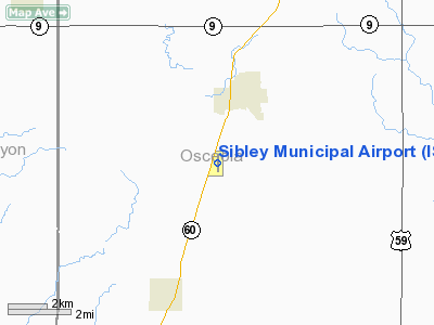
Location: |
Osceola County, IA |
|
Magnetic Variation: |
05E (1995) |
Owner & Manager
|
Ownership: |
Publicly owned |
|
Owner: |
City Of Sibley |
|
Address: |
City Hall, 808 3rd Ave
Sibley, IA 51249 |
|
Phone number: |
712-754-2541 |
|
Manager: |
Robert O'leary |
|
Address: |
1928 Olive Avenue
Sibley, IA 51249 |
|
Phone number: |
712-754-3467 |
Airport
Operations and Facilities
|
Airport
Use: |
Open to public |
|
Wind
indicator: |
Yes |
|
Segmented Circle: |
No |
|
Control
Tower: |
No |
|
Lighting
Schedule: |
RDO-CTL
ACTVT LIRL RY 17/35 AND PAPI RYS 17 & 35 - CTAF. |
|
Landing
fee charge: |
No |
|
Sectional chart: |
Omaha |
|
Region: |
ACE - Central |
|
Boundary
ARTCC: |
ZMP - Minneapolis |
|
Tie-in
FSS: |
FOD - Fort Dodge |
|
FSS on
Airport: |
No |
|
FSS
Phone: |
515-955-8114 |
|
FSS Toll
Free: |
1-800-WX-BRIEF |
|
NOTAMs
Facility: |
FOD (NOTAM-d service avaliable) |
|
Federal Agreements: |
Y1 |
Airport Communications
|
CTAF: |
122.800 |
|
Unicom: |
122.800 |
Airport Services
|
Fuel
available: |
100LLA |
|
Airframe
Repair: |
MAJOR |
|
Power
Plant Repair: |
MAJOR |
|
Bottled
Oxygen: |
NONE |
|
Bulk
Oxygen: |
NONE |
|
Runway Information
Runway 17/35
|
Dimension: |
3000 x 50 ft / 914.4 x 15.2 m |
|
Surface: |
CONC, Fair Condition |
|
Weight Limit: |
Single wheel: 28000 lbs.
Dual wheel: 48000 lbs. |
|
Edge Lights: |
Non-standard lighting system
RY 17/35 NSTD LIRL HAVE 6 THLD LGTS EACH. |
|
|
Runway 17
|
Runway 35
|
|
Longitude: |
095-45-35.1000W |
095-45-35.1000W |
|
Latitude: |
43-22-24.9000N |
43-21-55.4000N |
|
Traffic
Pattern: |
Left |
Left |
|
Markings: |
Basic, Good Condition |
Basic, Good Condition |
|
Crossing
Height: |
31.00 ft |
20.00 ft |
|
VASI: |
2-light PAPI on left side |
2-light PAPI on left side |
|
Visual
Glide Angle: |
3.00° |
3.00° |
|
Obstruction: |
15 ft road, 515.0 ft from runway, 21:1 slope to clear |
90 ft trees, 1800.0 ft from runway, 17:1 slope to clear |
|
Radio Navigation Aids
|
ID |
Type |
Name |
Ch |
Freq |
Var |
Dist |
|
ISB |
NDB |
Sibley |
|
269.00 |
05E |
0.3 nm |
|
SHL |
NDB |
Sheldon |
|
338.00 |
05E |
9.9 nm |
|
SOY |
NDB |
Sioux Center |
|
368.00 |
06E |
23.6 nm |
|
ORC |
NDB |
Orange City |
|
521.00 |
05E |
26.3 nm |
|
LTU |
NDB |
Little Sioux |
|
326.00 |
05E |
31.1 nm |
|
MJQ |
NDB |
Jackson |
|
353.00 |
04E |
37.6 nm |
|
CKP |
NDB |
Pilot Rock |
|
423.00 |
05E |
39.4 nm |
|
MWM |
NDB |
Windom |
|
203.00 |
03E |
43.1 nm |
|
PUF |
NDB |
Puff |
|
345.00 |
04E |
44.7 nm |
|
FS |
NDB |
Rokky |
|
245.00 |
06E |
47.3 nm |
|
EGQ |
NDB |
Emmetsburg |
|
410.00 |
04E |
48.8 nm |
|
PQN |
NDB/DME |
Pipestone |
028X |
284.00 |
06E |
43.8 nm |
|
EST |
VOR |
Estherville |
|
110.40 |
07E |
44.4 nm |
|
DDL |
VOR/DME |
Sheldon |
023X |
108.60 |
05E |
10.0 nm |
|
OTG |
VOR/DME |
Worthington |
043X |
110.60 |
08E |
18.4 nm |
|
SPW |
VOR/DME |
Spencer |
037X |
110.00 |
05E |
27.4 nm |
|
FSD |
VORTAC |
Sioux Falls |
097X |
115.00 |
09E |
47.6 nm |
Remarks
Based Aircraft
|
Aircraft
based on field: |
11 |
|
Single
Engine Airplanes: |
11 |
Operational Statistics
Time Period:
2005-07-27 -
2006-07-26
|
Aircraft
Operations: |
122/Week |
|
General
Aviation Local: |
43.2% |
|
General
Aviation Itinerant: |
56.8% |
Sibley Municipal Airport
Address:
Osceola County, IA
Tel:
712-754-2541, 712-754-3467
Images
and information placed above are from
http://www.airport-data.com/airport/ISB/
We
thank them for the data!
|
General Info |
| Country |
United
States |
| State |
IOWA
|
| FAA ID |
ISB
|
| Latitude |
43-22-10.150N |
|
Longitude |
095-45-35.100W |
|
Elevation |
1537
feet |
| Near
City |
SIBLEY
|
We don't guarantee the information is fresh and accurate. The data may
be wrong or outdated.
For more up-to-date information please refer to other sources.
|
|


