 |
|
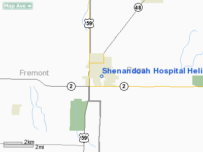
Shenandoah Hospital Heliport |
Location &
QuickFacts
|
FAA
Information Effective: |
2007-07-05 |
|
Airport
Identifier: |
23IA |
|
Airport
Status: |
Operational |
|
Longitude/Latitude: |
095-22-07.9500W/40-45-09.9800N
-95.368875/40.752772 (Estimated) |
|
Elevation: |
1039 ft / 316.69 m (Estimated) |
|
Land: |
0 acres |
|
From
nearest city: |
0 nautical miles N of Shenandoah, IA |
|
Location: |
Page County, IA |
|
Magnetic Variation: |
05E (1995) |
Owner & Manager
|
Ownership: |
Privately owned |
|
Owner: |
Shenandoah Memorial Hosital |
|
Address: |
300 Pershing Ave.
Shenandoah, IA 51601 |
|
Phone number: |
712-246-1230 |
|
Manager: |
Charles Millburg |
|
Address: |
300 Pershing Ave.
Shenandoah, IA 51601 |
|
Phone number: |
712-246-1230 |
Airport
Operations and Facilities
|
Airport
Use: |
Private
MEDICAL USE. |
|
Segmented Circle: |
No |
|
Control
Tower: |
No |
|
Region: |
ACE - Central |
|
Boundary
ARTCC: |
ZMP - Minneapolis |
|
Tie-in
FSS: |
FOD - Fort Dodge |
|
FSS
Phone: |
515-955-8114 |
|
FSS Toll
Free: |
1-800-WX-BRIEF |
|
Runway Information
Helipad H1
|
Dimension: |
40 x 40 ft / 12.2 x 12.2 m |
|
Surface: |
CONC, |
|
|
Runway H1
|
Runway
|
|
Traffic
Pattern: |
Left |
Left |
|
Radio Navigation Aids
|
ID |
Type |
Name |
Ch |
Freq |
Var |
Dist |
|
SDA |
NDB |
Shenandoah |
|
411.00 |
05E |
1.8 nm |
|
ICL |
NDB |
Clarinda |
|
353.00 |
04E |
15.6 nm |
|
RDK |
NDB |
Red Oak |
|
230.00 |
04E |
16.7 nm |
|
AFK |
NDB |
Nebraska City |
|
347.00 |
05E |
24.1 nm |
|
PMV |
NDB |
Plattsmouth |
|
329.00 |
06E |
27.3 nm |
|
AYB |
NDB |
Auburn |
|
430.00 |
05E |
27.6 nm |
|
CRZ |
NDB |
Corning |
|
278.00 |
04E |
31.4 nm |
|
EVU |
NDB |
Emville |
|
317.00 |
05E |
31.9 nm |
|
AIO |
NDB |
Atlantic |
|
365.00 |
04E |
41.8 nm |
|
FNB |
NDB |
Brenner |
|
404.00 |
05E |
41.9 nm |
|
MLE |
NDB |
Millard |
|
371.00 |
06E |
43.0 nm |
|
OM |
NDB |
Gerfi |
|
320.00 |
05E |
45.5 nm |
|
UNE |
NDB |
Union County |
|
379.00 |
04E |
48.0 nm |
|
HNR |
NDB |
Harlan |
|
272.00 |
05E |
49.7 nm |
|
OFF |
TACAN |
Offutt |
054X |
|
05E |
32.6 nm |
|
OVR |
VORTAC |
Omaha |
110X |
116.30 |
08E |
30.0 nm |
|
OMA |
VOT |
Omaha |
|
109.00 |
|
40.2 nm |
Remarks
-
PRVDD THE FATO,
THE APCH SFC, & TRANSITIONAL SFCS ARE CLEAR OF OBSTNS; THE EMS PERSONNEL WILL
BE USED TO CONTROL ACCESS TO THE HELIPAD WHEN IN USE; & COORDINATION
W/SHENANDOAH FIRE DEPT HAS BEEN MADE IN THE EVENT OF A FIRE.
Shenandoah Hospital Heliport
Address:
Page County, IA
Tel:
712-246-1230
Images
and information placed above are from
http://www.airport-data.com/airport/23IA/
We
thank them for the data!
|
General Info |
| Country |
United
States |
| State |
IOWA
|
| FAA ID |
23IA
|
| Latitude |
40-45-09.980N |
|
Longitude |
095-22-07.950W |
|
Elevation |
1039
feet |
| Near
City |
SHENANDOAH |
We don't guarantee the information is fresh and accurate. The data may
be wrong or outdated.
For more up-to-date information please refer to other sources.
|
|


