 |
|
|
|
|
|
Location &
QuickFacts
|
FAA
Information Effective: |
2007-07-05 |
|
Airport
Identifier: |
0IA4 |
|
Airport
Status: |
Operational |
|
Longitude/Latitude: |
091-03-00.5220W/41-02-00.1260N
-91.050145/41.033368 (Estimated) |
|
Elevation: |
700 ft / 213.36 m (Estimated) |
|
Land: |
17 acres |
|
From
nearest city: |
5 nautical miles NE of Mediapolis, IA |
|
Location: |
Des Moines County, IA |
|
Magnetic Variation: |
02E (1985) |
Owner & Manager
|
Ownership: |
Privately owned |
|
Owner: |
Robert W Sharar |
|
Address: |
7246 235th Street
Mediapolis, IA 52637 |
|
Phone number: |
319-394-3769 |
|
Manager: |
Robert W Sharar |
|
Address: |
7246 235th Street
Mediapolis, IA 52637 |
|
Phone number: |
319-394-3769 |
Airport
Operations and Facilities
|
Airport
Use: |
Private |
|
Wind
indicator: |
Yes |
|
Segmented Circle: |
No |
|
Control
Tower: |
No |
|
Lighting
Schedule: |
PHONE REQ
FOR RWY LGTS CALL 319-394-3769. |
|
Landing fee charge: |
No |
|
Sectional chart: |
Chicago |
|
Region: |
ACE - Central |
|
Boundary ARTCC: |
ZAU - Chicago |
|
Tie-in FSS: |
FOD - Fort Dodge |
|
FSS on Airport: |
No |
|
FSS Phone: |
515-955-8114 |
|
FSS Toll Free: |
1-800-WX-BRIEF |
Airport Services
|
Airframe
Repair: |
MAJOR |
|
Power
Plant Repair: |
MAJOR |
|
Runway Information
Runway 09/27
|
Dimension: |
3000 x 100 ft / 914.4 x 30.5 m |
|
Surface: |
TURF, |
|
Edge Lights: |
Low |
|
|
Runway 09
|
Runway 27
|
|
Traffic
Pattern: |
Left |
Left |
|
Obstruction: |
4 ft fence, 40.0 ft from runway |
|
|
Radio Navigation Aids
|
ID |
Type |
Name |
Ch |
Freq |
Var |
Dist |
|
MPZ |
NDB |
Mount Pleasant |
|
212.00 |
02E |
21.5 nm |
|
AWG |
NDB |
Washington |
|
219.00 |
02E |
31.8 nm |
|
JZY |
NDB |
Macomb |
|
251.00 |
01E |
38.1 nm |
|
EOK |
NDB |
Keokuk |
|
366.00 |
02E |
38.4 nm |
|
FFL |
NDB |
Fairfield |
|
332.00 |
03E |
42.6 nm |
|
DDD |
VOR/DME |
Port City |
112X |
116.50 |
01E |
20.5 nm |
|
GBG |
VOR/DME |
Galesburg |
035X |
109.80 |
03E |
28.5 nm |
|
BRL |
VORTAC |
Burlington |
051X |
111.40 |
05E |
19.5 nm |
|
MZV |
VORTAC |
Moline |
091X |
114.40 |
05E |
25.4 nm |
|
IOW |
VORTAC |
Iowa City |
109X |
116.20 |
05E |
38.7 nm |
|
CVA |
VORTAC |
Davenport |
085X |
113.80 |
04E |
48.0 nm |
|
DVN |
VOT |
Davenport Municipal |
|
111.80 |
|
40.6 nm |
Remarks
-
PROVIDED FENCE IS
REMOVED OR RWY IS DSPLCD SUF DSTC WHEREBY THE FENCE WOULD NO LONGER PRESENT A
PSBL UNSAFE COND FOR ACFT USING RWY.
Based
Aircraft
|
Aircraft based
on field: |
4 |
|
Single Engine
Airplanes: |
4 |
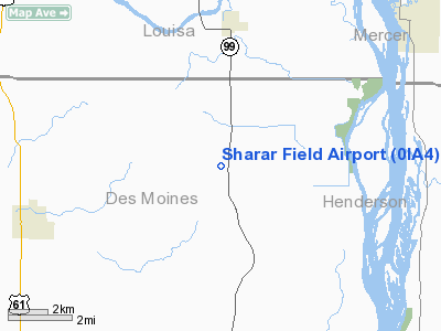
Sharar Field Airport
Address:
Des Moines County, IA
Tel:
319-394-3769
Images
and information placed above are from
http://www.airport-data.com/airport/0IA4/
We
thank them for the data!
|
General Info |
| Country |
United
States |
| State |
IOWA
|
| FAA ID |
0IA4
|
| Latitude |
41-02-00.126N |
|
Longitude |
091-03-00.522W |
|
Elevation |
700 feet
|
| Near
City |
MEDIAPOLIS |
We don't guarantee the information is fresh and accurate. The data may
be wrong or outdated.
For more up-to-date information please refer to other sources.
|
|


