 |
|
|
 |
(Click on the photo to enlarge) |
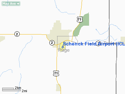
Location &
QuickFacts
|
FAA
Information Effective: |
2007-07-05 |
|
Airport
Identifier: |
ICL |
|
Airport
Status: |
Operational |
|
Longitude/Latitude: |
095-01-35.1360W/40-43-18.4210N
-95.026427/40.721784 (Estimated) |
|
Elevation: |
994 ft / 302.97 m (Estimated) |
|
Land: |
323 acres |
|
From
nearest city: |
1 nautical miles SE of Clarinda, IA |
|
Location: |
Page County, IA |
|
Magnetic Variation: |
04E (1995) |
Owner & Manager
|
Ownership: |
Publicly owned |
|
Owner: |
City Of Clarinda
ROBERT BAILEY, CITY MGR, 712-542-2136. |
|
Address: |
15th & Stuart
Clarinda, IA 51632 |
|
Phone number: |
712-542-2136 |
|
Manager: |
Milo Beery |
|
Address: |
Rt. 3 Box 25
Clarinda, IA 51632 |
|
Phone number: |
712-542-3010 |
Airport
Operations and Facilities
|
Airport
Use: |
Open to public |
|
Wind
indicator: |
Yes |
|
Segmented Circle: |
Yes |
|
Control
Tower: |
No |
|
Lighting
Schedule: |
DUSK-DAWN
ACTVT MIRL RY 02/20; REIL RYS 02; 20 & PAPI RYS 02 & 20 - CTAF. |
|
Beacon
Color: |
Clear-Green (lighted land airport) |
|
Landing
fee charge: |
No |
|
Sectional chart: |
Omaha |
|
Region: |
ACE - Central |
|
Boundary
ARTCC: |
ZMP - Minneapolis |
|
Tie-in
FSS: |
FOD - Fort Dodge |
|
FSS on
Airport: |
No |
|
FSS
Phone: |
515-955-8114 |
|
FSS Toll
Free: |
1-800-WX-BRIEF |
|
NOTAMs
Facility: |
ICL (NOTAM-d service avaliable) |
|
Federal Agreements: |
NPS1 |
Airport Communications
|
CTAF: |
122.800 |
|
Unicom: |
122.800 |
Airport Services
|
Fuel
available: |
100LLA |
|
Airframe
Repair: |
MINOR |
|
Power
Plant Repair: |
MINOR |
|
Bottled
Oxygen: |
NONE |
|
Bulk
Oxygen: |
NONE |
|
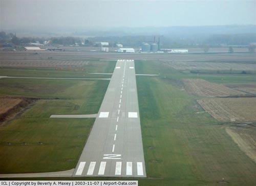
Runway Information
Runway 02/20
|
Dimension: |
5000 x 75 ft / 1524.0 x 22.9 m |
|
Surface: |
CONC, Good Condition |
|
Weight Limit: |
Single wheel: 12000 lbs. |
|
Edge Lights: |
Medium |
|
|
Runway 02
|
Runway 20
|
|
Longitude: |
095-01-50.1770W |
095-01-23.3790W |
|
Latitude: |
40-42-54.5110N |
40-43-39.5140N |
|
Elevation: |
984.00 ft |
994.00 ft |
|
Alignment: |
24 |
127 |
|
Traffic
Pattern: |
Left |
Left |
|
Markings: |
Non-precision instrument, Fair Condition |
Non-precision instrument, Fair Condition |
|
Crossing
Height: |
21.00 ft |
20.00 ft |
|
VASI: |
4-light PAPI on left side |
4-light PAPI on left side |
|
Visual
Glide Angle: |
3.00° |
3.00° |
|
Runway End
Identifier: |
Yes |
Yes |
|
Obstruction: |
15 ft road, 600.0 ft from runway, 26:1 slope to clear |
99 ft bldg, 2570.0 ft from runway, 155 ft left of
centerline, 23:1 slope to clear |
|
Runway 13/31
|
Dimension: |
2425 x 255 ft / 739.1 x 77.7 m |
|
Surface: |
TURF, Good Condition |
|
|
Runway 13
|
Runway 31
|
|
Longitude: |
095-01-41.5800W |
095-01-21.9230W |
|
Latitude: |
40-43-30.6860N |
40-43-11.9650N |
|
Alignment: |
127 |
127 |
|
Traffic
Pattern: |
Left |
Left |
|
Markings: |
None, |
, |
|
Obstruction: |
50 ft trees, 1300.0 ft from runway, 127 ft right of
centerline, 26:1 slope to clear |
32 ft trees, 944.0 ft from runway, 113 ft left of
centerline, 29:1 slope to clear |
|
Radio Navigation Aids
|
ID |
Type |
Name |
Ch |
Freq |
Var |
Dist |
|
ICL |
NDB |
Clarinda |
|
353.00 |
04E |
0.3 nm |
|
SDA |
NDB |
Shenandoah |
|
411.00 |
05E |
17.4 nm |
|
RDK |
NDB |
Red Oak |
|
230.00 |
04E |
20.5 nm |
|
CRZ |
NDB |
Corning |
|
278.00 |
04E |
20.6 nm |
|
EVU |
NDB |
Emville |
|
317.00 |
05E |
23.0 nm |
|
UNE |
NDB |
Union County |
|
379.00 |
04E |
34.0 nm |
|
AFK |
NDB |
Nebraska City |
|
347.00 |
05E |
38.7 nm |
|
AYB |
NDB |
Auburn |
|
430.00 |
05E |
39.5 nm |
|
AIO |
NDB |
Atlantic |
|
365.00 |
04E |
41.0 nm |
|
PMV |
NDB |
Plattsmouth |
|
329.00 |
06E |
42.4 nm |
|
GFZ |
NDB |
Greenfield |
|
338.00 |
04E |
44.9 nm |
|
FNB |
NDB |
Brenner |
|
404.00 |
05E |
46.5 nm |
|
OFF |
TACAN |
Offutt |
054X |
|
05E |
46.3 nm |
|
OVR |
VORTAC |
Omaha |
110X |
116.30 |
08E |
41.9 nm |
|
STJ |
VORTAC |
St Joseph |
102X |
115.50 |
08E |
46.0 nm |
|
LMN |
VORTAC |
Lamoni |
114X |
116.70 |
07E |
48.9 nm |
Remarks
-
PROVIDED APCH TO
EACH RWY IS MAINTAINED FOR A MINIMUM 20:1 GLIDE SLOPE AND TRANSITIONAL SURFACE
BE MAINTAINED FOR A 7:1 SLOPE.
Based
Aircraft
|
Aircraft based
on field: |
23 |
|
Single Engine
Airplanes: |
22 |
|
Ultralights: |
1 |
Operational Statistics
Time Period:
2003-09-29 -
2004-09-27
|
Aircraft
Operations: |
109/Week |
|
General
Aviation Local: |
50.0% |
|
General
Aviation Itinerant: |
50.0% |
Schenck Field Airport
Address:
Page County, IA
Tel:
712-542-2136, 712-542-3010
Images
and information placed above are from
http://www.airport-data.com/airport/ICL/
We
thank them for the data!
|
General Info |
| Country |
United
States |
| State |
IOWA
|
| FAA ID |
ICL
|
| Latitude |
40-43-18.421N |
|
Longitude |
095-01-35.136W |
|
Elevation |
992 feet
|
| Near
City |
CLARINDA
|
We don't guarantee the information is fresh and accurate. The data may
be wrong or outdated.
For more up-to-date information please refer to other sources.
|
|


