 |
|
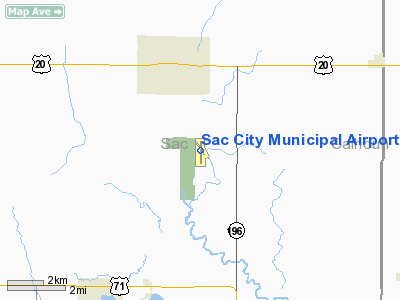
Sac City Municipal Airport |
|
|
Location &
QuickFacts
|
FAA
Information Effective: |
2007-07-05 |
|
Airport
Identifier: |
SKI |
|
Airport
Status: |
Operational |
|
Longitude/Latitude: |
094-58-46.8710W/42-22-44.9280N
-94.979686/42.379147 (Estimated) |
|
Elevation: |
1250 ft / 381.00 m (Surveyed) |
|
Land: |
136 acres |
|
From
nearest city: |
3 nautical miles S of Sac City, IA |
|
Location: |
Sac County, IA |
|
Magnetic Variation: |
04E (1995) |
Owner & Manager
|
Ownership: |
Publicly owned |
|
Owner: |
City Of Sac City |
|
Address: |
P.o. Box 37 Hwy 20 East
Sac City, IA 50583 |
|
Phone
number: |
712-662-7593 |
|
Manager: |
Julie Howes |
|
Address: |
3062 280 Th St
Sac City, IA 50583 |
|
Phone number: |
712-662-7801 |
Airport Operations and Facilities
|
Airport
Use: |
Open to public |
|
Wind
indicator: |
Yes |
|
Segmented Circle: |
No |
|
Control
Tower: |
No |
|
Lighting
Schedule: |
DUSK-DAWN
ACTVT MIRL RYS 14/32 & 18/36; VASI RYS 14 & 32; PVASI RYS 18 & 36;
REIL RY 36 - CTAF. |
|
Beacon
Color: |
Clear-Green (lighted land airport) |
|
Landing
fee charge: |
No |
|
Sectional chart: |
Omaha |
|
Region: |
ACE - Central |
|
Boundary
ARTCC: |
ZMP - Minneapolis |
|
Tie-in
FSS: |
FOD - Fort Dodge |
|
FSS on
Airport: |
No |
|
FSS
Phone: |
515-955-8114 |
|
FSS Toll
Free: |
1-800-WX-BRIEF |
|
NOTAMs
Facility: |
FOD (NOTAM-d service avaliable) |
|
Federal Agreements: |
NGY |
Airport Communications
|
CTAF: |
122.800 |
|
Unicom: |
122.800 |
Airport Services
|
Fuel
available: |
100LL |
|
Airframe
Repair: |
NONE |
|
Power
Plant Repair: |
NONE |
|
Runway Information
Runway 14/32
|
Dimension: |
2350 x 60 ft / 716.3 x 18.3 m |
|
Surface: |
CONC, Good Condition |
|
Weight Limit: |
Single wheel: 12500 lbs. |
|
Edge Lights: |
Medium |
|
|
Runway 14
|
Runway 32
|
|
Longitude: |
094-58-55.9460W |
094-58-39.0750W |
|
Latitude: |
42-23-00.7774N |
42-22-41.2220N |
|
Elevation: |
1249.00 ft |
1236.00 ft |
|
Alignment: |
127 |
127 |
|
Traffic
Pattern: |
Left |
Left |
|
Markings: |
Basic, Good Condition |
Basic, Good Condition |
|
Crossing
Height: |
37.00 ft |
36.00 ft |
|
VASI: |
2-box on left side
OUT INDEFINITELY |
2-box on left side
OUT INDEFINITELY |
|
Visual
Glide Angle: |
3.00° |
3.00° |
|
Runway 18/36
|
Dimension: |
4100 x 75 ft / 1249.7 x 22.9 m |
|
Surface: |
CONC, Good Condition |
|
Edge Lights: |
Medium |
|
|
Runway 18
|
Runway 36
|
|
Longitude: |
094-58-45.8000W |
094-58-46.3000W |
|
Latitude: |
42-23-01.2000N |
42-22-20.7000N |
|
Elevation: |
1245.00 ft |
1235.00 ft |
|
Alignment: |
127 |
1 |
|
Traffic
Pattern: |
Left |
Left |
|
Markings: |
Non-precision instrument, Fair Condition |
Non-precision instrument, Fair Condition |
|
Crossing
Height: |
11.00 ft |
14.00 ft |
|
VASI: |
pulsating/steady burning on left side |
pulsating/steady burning on left side |
|
Visual
Glide Angle: |
3.00° |
3.00° |
|
Runway End
Identifier: |
|
Yes |
|
Obstruction: |
15 ft road, 560.0 ft from runway, 24:1 slope to clear |
91 ft pline, 4200.0 ft from runway, 43:1 slope to clear |
|
Radio Navigation Aids
|
ID |
Type |
Name |
Ch |
Freq |
Var |
Dist |
|
SKI |
NDB |
Sac City |
|
356.00 |
04E |
0.1 nm |
|
SLB |
NDB |
Storm Lake |
|
434.00 |
04E |
17.7 nm |
|
CIN |
NDB |
Carroll |
|
397.00 |
04E |
21.9 nm |
|
POH |
NDB |
Pocahontas |
|
428.00 |
06E |
26.5 nm |
|
DNS |
NDB |
Denison |
|
350.00 |
04E |
29.7 nm |
|
CKP |
NDB |
Pilot Rock |
|
423.00 |
05E |
33.1 nm |
|
EFW |
NDB |
Jefferson |
|
391.00 |
03E |
35.9 nm |
|
MEY |
NDB |
Mapleton |
|
335.00 |
05E |
38.2 nm |
|
ADU |
NDB |
Audubon |
|
266.00 |
04E |
41.5 nm |
|
EGQ |
NDB |
Emmetsburg |
|
410.00 |
04E |
45.0 nm |
|
LTU |
NDB |
Little Sioux |
|
326.00 |
05E |
45.5 nm |
|
GCT |
NDB |
Guthrie Center |
|
518.00 |
05E |
48.5 nm |
|
PRO |
NDB |
Perry |
|
251.00 |
06E |
49.2 nm |
|
EBS |
NDB |
Webster City |
|
323.00 |
03E |
49.4 nm |
|
SPW |
VOR/DME |
Spencer |
037X |
110.00 |
05E |
48.1 nm |
|
FOD |
VORTAC |
Fort Dodge |
082X |
113.50 |
07E |
33.4 nm |
Remarks
-
LINE OF SIGHT
PROBLEMS EXIST BTN RYS 36 & 14/32.
-
MATT WALLACE -
CHAIRMAN ARPT CMSN (712) 662-4806.
-
RY 36 IS CALM
WIND RY.
-
EXISTED PRIOR TO 1959.
Based Aircraft
|
Aircraft based
on field: |
12 |
|
Single Engine
Airplanes: |
12 |
Operational Statistics
Time Period:
2005-07-13 -
2006-07-12
|
Aircraft
Operations: |
122/Week |
|
General
Aviation Local: |
43.2% |
|
General
Aviation Itinerant: |
56.8% |
Sac City Municipal Airport
Address:
Sac County, IA
Tel:
712-662-7593,
712-662-7801
Images
and information placed above are from
http://www.airport-data.com/airport/SKI/
We
thank them for the data!
|
General Info |
| Country |
United
States |
| State |
IOWA
|
| FAA ID |
SKI
|
| Latitude |
42-22-44.700N |
|
Longitude |
094-58-46.500W |
|
Elevation |
1250
feet |
| Near
City |
SAC CITY
|
We don't guarantee the information is fresh and accurate. The data may
be wrong or outdated.
For more up-to-date information please refer to other sources.
|
|


