 |
|
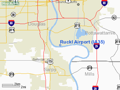
Location &
QuickFacts
|
FAA
Information Effective: |
2007-07-05 |
|
Airport
Identifier: |
IA35 |
|
Airport
Status: |
Operational |
|
Longitude/Latitude: |
095-54-15.0440W/41-11-13.9950N
-95.904179/41.187221 (Estimated) |
|
Elevation: |
970 ft / 295.66 m (Estimated) |
|
Land: |
0 acres |
|
From
nearest city: |
3 nautical miles SW of Council Bluffs, IA |
|
Location: |
Pottawattamie County, IA |
|
Magnetic Variation: |
06E (1985) |
Owner & Manager
|
Ownership: |
Privately owned |
|
Owner: |
Ernest Ruckl |
|
Address: |
1308 N 52nd St
Omaha, NE 68132 |
|
Address: |
|
|
Phone number: |
402-556-5431 |
Airport Operations and Facilities
|
Airport Use: |
Private |
|
Wind indicator: |
No |
|
Segmented Circle: |
No |
|
Control Tower: |
No |
|
Sectional chart: |
Omaha |
|
Region: |
ACE - Central |
|
Boundary ARTCC: |
ZMP - Minneapolis |
|
Tie-in FSS: |
FOD - Fort Dodge |
|
FSS on Airport: |
No |
|
FSS Phone: |
515-955-8114 |
|
FSS Toll Free: |
1-800-WX-BRIEF |
Airport Services
|
Airframe
Repair: |
NONE |
|
Power
Plant Repair: |
NONE |
|
Runway Information
Runway E/W
|
Dimension: |
2400 x 120 ft / 731.5 x 36.6 m |
|
Surface: |
TURF, |
|
|
Runway E
|
Runway W
|
|
Traffic
Pattern: |
Left |
Left |
|
Radio Navigation Aids
|
ID |
Type |
Name |
Ch |
Freq |
Var |
Dist |
|
MLE |
NDB |
Millard |
|
371.00 |
06E |
9.5 nm |
|
OM |
NDB |
Gerfi |
|
320.00 |
05E |
11.1 nm |
|
PMV |
NDB |
Plattsmouth |
|
329.00 |
06E |
14.6 nm |
|
RDK |
NDB |
Red Oak |
|
230.00 |
04E |
31.2 nm |
|
AHQ |
NDB |
Wahoo |
|
400.00 |
07E |
31.5 nm |
|
FET |
NDB |
Fremont |
|
311.00 |
06E |
31.9 nm |
|
SDA |
NDB |
Shenandoah |
|
411.00 |
05E |
34.5 nm |
|
HNR |
NDB |
Harlan |
|
272.00 |
05E |
34.7 nm |
|
AFK |
NDB |
Nebraska City |
|
347.00 |
05E |
35.0 nm |
|
AIO |
NDB |
Atlantic |
|
365.00 |
04E |
40.9 nm |
|
AYB |
NDB |
Auburn |
|
430.00 |
05E |
45.4 nm |
|
LN |
NDB |
Potts |
|
385.00 |
06E |
47.1 nm |
|
ICL |
NDB |
Clarinda |
|
353.00 |
04E |
48.5 nm |
|
OFF |
TACAN |
Offutt |
054X |
|
05E |
4.2 nm |
|
TQE |
VOR |
Tekamah |
|
108.40 |
07E |
36.6 nm |
|
SCB |
VOR/DME |
Scribner |
47X |
111.00 |
06E |
41.2 nm |
|
OVR |
VORTAC |
Omaha |
110X |
116.30 |
08E |
7.7 nm |
|
LNK |
VORTAC |
Lincoln |
108X |
116.10 |
09E |
41.1 nm |
|
OMA |
VOT |
Omaha |
|
109.00 |
|
6.6 nm |
Remarks
-
(E137-1) TREES
ADJACENT TO RUNWAY.
Based
Aircraft
|
Aircraft based
on field: |
1 |
|
Single Engine
Airplanes: |
1 |
Ruckl Airport
Address:
Pottawattamie County, IA
Tel:
402-556-5431
Images
and information placed above are from
http://www.airport-data.com/airport/IA35/
We
thank them for the data!
|
General Info |
| Country |
United
States |
| State |
IOWA
|
| FAA ID |
IA35
|
| Latitude |
41-11-13.995N |
|
Longitude |
095-54-15.044W |
|
Elevation |
970 feet
|
| Near
City |
COUNCIL
BLUFFS |
We don't guarantee the information is fresh and accurate. The data may
be wrong or outdated.
For more up-to-date information please refer to other sources.
|
|


