 |
|
|
|
|
|
Location &
QuickFacts
|
FAA
Information Effective: |
2007-07-05 |
|
Airport
Identifier: |
IA87 |
|
Airport
Status: |
Operational |
|
Longitude/Latitude: |
093-49-15.8090W/41-39-26.9570N
-93.821058/41.657488 (Estimated) |
|
Elevation: |
965 ft / 294.13 m (Estimated) |
|
Land: |
0 acres |
|
From
nearest city: |
3 nautical miles SW of Grimes, IA |
|
Location: |
Dallas County, IA |
|
Magnetic Variation: |
04E (1985) |
Owner & Manager
|
Ownership: |
Privately owned |
|
Owner: |
Thomas & Linda Robel |
|
Address: |
3326 260th St
Grimes, IA 50111 |
|
Phone number: |
515-986-3253 |
|
Manager: |
Thomas & Linda Robel |
|
Address: |
3326 260th St
Grimes, IA 50111 |
|
Phone number: |
515-986-3253 |
Airport Operations and Facilities
|
Airport Use: |
Private |
|
Wind indicator: |
No |
|
Segmented Circle: |
No |
|
Control Tower: |
No |
|
Landing fee charge: |
No |
|
Sectional chart: |
Omaha |
|
Region: |
ACE - Central |
|
Boundary ARTCC: |
ZMP - Minneapolis |
|
Tie-in FSS: |
FOD - Fort Dodge |
|
FSS on Airport: |
No |
|
FSS Phone: |
515-955-8114 |
|
FSS Toll Free: |
1-800-WX-BRIEF |
Airport Services
|
Airframe
Repair: |
NONE |
|
Power
Plant Repair: |
NONE |
|
Bottled
Oxygen: |
NONE |
|
Bulk
Oxygen: |
NONE |
|
Runway Information
Runway 09/27
|
Dimension: |
2600 x 150 ft / 792.5 x 45.7 m |
|
Surface: |
TURF, |
|
|
Runway 09
|
Runway 27
|
|
Traffic
Pattern: |
Left |
Right |
|
Runway End
Identifier: |
No |
No |
|
Centerline
Lights: |
No |
No |
|
Touchdown
Lights: |
No |
No |
|
Obstruction: |
|
35 ft pline, 100.0 ft from runway |
|
Radio Navigation Aids
|
ID |
Type |
Name |
Ch |
Freq |
Var |
Dist |
|
IKV |
NDB |
Ankeny |
|
275.00 |
03E |
11.8 nm |
|
PRO |
NDB |
Perry |
|
251.00 |
06E |
18.4 nm |
|
BNW |
NDB |
Boone |
|
407.00 |
03E |
23.9 nm |
|
GCT |
NDB |
Guthrie Center |
|
518.00 |
05E |
27.5 nm |
|
EFW |
NDB |
Jefferson |
|
391.00 |
03E |
31.7 nm |
|
GFZ |
NDB |
Greenfield |
|
338.00 |
04E |
34.4 nm |
|
OXV |
NDB |
Knoxville |
|
284.00 |
03E |
38.5 nm |
|
PEA |
NDB |
Pella |
|
257.00 |
02E |
42.3 nm |
|
CNC |
NDB |
Chariton |
|
335.00 |
05E |
43.7 nm |
|
EBS |
NDB |
Webster City |
|
323.00 |
03E |
47.2 nm |
|
UNE |
NDB |
Union County |
|
379.00 |
04E |
48.3 nm |
|
MIW |
NDB |
Marshalltown |
|
239.00 |
03E |
48.7 nm |
|
ADU |
NDB |
Audubon |
|
266.00 |
04E |
48.9 nm |
|
CIN |
NDB |
Carroll |
|
397.00 |
04E |
49.0 nm |
|
GGI |
NDB |
Grinnell |
|
248.00 |
02E |
49.1 nm |
|
TNU |
VOR/DME |
Newton |
072X |
112.50 |
03E |
32.8 nm |
|
JWJ |
VOR/DME |
Elmwood |
031X |
109.40 |
03E |
49.1 nm |
|
DSM |
VORTAC |
Des Moines |
122X |
117.50 |
07E |
15.4 nm |
|
DSM |
VOT |
Des Moines |
|
109.20 |
|
9.7 nm |
Remarks
-
PRVDD ALL TFC
PATS BE FLOWN ON N SIDE OF ROBEL FIELD; I.E. RGT TFC TO RWY 27 LEFT TFC TO RWY
9 & THE APCH TO EA RWY IS MAINTD FOR A MIN 20:1 GS. & PRVDD THE TRANSITIONAL
SFC IS MAINTD FOR A MIN 7:1 SLOPE.
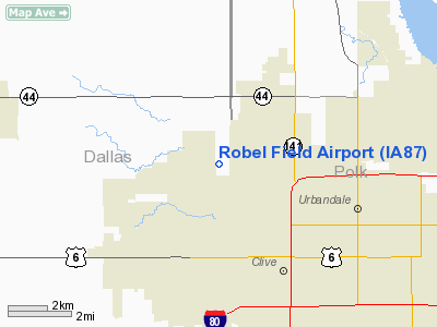
Robel Field Airport
Address:
Dallas County, IA
Tel:
515-986-3253
Images
and information placed above are from
http://www.airport-data.com/airport/IA87/
We
thank them for the data!
|
General Info |
| Country |
United
States |
| State |
IOWA
|
| FAA ID |
IA87
|
| Latitude |
41-39-26.957N |
|
Longitude |
093-49-15.809W |
|
Elevation |
965 feet
|
| Near
City |
GRIMES
|
We don't guarantee the information is fresh and accurate. The data may
be wrong or outdated.
For more up-to-date information please refer to other sources.
|
|


