 |
|
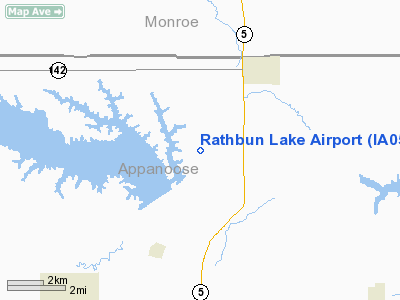
Location &
QuickFacts
|
FAA
Information Effective: |
2007-07-05 |
|
Airport
Identifier: |
IA05 |
|
Airport
Status: |
Operational |
|
Longitude/Latitude: |
092-51-30.7110W/40-51-06.0400N
-92.858531/40.851678 (Estimated) |
|
Elevation: |
1200 ft / 365.76 m (Estimated) |
|
Land: |
0 acres |
|
From
nearest city: |
6 nautical miles N of Centerville, IA |
|
Location: |
Appanoose County, IA |
|
Magnetic Variation: |
03E (1985) |
Owner & Manager
|
Ownership: |
Privately owned |
|
Owner: |
Rathbun Lake Estates Inc |
|
Address: |
603 W Spring
Sigourney, IA 52591 |
|
Phone number: |
515-622-2810 |
|
Manager: |
J E Baumert |
|
Address: |
603 W Spring
Sigourney, IA 52591 |
|
Phone number: |
515-622-2810 |
Airport
Operations and Facilities
|
Airport
Use: |
Private |
|
Wind
indicator: |
No |
|
Segmented Circle: |
No |
|
Control
Tower: |
No |
|
Landing
fee charge: |
No |
|
Sectional chart: |
Chicago |
|
Region: |
ACE - Central |
|
Boundary
ARTCC: |
ZAU - Chicago |
|
Tie-in
FSS: |
FOD - Fort Dodge |
|
FSS on
Airport: |
No |
|
FSS
Phone: |
515-955-8114 |
|
FSS Toll
Free: |
1-800-WX-BRIEF |
|
Runway Information
Runway 18/36
|
Dimension: |
3000 x 150 ft / 914.4 x 45.7 m |
|
Surface: |
TURF, |
|
|
Runway 18
|
Runway 36
|
|
Traffic
Pattern: |
Left |
Left |
|
Radio Navigation Aids
|
ID |
Type |
Name |
Ch |
Freq |
Var |
Dist |
|
TVK |
NDB |
Centerville |
|
290.00 |
04E |
10.1 nm |
|
BEX |
NDB |
Bloomfield |
|
269.00 |
02E |
20.5 nm |
|
CNC |
NDB |
Chariton |
|
335.00 |
05E |
24.9 nm |
|
OOA |
NDB |
Oskaloosa |
|
414.00 |
03E |
28.1 nm |
|
OXV |
NDB |
Knoxville |
|
284.00 |
03E |
29.1 nm |
|
PEA |
NDB |
Pella |
|
257.00 |
02E |
33.5 nm |
|
FFL |
NDB |
Fairfield |
|
332.00 |
03E |
40.7 nm |
|
OTM |
VOR/DME |
Ottumwa |
053X |
111.60 |
06E |
26.4 nm |
|
IRK |
VORTAC |
Kirksville |
093X |
114.60 |
06E |
44.8 nm |
Remarks
-
ARPT CLOSED UNTIL
FURTHER NOTICE.
Rathbun Lake Airport
Address:
Appanoose County, IA
Tel:
515-622-2810
Images
and information placed above are from
http://www.airport-data.com/airport/IA05/
We
thank them for the data!
|
General Info |
| Country |
United
States |
| State |
IOWA
|
| FAA ID |
IA05
|
| Latitude |
40-51-06.040N |
|
Longitude |
092-51-30.711W |
|
Elevation |
1200
feet |
| Near
City |
CENTERVILLE |
We don't guarantee the information is fresh and accurate. The data may
be wrong or outdated.
For more up-to-date information please refer to other sources.
|
|


