 |
|
|
|
|
|
Location &
QuickFacts
|
FAA
Information Effective: |
2007-07-05 |
|
Airport
Identifier: |
2Y0 |
|
Airport
Status: |
Operational |
|
Longitude/Latitude: |
095-36-51.5000W/43-04-40.7000N
-95.614306/43.077972 (Estimated) |
|
Elevation: |
1481 ft / 451.41 m (Estimated) |
|
Land: |
10 acres |
|
From
nearest city: |
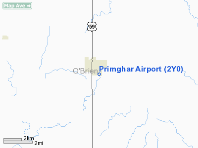
1 nautical miles E of Primghar, IA |
|
Location: |
O Brien County, IA |
|
Magnetic Variation: |
05E (1985) |
Owner & Manager
|
Ownership: |
Publicly owned |
|
Owner: |
City Of Primghar |
|
Address: |
160 South Hayes Avenue
Primghar, IA 51245 |
|
Phone number: |
712-957-2435 |
|
Address: |
Primghar, IA 51245 |
|
Phone number: |
712-957-2435 |
Airport
Operations and Facilities
|
Airport
Use: |
Open to public |
|
Wind
indicator: |
Yes |
|
Segmented Circle: |
No |
|
Control
Tower: |
No |
|
Lighting
Schedule: |
DUSK-DAWN |
|
Landing
fee charge: |
No |
|
Sectional chart: |
Omaha |
|
Region: |
ACE - Central |
|
Boundary
ARTCC: |
ZMP - Minneapolis |
|
Tie-in
FSS: |
FOD - Fort Dodge |
|
FSS on
Airport: |
No |
|
FSS
Phone: |
515-955-8114 |
|
FSS Toll
Free: |
1-800-WX-BRIEF |
|
NOTAMs
Facility: |
FOD (NOTAM-d service avaliable) |
Airport Communications
Airport Services
|
Airframe
Repair: |
NONE |
|
Power
Plant Repair: |
NONE |
|
Bulk
Oxygen: |
NONE |
|
Runway Information
Runway 17/35
|
Dimension: |
1985 x 105 ft / 605.0 x 32.0 m |
|
Surface: |
ASPH-TURF, Fair Condition
ONLY A SMALL PORTION OF THE RY IS ASPH; REMAINDER IS TURF - THE NORTH 855 FT
BY 20 FT CENTER PORTION OF RY LENGTH IS ASPH. |
|
Edge Lights: |
Low |
|
|
Runway 17
|
Runway 35
|
|
Traffic
Pattern: |
Left |
Left |
|
Obstruction: |
36 ft pole, 905.0 ft from runway, 68 ft right of
centerline, 25:1 slope to clear |
5 ft fence, 128.0 ft from runway, 25:1 slope to clear |
|
Radio Navigation Aids
|
ID |
Type |
Name |
Ch |
Freq |
Var |
Dist |
|
SHL |
NDB |
Sheldon |
|
338.00 |
05E |
12.6 nm |
|
ISB |
NDB |
Sibley |
|
269.00 |
05E |
18.5 nm |
|
ORC |
NDB |
Orange City |
|
521.00 |
05E |
20.3 nm |
|
CKP |
NDB |
Pilot Rock |
|
423.00 |
05E |
21.0 nm |
|
LTU |
NDB |
Little Sioux |
|
326.00 |
05E |
21.3 nm |
|
SOY |
NDB |
Sioux Center |
|
368.00 |
06E |
25.5 nm |
|
SLB |
NDB |
Storm Lake |
|
434.00 |
04E |
33.0 nm |
|
EGQ |
NDB |
Emmetsburg |
|
410.00 |
04E |
39.8 nm |
|
PUF |
NDB |
Puff |
|
345.00 |
04E |
41.8 nm |
|
MJQ |
NDB |
Jackson |
|
353.00 |
04E |
43.9 nm |
|
POH |
NDB |
Pocahontas |
|
428.00 |
06E |
47.0 nm |
|
EST |
VOR |
Estherville |
|
110.40 |
07E |
43.0 nm |
|
DDL |
VOR/DME |
Sheldon |
023X |
108.60 |
05E |
12.6 nm |
|
SPW |
VOR/DME |
Spencer |
037X |
110.00 |
05E |
18.8 nm |
|
OTG |
VOR/DME |
Worthington |
043X |
110.60 |
08E |
34.2 nm |
Remarks
-
RY 17 ALSO HAS
FARM SHED & HANGAR 225 FT FROM THR 100 FT L.
Operational Statistics
Time Period:
2004-11-22 -
2005-11-21
|
Aircraft
Operations: |
15/Week |
|
General
Aviation Local: |
33.3% |
|
General
Aviation Itinerant: |
66.7% |
Primghar Airport
Address:
O Brien County, IA
Tel:
712-957-2435
Images
and information placed above are from
http://www.airport-data.com/airport/2Y0/
We
thank them for the data!
|
General Info |
| Country |
United
States |
| State |
IOWA
|
| FAA ID |
2Y0
|
| Latitude |
43-04-59.917N |
|
Longitude |
095-36-46.033W |
|
Elevation |
1481
feet |
| Near
City |
PRIMGHAR
|
We don't guarantee the information is fresh and accurate. The data may
be wrong or outdated.
For more up-to-date information please refer to other sources.
|
|


