 |
|
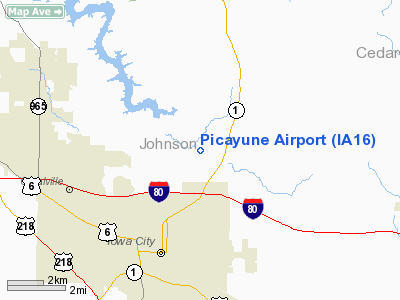
Location &
QuickFacts
|
FAA
Information Effective: |
2007-07-05 |
|
Airport
Identifier: |
IA16 |
|
Airport
Status: |
Operational |
|
Longitude/Latitude: |
091-30-00.6080W/41-42-30.0570N
-91.500169/41.708349 (Estimated) |
|
Elevation: |
800 ft / 243.84 m (Estimated) |
|
Land: |
0 acres |
|
From
nearest city: |
2 nautical miles N of Iowa City, IA |
|
Location: |
Johnson County, IA |
|
Magnetic Variation: |
02E (1985) |
Owner & Manager
|
Ownership: |
Privately owned |
|
Owner: |
John Tiffany |
|
Address: |
4403 Toad Road Ne
Iowa City, IA 52240 |
|
Phone
number: |
319-354-2843 |
|
Manager: |
Gary L Lust |
|
Address: |
P.o. Box 958
Driggs, ID 83422 |
|
Phone number: |
208-354-2548 |
Airport Operations and Facilities
|
Airport Use: |
Private |
|
Wind indicator: |
Yes |
|
Segmented Circle: |
No |
|
Control Tower: |
No |
|
Landing fee charge: |
No |
|
Sectional chart: |
Chicago |
|
Region: |
ACE - Central |
|
Boundary ARTCC: |
ZAU - Chicago |
|
Tie-in FSS: |
FOD - Fort Dodge |
|
FSS on Airport: |
No |
|
FSS Phone: |
515-955-8114 |
|
FSS Toll Free: |
1-800-WX-BRIEF |
Airport Services
|
Airframe
Repair: |
NONE |
|
Power
Plant Repair: |
NONE |
|
Runway Information
Runway 06/24
|
Dimension: |
1800 x 75 ft / 548.6 x 22.9 m |
|
Surface: |
TURF, |
|
|
Runway 06
|
Runway 24
|
|
Traffic
Pattern: |
Left |
Left |
|
Displaced
threshold: |
100.00 ft |
100.00 ft |
|
Radio Navigation Aids
|
ID |
Type |
Name |
Ch |
Freq |
Var |
Dist |
|
AWG |
NDB |
Washington |
|
219.00 |
02E |
26.9 nm |
|
MXO |
NDB |
Monticello |
|
397.00 |
01E |
33.7 nm |
|
TZT |
NDB |
Belle Plaine |
|
371.00 |
02E |
36.7 nm |
|
VTI |
NDB |
Garrison |
|
338.00 |
03E |
38.6 nm |
|
OQW |
NDB |
Maquoketa |
|
386.00 |
02E |
39.7 nm |
|
MPZ |
NDB |
Mount Pleasant |
|
212.00 |
02E |
46.0 nm |
|
FFL |
NDB |
Fairfield |
|
332.00 |
03E |
47.3 nm |
|
IIB |
NDB |
Wapsie |
|
206.00 |
02E |
49.0 nm |
|
CID |
VOR/DME |
Cedar Rapids |
088X |
114.10 |
05E |
16.7 nm |
|
DDD |
VOR/DME |
Port City |
112X |
116.50 |
01E |
25.9 nm |
|
IOW |
VORTAC |
Iowa City |
109X |
116.20 |
05E |
12.5 nm |
|
MZV |
VORTAC |
Moline |
091X |
114.40 |
05E |
45.2 nm |
|
CVA |
VORTAC |
Davenport |
085X |
113.80 |
04E |
45.6 nm |
|
DVN |
VOT |
Davenport Municipal |
|
111.80 |
|
41.5 nm |
Remarks
-
PROVIDED TREES
ARE TOPPED OR REMOVED OR THE RWY THR DSPLCD TO PROVIDE A 20:1 CLEAR GLIDE
SLOPE.
Based
Aircraft
|
Aircraft based
on field: |
3 |
|
Single Engine
Airplanes: |
3 |
Picayune Airport
Address:
Johnson County, IA
Tel:
319-354-2843,
208-354-2548
Images
and information placed above are from
http://www.airport-data.com/airport/IA16/
We
thank them for the data!
|
General Info |
| Country |
United
States |
| State |
IOWA
|
| FAA ID |
IA16
|
| Latitude |
41-42-30.057N |
|
Longitude |
091-30-00.608W |
|
Elevation |
800 feet
|
| Near
City |
IOWA
CITY |
We don't guarantee the information is fresh and accurate. The data may
be wrong or outdated.
For more up-to-date information please refer to other sources.
|
|


