 |
|
|
|
|
|
Location &
QuickFacts
|
FAA
Information Effective: |
2007-07-05 |
|
Airport
Identifier: |
PEA |
|
Airport
Status: |
Operational |
|
Longitude/Latitude: |
092-56-45.1800W/41-24-00.2400N
-92.945883/41.400067 (Estimated) |
|
Elevation: |
885 ft / 269.75 m (Surveyed) |
|
Land: |
84 acres |
|
From
nearest city: |
1 nautical miles W of Pella, IA |
|
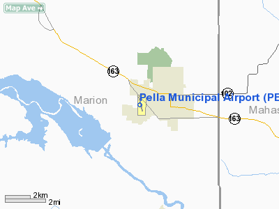
Location: |
Marion County, IA |
|
Magnetic Variation: |
02E (2000) |
Owner & Manager
|
Ownership: |
Publicly owned |
|
Owner: |
City Of Pella |
|
Address: |
717 Main
Pella, IA 50219 |
|
Phone
number: |
641-628-4173 |
|
Manager: |
Shane Vandevoort |
|
Address: |
501 West 15th Street
Pella, IA 50219 |
|
Phone number: |
641-628-9393 |
Airport Operations and Facilities
|
Airport
Use: |
Open to public |
|
Wind
indicator: |
Yes |
|
Segmented Circle: |
No |
|
Control
Tower: |
No |
|
Lighting
Schedule: |
DUSK-DAWN
MIRL RY 16/34 PRESET LOW INTST; TO INCREASE INTST AND ACTVT PAPI AND
REIL RYS 16 & 34 - CTAF. |
|
Beacon
Color: |
Clear-Green (lighted land airport) |
|
Landing
fee charge: |
No |
|
Sectional chart: |
Chicago |
|
Region: |
ACE - Central |
|
Traffic
Pattern Alt: |
816 ft |
|
Boundary
ARTCC: |
ZAU - Chicago |
|
Responsible ARTCC: |
ZMP - Minneapolis |
|
Tie-in
FSS: |
FOD - Fort Dodge |
|
FSS on
Airport: |
No |
|
FSS
Phone: |
515-955-8114 |
|
FSS Toll
Free: |
1-800-WX-BRIEF |
|
NOTAMs
Facility: |
PEA (NOTAM-d service avaliable) |
|
Federal Agreements: |
N |
Airport Communications
|
CTAF: |
122.800 |
|
Unicom: |
122.800 |
Airport Services
|
Fuel
available: |
100LLA |
|
Airframe
Repair: |
MAJOR |
|
Power
Plant Repair: |
MAJOR |
|
Runway Information
Runway 16/34
|
Dimension: |
5400 x 75 ft / 1645.9 x 22.9 m |
|
Surface: |
CONC, Good Condition |
|
Edge Lights: |
Medium |
|
|
Runway 16
|
Runway 34
|
|
Longitude: |
092-56-52.8100W |
092-56-37.4200W |
|
Latitude: |
41-24-30.4400N |
41-23-38.3500N |
|
Elevation: |
878.00 ft |
871.00 ft |
|
Alignment: |
127 |
127 |
|
Traffic
Pattern: |
Left |
Left |
|
Markings: |
Non-precision instrument, Good Condition |
Non-precision instrument, Good Condition |
|
Crossing
Height: |
37.00 ft |
31.00 ft |
|
Displaced
threshold: |
200.00 ft |
200.00 ft |
|
VASI: |
2-light PAPI on left side |
2-light PAPI on left side |
|
Visual
Glide Angle: |
3.30° |
3.00° |
|
Runway End
Identifier: |
Yes |
Yes |
|
Obstruction: |
8 ft road, 500.0 ft from runway, 37:1 slope to clear
RY 16 APCH SLOPE TO DSPLCD THLD 50:1. |
35 ft trees, 667.0 ft from runway, 180 ft left of
centerline, 13:1 slope to clear
RY 34 APCH SLOPE TO DSPLCD THLD 24:1. |
|
Decleard
distances: |
Take off run available 5400.00 ft
Take off distance available 5400.00 ft
Actual stop distance available 5200.00 ft
Landing distance available 5000.00 ft |
Take off run available 5400.00 ft
Take off distance available 5400.00 ft
Actual stop distance available 5200.00 ft
Landing distance available 5000.00 ft |
|
Radio Navigation Aids
|
ID |
Type |
Name |
Ch |
Freq |
Var |
Dist |
|
PEA |
NDB |
Pella |
|
257.00 |
02E |
0.3 nm |
|
OXV |
NDB |
Knoxville |
|
284.00 |
03E |
9.8 nm |
|
GGI |
NDB |
Grinnell |
|
248.00 |
02E |
21.0 nm |
|
OOA |
NDB |
Oskaloosa |
|
414.00 |
03E |
23.2 nm |
|
CNC |
NDB |
Chariton |
|
335.00 |
05E |
29.7 nm |
|
IKV |
NDB |
Ankeny |
|
275.00 |
03E |
33.1 nm |
|
TZT |
NDB |
Belle Plaine |
|
371.00 |
02E |
41.7 nm |
|
MIW |
NDB |
Marshalltown |
|
239.00 |
03E |
42.7 nm |
|
TVK |
NDB |
Centerville |
|
290.00 |
04E |
42.9 nm |
|
BEX |
NDB |
Bloomfield |
|
269.00 |
02E |
45.8 nm |
|
FFL |
NDB |
Fairfield |
|
332.00 |
03E |
49.2 nm |
|
TNU |
VOR/DME |
Newton |
072X |
112.50 |
03E |
24.2 nm |
|
OTM |
VOR/DME |
Ottumwa |
053X |
111.60 |
06E |
35.8 nm |
|
JWJ |
VOR/DME |
Elmwood |
031X |
109.40 |
03E |
42.8 nm |
|
DSM |
VORTAC |
Des Moines |
122X |
117.50 |
07E |
31.8 nm |
|
DSM |
VOT |
Des Moines |
|
109.20 |
|
33.8 nm |
Remarks
-
DEER ON & INVOF ARPT.
-
PRVDD EACH APCH
IS MAINTD FOR MIN 20:1 GLIDE SLOPE AND TRSNL SFC MAINTD FOR 7:1 SLOPE.
Based
Aircraft
|
Aircraft based
on field: |
28 |
|
Single Engine
Airplanes: |
23 |
|
Multi Engine
Airplanes: |
3 |
|
Jet Engine
Airplanes: |
2 |
Operational Statistics
Time Period:
2003-07-08 -
2004-07-06
|
Aircraft
Operations: |
180/Week |
|
General
Aviation Local: |
73.3% |
|
General
Aviation Itinerant: |
26.7% |
Pella Municipal Airport
Address:
Marion County, IA
Tel:
641-628-4173,
641-628-9393
Images
and information placed above are from
http://www.airport-data.com/airport/PEA/
We
thank them for the data!
|
General Info |
| Country |
United
States |
| State |
IOWA
|
| FAA ID |
PEA
|
| Latitude |
41-24-00.240N |
|
Longitude |
092-56-45.180W |
|
Elevation |
885 feet
|
| Near
City |
PELLA
|
We don't guarantee the information is fresh and accurate. The data may
be wrong or outdated.
For more up-to-date information please refer to other sources.
|
|


