 |
|
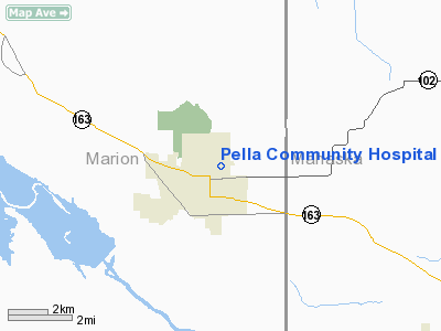
Pella Community Hospital Heliport |
Location &
QuickFacts
|
FAA
Information Effective: |
2007-07-05 |
|
Airport
Identifier: |
7IA9 |
|
Airport
Status: |
Operational |
|
Longitude/Latitude: |
092-54-35.7120W/41-24-44.9920N
-92.909920/41.412498 (Estimated) |
|
Elevation: |
836 ft / 254.81 m (Estimated) |
|
Land: |
0 acres |
|
From
nearest city: |
0 nautical miles N of Pella, IA |
|
Location: |
Marion County, IA |
|
Magnetic Variation: |
03E (1995) |
Owner & Manager
|
Ownership: |
Privately owned |
|
Owner: |
Pella Community Hospital |
|
Address: |
404 Jefferson
Pella, IA 50219 |
|
Phone number: |
515-628-3150 |
|
Manager: |
Robert D Kroese |
|
Address: |
404 Jefferson
Pella, IA 50219 |
|
Phone number: |
515-628-3150 |
Airport
Operations and Facilities
|
Airport
Use: |
Private
MEDICAL USE. |
|
Wind
indicator: |
Yes |
|
Segmented Circle: |
No |
|
Control
Tower: |
No |
|
Sectional chart: |
Chicago |
|
Region: |
ACE - Central |
|
Boundary
ARTCC: |
ZAU - Chicago |
|
Tie-in
FSS: |
FOD - Fort Dodge |
|
FSS on
Airport: |
No |
|
FSS
Phone: |
515-955-8114 |
|
FSS Toll
Free: |
1-800-WX-BRIEF |
|
Runway Information
Helipad H1
|
Dimension: |
40 x 40 ft / 12.2 x 12.2 m |
|
Surface: |
CONC, |
|
|
Runway H1
|
Runway
|
|
Traffic
Pattern: |
Left |
Left |
|
Radio Navigation Aids
|
ID |
Type |
Name |
Ch |
Freq |
Var |
Dist |
|
PEA |
NDB |
Pella |
|
257.00 |
02E |
1.6 nm |
|
OXV |
NDB |
Knoxville |
|
284.00 |
03E |
11.6 nm |
|
GGI |
NDB |
Grinnell |
|
248.00 |
02E |
19.6 nm |
|
OOA |
NDB |
Oskaloosa |
|
414.00 |
03E |
22.1 nm |
|
CNC |
NDB |
Chariton |
|
335.00 |
05E |
31.4 nm |
|
IKV |
NDB |
Ankeny |
|
275.00 |
03E |
34.1 nm |
|
TZT |
NDB |
Belle Plaine |
|
371.00 |
02E |
40.0 nm |
|
MIW |
NDB |
Marshalltown |
|
239.00 |
03E |
41.9 nm |
|
TVK |
NDB |
Centerville |
|
290.00 |
04E |
43.6 nm |
|
BEX |
NDB |
Bloomfield |
|
269.00 |
02E |
45.6 nm |
|
FFL |
NDB |
Fairfield |
|
332.00 |
03E |
48.1 nm |
|
TNU |
VOR/DME |
Newton |
072X |
112.50 |
03E |
24.0 nm |
|
OTM |
VOR/DME |
Ottumwa |
053X |
111.60 |
06E |
35.0 nm |
|
JWJ |
VOR/DME |
Elmwood |
031X |
109.40 |
03E |
42.0 nm |
|
DSM |
VORTAC |
Des Moines |
122X |
117.50 |
07E |
33.3 nm |
|
DSM |
VOT |
Des Moines |
|
109.20 |
|
35.2 nm |
Remarks
-
OWNER DESIRES
ARPT NOT BE CHARTED.
-
PRVDD APCH/DEP
PATHS CLEAR FOR A 8:1 GLIDE SLOPE; TRANSITIONAL SFC CLEAR FOR A 2:1 SLOPE &
HOSPITAL PERSONNEL WILL CONTROL PUBLIC ACCESS TO HELIPORT DURING FLIGHT OPNS.
Pella Community Hospital
Heliport
Address:
Marion County, IA
Tel:
515-628-3150
Images
and information placed above are from
http://www.airport-data.com/airport/7IA9/
We
thank them for the data!
|
General Info |
| Country |
United
States |
| State |
IOWA
|
| FAA ID |
7IA9
|
| Latitude |
41-24-44.992N |
|
Longitude |
092-54-35.712W |
|
Elevation |
836 feet
|
| Near
City |
PELLA
|
We don't guarantee the information is fresh and accurate. The data may
be wrong or outdated.
For more up-to-date information please refer to other sources.
|
|


