 |
|
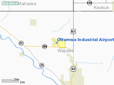
Ottumwa Industrial Airport |
| Ottumwa Regional Airport |
 |
| IATA: OTM â ICAO: KOTM â FAA LID: OTM |
| Summary |
| Airport type |
Public |
| Owner |
City of Ottumwa |
| Serves |
Ottumwa, Iowa |
| Elevation AMSL |
845 ft / 258 m |
| Coordinates |
41°06â²24â³N 092°26â²53â³W / 41.10667°N 92.44806°W / 41.10667; -92.44806 |
| Runways |
| Direction |
Length |
Surface |
| ft |
m |
| 13/31 |
5,885 |
1,794 |
Asphalt/Concrete |
| 4/22 |
5,178 |
1,578 |
Asphalt |
| Statistics (2009) |
| Aircraft operations |
16,450 |
| Based aircraft |
33 |
| Source: Federal Aviation Administration |
Ottumwa Regional Airport (IATA: OTM, ICAO: KOTM, FAA LID: OTM), formerly known as Ottumwa Industrial Airport, is a public airport located five miles (8 km) northwest of the central business district of Ottumwa, a city in Wapello County, Iowa, United States. The airport is owned by the City of Ottumwa and is operated by the Airport Advisory Board. It is listed as a general aviation airport in the National Plan of Integrated Airport System (NPIAS) and as an Enhanced Service Airport in the Iowa Aviation System Plan. History
Ottumwa Naval Air Station was constructed as a Naval Training Center during World War II. The facility, which is located approximately 5 miles (8.0 km) northwest of the central business district, served as a primary flight training center. Former U.S. President Richard M. Nixon served here from October 1942 until May 1943.
In October 1947, the Navy abandoned the air station, and sold it to the City of Ottumwa. In December, 1947, Central States Airlines began commercial air service to Ottumwa. Ottumwa was later served by Braniff Airlines, and then Ozark Airlines. Ozark Airlines ended service to Ottumwa in the late 1970s and was replaced by Mississippi Valley Airlines until 1983. In 1985, Ottumwa Industrial Airport was served by Great Lakes Aviation, with that service coming to an end in 2001. Since that time, Ottumwa has not been served by an air carrier.
In 2002, the City of Ottumwa, in conjunction with the Federal Aviation Administration constructed a new terminal at the airport, replacing the World War II-era operations building that had served as the terminal. The new facility cost nearly $1 million.
Facilities and aircraft
Ottumwa Regional Airport covers an area of 1,600 acres (647 ha) at an elevation of 845 feet (258 m) above mean sea level. It has two runways: 13/31 is 5,885 by 150 feet (1,794 x 46 m) with an asphalt/concrete pavement and 4/22 is 5,178 by 200 feet (1,578 x 61 m) with an asphalt surface. Runway 13/31 is the primary runway, with Runway 31 having an ILS (Instrument Landing System).
For the 12-month period ending June 4, 2009, the airport had 16,450 general aviation aircraft operations, an average of 45 per day. At that time there were 33 aircraft based at this airport: 73% single-engine, 12% multi-engine, 9% jet, 3% helicopter and 3% ultralight.
The above content comes from Wikipedia and is published under free licenses – click here to read more.
Location &
QuickFacts
|
FAA
Information Effective: |
2007-07-05 |
|
Airport
Identifier: |
OTM |
|
Airport
Status: |
Operational |
|
Longitude/Latitude: |
092-26-52.5830W/41-06-23.7460N
-92.447940/41.106596 (Estimated) |
|
Elevation: |
845 ft / 257.56 m (Surveyed) |
|
Land: |
1600 acres |
|
From
nearest city: |
5 nautical miles NW of Ottumwa, IA |
|
Location: |
Wapello County, IA |
|
Magnetic Variation: |
03E (1985) |
Owner & Manager
|
Ownership: |
Publicly owned |
|
Owner: |
City Of Ottumwa |
|
Address: |
City Hall
Ottumwa, IA 52501 |
|
Phone number: |
641-683-0606 |
|
Manager: |
Tom Francis |
|
Address: |
14802 Terminal St
Ottumwa, IA 52501 |
|
Phone number: |
641-683-0619 |
Airport
Operations and Facilities
|
Airport
Use: |
Open to public |
|
Wind
indicator: |
Yes |
|
Segmented Circle: |
Yes |
|
Control
Tower: |
No |
|
Lighting
Schedule: |
DUSK-DAWN
ACTVT MALSR RY 31; HIRL RY 13/31; MIRL RY 04/22; VASI RYS 04; 13; 22;
ODALS RY 13; & REIL RY 13 - CTAF. |
|
Beacon
Color: |
Clear-Green (lighted land airport) |
|
Landing
fee charge: |
No |
|
Sectional chart: |
Chicago |
|
Region: |
ACE - Central |
|
Boundary
ARTCC: |
ZAU - Chicago |
|
Tie-in
FSS: |
FOD - Fort Dodge |
|
FSS on
Airport: |
No |
|
FSS
Phone: |
515-955-8114 |
|
FSS Toll
Free: |
1-800-WX-BRIEF |
|
NOTAMs
Facility: |
OTM (NOTAM-d service avaliable) |
|
Federal Agreements: |
NGPY |
Airport Communications
|
CTAF: |
123.000 |
|
Unicom: |
123.000 |
Airport Services
|
Fuel
available: |
100LLA |
|
Airframe
Repair: |
MAJOR |
|
Power
Plant Repair: |
MAJOR |
|
Bottled
Oxygen: |
NONE |
|
Bulk
Oxygen: |
HIGH/LOW
< HRS DALGT AVBL> |
|
Runway Information
Runway 04/22
|
Dimension: |
5178 x 200 ft / 1578.3 x 61.0 m |
|
Surface: |
ASPH, Fair Condition |
|
Weight Limit: |
Single wheel: 42000 lbs.
Dual wheel: 65000 lbs.
Dual tandem wheel: 120000 lbs. |
|
Edge Lights: |
Medium |
|
|
Runway 04
|
Runway 22
|
|
Longitude: |
092-27-15.1430W |
092-26-27.3410W |
|
Latitude: |
41-06-11.1880N |
41-06-47.3780N |
|
Elevation: |
841.00 ft |
836.00 ft |
|
Alignment: |
45 |
127 |
|
Traffic
Pattern: |
Left |
Left |
|
Markings: |
Non-precision instrument, Fair Condition |
Non-precision instrument, Fair Condition |
|
Crossing
Height: |
45.00 ft |
49.00 ft |
|
VASI: |
4-box on left side |
4-box on left side |
|
Visual
Glide Angle: |
3.00° |
3.00° |
|
Obstruction: |
40 ft tree, 1110.0 ft from runway, 139 ft right of
centerline, 22:1 slope to clear |
, 50:1 slope to clear |
|
Runway 13/31
|
Dimension: |
5885 x 150 ft / 1793.7 x 45.7 m |
|
Surface: |
ASPH-CONC, Good Condition |
|
Weight Limit: |
Single wheel: 80000 lbs.
Dual wheel: 105000 lbs.
Dual tandem wheel: 175000 lbs. |
|
Edge Lights: |
High |
|
|
Runway 13
|
Runway 31
|
|
Longitude: |
092-27-20.9550W |
092-26-26.5650W |
|
Latitude: |
41-06-39.4200N |
41-05-58.3290N |
|
Elevation: |
840.00 ft |
838.00 ft |
|
Alignment: |
127 |
127 |
|
ILS Type: |
|
ILS |
|
Traffic
Pattern: |
Left |
Left |
|
Markings: |
Precision instrument, Good Condition |
Precision instrument, Good Condition |
|
Crossing
Height: |
41.00 ft |
0.00 ft |
|
VASI: |
4-box on left side |
|
|
Visual
Glide Angle: |
3.00° |
0.00° |
|
Approach
lights: |
ODALS |
MALSR |
|
Runway End
Identifier: |
Yes |
|
|
Radio Navigation Aids
|
ID |
Type |
Name |
Ch |
Freq |
Var |
Dist |
|
OOA |
NDB |
Oskaloosa |
|
414.00 |
03E |
7.4 nm |
|
FFL |
NDB |
Fairfield |
|
332.00 |
03E |
21.6 nm |
|
BEX |
NDB |
Bloomfield |
|
269.00 |
02E |
21.7 nm |
|
PEA |
NDB |
Pella |
|
257.00 |
02E |
28.7 nm |
|
OXV |
NDB |
Knoxville |
|
284.00 |
03E |
32.2 nm |
|
TVK |
NDB |
Centerville |
|
290.00 |
04E |
32.5 nm |
|
AWG |
NDB |
Washington |
|
219.00 |
02E |
36.6 nm |
|
GGI |
NDB |
Grinnell |
|
248.00 |
02E |
38.4 nm |
|
CNC |
NDB |
Chariton |
|
335.00 |
05E |
41.8 nm |
|
MPZ |
NDB |
Mount Pleasant |
|
212.00 |
02E |
43.7 nm |
|
TZT |
NDB |
Belle Plaine |
|
371.00 |
02E |
47.4 nm |
|
OTM |
VOR/DME |
Ottumwa |
053X |
111.60 |
06E |
7.2 nm |
|
IOW |
VORTAC |
Iowa City |
109X |
116.20 |
05E |
45.1 nm |
Remarks
-
LINE OF SIGHT
VISION BLOCKED BTN RWYS 22 & 31.
-
SKYDIVING INVOF ARPT.
-
RY 31 IS
PREFERRED CALM WIND RY.
-
TWY 'A' FM
INTERSECTION RYS 04/22 & 13/31 TO AER 13 - 36 FT WIDE.
Based
Aircraft
|
Aircraft based
on field: |
36 |
|
Single Engine
Airplanes: |
26 |
|
Multi Engine
Airplanes: |
7 |
|
Jet Engine
Airplanes: |
2 |
|
Ultralights: |
1
ULTRALIGHT ACTIVITY ON & INVOF ARPT MON-FRI 1600 TO 1/2 HR AFT SS; SAT; SUN;
& HOLIDAYS SR TO 1/2 HR AFT SS. |
Operational Statistics
Time Period:
2005-08-25 - 2006-08-24
|
Aircraft
Operations: |
244/Week |
|
General
Aviation Local: |
43.2% |
|
General
Aviation Itinerant: |
56.8% |
Ottumwa Industrial Airport
Address:
Wapello County, IA
Tel:
641-683-0606, 641-683-0619
Images
and information placed above are from
http://www.airport-data.com/airport/OTM/
We
thank them for the data!
|
General Info |
| Country |
United
States |
| State |
IOWA
|
| FAA ID |
OTM
|
| Latitude |
41-06-23.746N |
|
Longitude |
092-26-52.583W |
|
Elevation |
845 feet
|
| Near
City |
OTTUMWA
|
We don't guarantee the information is fresh and accurate. The data may
be wrong or outdated.
For more up-to-date information please refer to other sources.
|
|


