 |
|
|
|
|
|
Location &
QuickFacts
|
FAA
Information Effective: |
2007-07-05 |
|
Airport
Identifier: |
D02 |
|
Airport
Status: |
Operational |
|
Longitude/Latitude: |
092-47-45.6970W/43-17-32.8980N
-92.796027/43.292472 (Estimated) |
|
Elevation: |
1168 ft / 356.01 m (Surveyed) |
|
Land: |
34 acres |
|
From
nearest city: |
1 nautical miles NE of Osage, IA |
|
Location: |
Mitchell County, IA |
|
Magnetic Variation: |
03E (1985) |
Owner & Manager
|
Ownership: |
Publicly owned |
|
Owner: |
City Of Osage |
|
Address: |
806 Main Street, P.o. Box 29
Osage, IA 50461 |
|
Phone
number: |
641-732-3709 |
|
Manager: |
Jerry Dunlay Pu Wks Dir |
|
Address: |
806 Main, P.o. Box 29
Osage, IA 50461-1439 |
|
Phone number: |
641-732-3709 |
Airport Operations and Facilities
|
Airport
Use: |
Open to public |
|
Wind
indicator: |
Yes |
|
Segmented Circle: |
No |
|
Control
Tower: |
No |
|
Lighting
Schedule: |
DUSK-DAWN |
|
Landing
fee charge: |
No |
|
Sectional chart: |
Chicago |
|
Region: |
ACE - Central |
|
Boundary
ARTCC: |
ZMP - Minneapolis |
|
Tie-in
FSS: |
FOD - Fort Dodge |
|
FSS on
Airport: |
No |
|
FSS
Phone: |
515-955-8114 |
|
FSS Toll
Free: |
1-800-WX-BRIEF |
|
NOTAMs
Facility: |
FOD (NOTAM-d service avaliable) |
Airport
Communications
|
CTAF: |
122.800 |
|
Unicom: |
122.800
UNICOM LCTD OSAGE POLICE STN, 24 HR OPN, PHONE 515-732-3777. |
Airport Services
|
Airframe
Repair: |
NONE |
|
Power
Plant Repair: |
NONE |
|
Runway Information
Runway 17/35
|
Dimension: |
3400 x 50 ft / 1036.3 x 15.2 m |
|
Surface: |
ASPH, Good Condition |
|
Edge Lights: |
Medium |
|
|
Runway 17
|
Runway 35
|
|
Traffic
Pattern: |
Left |
Left |
|
Markings: |
Basic, Good Condition |
Basic, Good Condition |
|
Obstruction: |
21 ft road, 600.0 ft from runway, 19:1 slope to clear |
40 ft pline, 930.0 ft from runway, 18:1 slope to clear |
|
Radio Navigation Aids
|
ID |
Type |
Name |
Ch |
Freq |
Var |
Dist |
|
IY |
NDB |
Chukk |
|
417.00 |
03E |
10.0 nm |
|
CCY |
NDB |
Charles City |
|
375.00 |
03E |
15.8 nm |
|
CJJ |
NDB |
Cresco |
|
293.00 |
02E |
29.4 nm |
|
FXY |
NDB |
Forest City |
|
359.00 |
05E |
36.3 nm |
|
HPT |
NDB |
Hampton |
|
230.00 |
03E |
38.9 nm |
|
DEH |
NDB |
Decorah |
|
236.00 |
01E |
46.4 nm |
|
XWY |
NDB |
West Union |
|
278.00 |
02E |
49.2 nm |
|
JAY |
VOR/DME |
Austin |
019X |
108.20 |
03E |
17.9 nm |
|
RST |
VOR/DME |
Rochester |
057X |
112.00 |
05E |
30.7 nm |
|
AEL |
VOR/DME |
Albert Lea |
035X |
109.80 |
05E |
34.3 nm |
|
MCW |
VORTAC |
Mason City |
096X |
114.90 |
06E |
26.2 nm |
|
ALO |
VORTAC |
Waterloo |
059X |
112.20 |
06E |
47.6 nm |
Remarks
-
PRVDD THE APCH TO
EACH RWY IS MAINTAINED FOR MIN 20:1 GLIDE SLOPE AND THE TRANSITIONAL SURFACE
BE MAINTAINED FOR A 7:1 SLOPE.
Based
Aircraft
|
Aircraft based
on field: |
6 |
|
Single Engine
Airplanes: |
6 |
Operational Statistics
Time Period:
2005-09-07 -
2006-09-06
|
Aircraft
Operations: |
59/Week |
|
General
Aviation Local: |
40.0% |
|
General
Aviation Itinerant: |
60.0% |
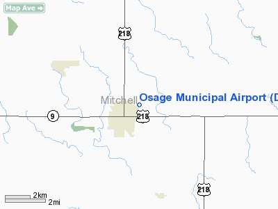
Osage Municipal Airport
Address:
Mitchell County, IA
Tel:
641-732-3709
Images
and information placed above are from
http://www.airport-data.com/airport/D02/
We
thank them for the data!
|
General Info |
| Country |
United
States |
| State |
IOWA
|
| FAA ID |
D02
|
| Latitude |
43-17-32.898N |
|
Longitude |
092-47-45.697W |
|
Elevation |
1168
feet |
| Near
City |
OSAGE
|
We don't guarantee the information is fresh and accurate. The data may
be wrong or outdated.
For more up-to-date information please refer to other sources.
|
|


