 |
|
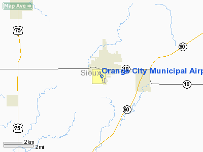
Orange City Municipal Airport |
|
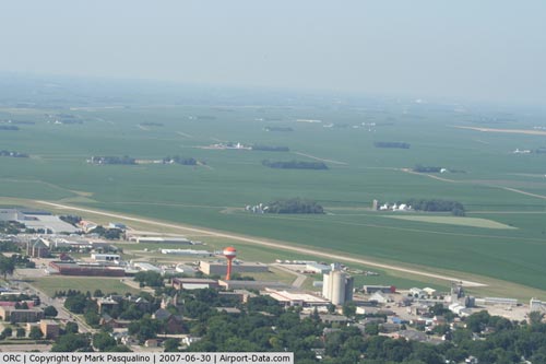 |
(Click on the photo to enlarge) |
Location &
QuickFacts
|
FAA
Information Effective: |
2007-07-05 |
|
Airport
Identifier: |
ORC |
|
Airport
Status: |
Operational |
|
Longitude/Latitude: |
096-03-46.0680W/42-59-24.9520N
-96.062797/42.990264 (Estimated) |
|
Elevation: |
1414 ft / 430.99 m (Estimated) |
|
Land: |
80 acres |
|
From
nearest city: |
1 nautical miles S of Orange City, IA |
|
Location: |
Sioux County, IA |
|
Magnetic Variation: |
05E (1995) |
Owner & Manager
|
Ownership: |
Publicly owned |
|
Owner: |
City Of Orange City |
|
Address: |
125 Central Ave Se
Orange City, IA 51041 |
|
Phone
number: |
712-707-4885 |
|
Manager: |
City Administrator
DUANE FEEKES; DITJ MANAGER; (712) 707-4885. |
|
Address: |
Rt 2
Orange City, IA 51041 |
|
Phone number: |
712-707-4885 |
Airport
Operations and Facilities
|
Airport
Use: |
Open to public |
|
Wind
indicator: |
Yes |
|
Segmented Circle: |
No |
|
Control
Tower: |
No |
|
Lighting
Schedule: |
DUSK-DAWN
ACTVT MIRL RY 16/34; VASI & REIL RYS 16 & 34 - CTAF. |
|
Beacon
Color: |
Clear-Green (lighted land airport)
ROTG BCN OTS INDEFLY. |
|
Landing
fee charge: |
No |
|
Sectional chart: |
Omaha |
|
Region: |
ACE - Central |
|
Boundary
ARTCC: |
ZMP - Minneapolis |
|
Tie-in
FSS: |
FOD - Fort Dodge |
|
FSS on
Airport: |
No |
|
FSS
Phone: |
515-955-8114 |
|
FSS Toll
Free: |
1-800-WX-BRIEF |
|
NOTAMs
Facility: |
ORC (NOTAM-d service avaliable) |
|
Federal Agreements: |
NY1 |
Airport Communications
|
CTAF: |
122.800 |
|
Unicom: |
122.800 |
Airport Services
|
Fuel
available: |
100LLA |
|
Bottled
Oxygen: |
NONE |
|
Bulk
Oxygen: |
NONE |
|
Runway Information
Runway 16/34
|
Dimension: |
4250 x 60 ft / 1295.4 x 18.3 m |
|
Surface: |
CONC, Good Condition |
|
Weight Limit: |
Single wheel: 28000 lbs.
Dual wheel: 48000 lbs. |
|
Edge Lights: |
Medium |
|
|
Runway 16
|
Runway 34
|
|
Longitude: |
096-03-53.5800W |
096-03-38.5600W |
|
Latitude: |
42-59-45.2000N |
42-59-04.7000N |
|
Elevation: |
1414.00 ft |
1392.00 ft |
|
Alignment: |
127 |
127 |
|
Traffic
Pattern: |
Left |
Left |
|
Markings: |
Non-precision instrument, Good Condition |
Non-precision instrument, Good Condition |
|
VASI: |
2-box on left side |
2-box on left side |
|
Runway End
Identifier: |
Yes |
Yes |
|
Obstruction: |
62 ft tree, 1246.0 ft from runway, 94 ft left of
centerline, 16:1 slope to clear |
19 ft road, 450.0 ft from runway, 13:1 slope to clear |
|
Radio Navigation Aids
|
ID |
Type |
Name |
Ch |
Freq |
Var |
Dist |
|
ORC |
NDB |
Orange City |
|
521.00 |
05E |
0.1 nm |
|
SOY |
NDB |
Sioux Center |
|
368.00 |
06E |
10.2 nm |
|
SHL |
NDB |
Sheldon |
|
338.00 |
05E |
16.8 nm |
|
ISB |
NDB |
Sibley |
|
269.00 |
05E |
26.5 nm |
|
CKP |
NDB |
Pilot Rock |
|
423.00 |
05E |
27.3 nm |
|
OI |
NDB |
Tommi |
|
305.00 |
07E |
36.4 nm |
|
GAK |
NDB |
Sioux Gateway |
|
233.00 |
06E |
37.8 nm |
|
VMR |
NDB |
Vermillion |
|
375.00 |
06E |
40.7 nm |
|
SU |
NDB |
Salix |
|
414.00 |
07E |
41.1 nm |
|
LTU |
NDB |
Little Sioux |
|
326.00 |
05E |
41.7 nm |
|
SLB |
NDB |
Storm Lake |
|
434.00 |
04E |
43.0 nm |
|
FS |
NDB |
Rokky |
|
245.00 |
06E |
45.2 nm |
|
DDL |
VOR/DME |
Sheldon |
023X |
108.60 |
05E |
16.7 nm |
|
SPW |
VOR/DME |
Spencer |
037X |
110.00 |
05E |
39.2 nm |
|
OTG |
VOR/DME |
Worthington |
043X |
110.60 |
08E |
44.7 nm |
|
SUX |
VORTAC |
Sioux City |
112X |
116.50 |
09E |
40.5 nm |
Remarks
-
E111 PRVDD APCH
TO EACH RWY IS MAINTD FOR A MIN 20:1 GLIDE SLOPE & THE TRANSITIONAL SFC MAINTD
FOR A 7:1 SLOPE.
Based
Aircraft
|
Aircraft based
on field: |
5 |
|
Single Engine
Airplanes: |
3 |
|
Multi Engine
Airplanes: |
2 |
Operational Statistics
Time Period:
2005-07-28 -
2006-07-27
|
Aircraft
Operations: |
66/Week |
|
General
Aviation Local: |
43.2% |
|
General
Aviation Itinerant: |
56.8% |
Orange City Municipal Airport
Address:
Sioux County, IA
Tel:
712-707-4885
Images
and information placed above are from
http://www.airport-data.com/airport/ORC/
We
thank them for the data!
|
General Info |
| Country |
United
States |
| State |
IOWA
|
| FAA ID |
ORC
|
| Latitude |
42-59-24.952N |
|
Longitude |
096-03-46.068W |
|
Elevation |
1414
feet |
| Near
City |
ORANGE
CITY |
We don't guarantee the information is fresh and accurate. The data may
be wrong or outdated.
For more up-to-date information please refer to other sources.
|
|


