 |
|
|
|
|
|
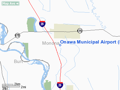
Location &
QuickFacts
|
FAA
Information Effective: |
2007-07-05 |
|
Airport
Identifier: |
K36 |
|
Airport
Status: |
Operational |
|
Longitude/Latitude: |
096-06-13.0000W/42-00-16.0000N
-96.103611/42.004444 (Estimated) |
|
Elevation: |
1047 ft / 319.13 m (Estimated) |
|
Land: |
33 acres |
|
From
nearest city: |
1 nautical miles SW of Onawa, IA |
|
Location: |
Monona County, IA |
|
Magnetic Variation: |
06E (1985) |
Owner & Manager
|
Ownership: |
Publicly owned |
|
Owner: |
City Of Onawa |
|
Address: |
914 Diamond
Onawa, IA 51040 |
|
Phone number: |
712-433-1181 |
|
Manager: |
Jeff Sander |
|
Address: |
914 Diamond
Onawa, IA 51040 |
|
Phone number: |
712-433-1511 |
Airport
Operations and Facilities
|
Airport
Use: |
Open to public |
|
Wind
indicator: |
Yes |
|
Segmented Circle: |
No |
|
Control
Tower: |
No |
|
Lighting
Schedule: |
DUSK-DAWN
ACTVT MIRL RY 15/33; PAPI & REIL RYS 15 & 33 - CTAF. |
|
Landing
fee charge: |
No |
|
Sectional chart: |
Omaha |
|
Region: |
ACE - Central |
|
Boundary
ARTCC: |
ZMP - Minneapolis |
|
Tie-in
FSS: |
FOD - Fort Dodge |
|
FSS on
Airport: |
No |
|
FSS
Phone: |
515-955-8114 |
|
FSS Toll
Free: |
1-800-WX-BRIEF |
|
NOTAMs
Facility: |
FOD (NOTAM-d service avaliable) |
Airport Communications
|
CTAF: |
123.000 |
|
Unicom: |
123.000 |
Airport Services
|
Airframe
Repair: |
NONE |
|
Power
Plant Repair: |
NONE |
|
Bottled
Oxygen: |
NONE |
|
Bulk
Oxygen: |
NONE |
|
Runway Information
Runway 15/33
|
Dimension: |
3400 x 60 ft / 1036.3 x 18.3 m |
|
Surface: |
CONC, Good Condition |
|
Weight Limit: |
Single wheel: 4000 lbs. |
|
Edge Lights: |
Medium |
|
|
Runway 15
|
Runway 33
|
|
Traffic
Pattern: |
Left |
Left |
|
Markings: |
Non-precision instrument, Fair Condition |
Non-precision instrument, Fair Condition |
|
Crossing
Height: |
26.00 ft |
26.00 ft |
|
VASI: |
2-light PAPI on left side |
2-light PAPI on left side |
|
Visual
Glide Angle: |
3.00° |
3.00° |
|
Runway End
Identifier: |
Yes |
Yes |
|
Obstruction: |
73 ft trees, 2630.0 ft from runway, 110 ft right of
centerline, 33:1 slope to clear |
40 ft pline, 970.0 ft from runway, 19:1 slope to clear |
|
Radio Navigation Aids
|
ID |
Type |
Name |
Ch |
Freq |
Var |
Dist |
|
MEY |
NDB |
Mapleton |
|
335.00 |
05E |
17.4 nm |
|
SU |
NDB |
Salix |
|
414.00 |
07E |
21.1 nm |
|
GAK |
NDB |
Sioux Gateway |
|
233.00 |
06E |
27.3 nm |
|
OI |
NDB |
Tommi |
|
305.00 |
07E |
31.7 nm |
|
DNS |
NDB |
Denison |
|
350.00 |
04E |
32.4 nm |
|
FET |
NDB |
Fremont |
|
311.00 |
06E |
38.1 nm |
|
OM |
NDB |
Gerfi |
|
320.00 |
05E |
38.9 nm |
|
LCG |
NDB |
Wayne |
|
389.00 |
06E |
41.8 nm |
|
HNR |
NDB |
Harlan |
|
272.00 |
05E |
42.7 nm |
|
MLE |
NDB |
Millard |
|
371.00 |
06E |
48.7 nm |
|
TQE |
VOR |
Tekamah |
|
108.40 |
07E |
15.1 nm |
|
SCB |
VOR/DME |
Scribner |
47X |
111.00 |
06E |
33.6 nm |
|
SUX |
VORTAC |
Sioux City |
112X |
116.50 |
09E |
22.7 nm |
|
OMA |
VOT |
Omaha |
|
109.00 |
|
43.7 nm |
Remarks
-
RY 33 IS CALM
WIND RY.
-
CONDL--PROVIDED A
CLEAR APPROACH TO EACH RWY IS MAINTAINED FOR A MINIMUM 20:1 GLIDE SLOPE AND
THE TRANSITIONAL SURFACE IS MAINTAINED FOR A 7:1 SLOPE.
Based Aircraft
|
Aircraft based
on field: |
4 |
|
Single Engine
Airplanes: |
4 |
Operational Statistics
Time Period:
2005-06-28 -
2006-06-27
|
Aircraft
Operations: |
19/Week |
|
General
Aviation Local: |
43.1% |
|
General
Aviation Itinerant: |
56.9% |
Onawa Municipal Airport
Address:
Monona County, IA
Tel:
712-433-1181, 712-433-1511
Images
and information placed above are from
http://www.airport-data.com/airport/K36/
We
thank them for the data!
|
General Info |
| Country |
United
States |
| State |
IOWA
|
| FAA ID |
K36
|
| Latitude |
42-00-16.000N |
|
Longitude |
096-06-13.000W |
|
Elevation |
1047
feet |
| Near
City |
ONAWA
|
We don't guarantee the information is fresh and accurate. The data may
be wrong or outdated.
For more up-to-date information please refer to other sources.
|
|


