 |
|
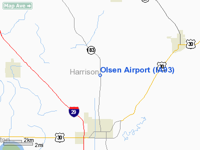
Location &
QuickFacts
|
FAA
Information Effective: |
2007-07-05 |
|
Airport
Identifier: |
IA93 |
|
Airport
Status: |
Operational |
|
Longitude/Latitude: |
095-53-44.0360W/41-36-45.9670N
-95.895566/41.612769 (Estimated) |
|
Elevation: |
1030 ft / 313.94 m (Estimated) |
|
Land: |
10 acres |
|
From
nearest city: |
4 nautical miles N of Missouri Valley, IA |
|
Location: |
Harrison County, IA |
|
Magnetic Variation: |
06E (1985) |
Owner & Manager
|
Ownership: |
Privately owned |
|
Owner: |
Ken Olsen |
|
Address: |
Rt 2 Box 92a
Missouri Valley, IA 51555 |
|
Phone
number: |
712-642-2990 |
|
Manager: |
Ken Olsen |
|
Address: |
Rt 2 Box 92a
Missouri Valley, IA 51555 |
|
Phone number: |
712-642-2990 |
Airport Operations and Facilities
|
Airport
Use: |
Private |
|
Segmented Circle: |
No |
|
Control
Tower: |
No |
|
Sectional chart: |
Omaha |
|
Region: |
ACE - Central |
|
Boundary
ARTCC: |
ZMP - Minneapolis |
|
Tie-in
FSS: |
FOD - Fort Dodge |
|
FSS
Phone: |
515-955-8114 |
|
FSS Toll
Free: |
1-800-WX-BRIEF |
|
Runway Information
Runway 17/35
|
Dimension: |
2500 x 50 ft / 762.0 x 15.2 m |
|
Surface: |
TURF, |
|
|
Runway 17
|
Runway 35
|
|
Traffic
Pattern: |
Left |
Left |
|
Displaced
threshold: |
500.00 ft |
0.00 ft |
|
Radio Navigation Aids
|
ID |
Type |
Name |
Ch |
Freq |
Var |
Dist |
|
OM |
NDB |
Gerfi |
|
320.00 |
05E |
15.0 nm |
|
HNR |
NDB |
Harlan |
|
272.00 |
05E |
25.0 nm |
|
MLE |
NDB |
Millard |
|
371.00 |
06E |
27.0 nm |
|
FET |
NDB |
Fremont |
|
311.00 |
06E |
29.7 nm |
|
DNS |
NDB |
Denison |
|
350.00 |
04E |
32.1 nm |
|
MEY |
NDB |
Mapleton |
|
335.00 |
05E |
34.4 nm |
|
AHQ |
NDB |
Wahoo |
|
400.00 |
07E |
38.8 nm |
|
PMV |
NDB |
Plattsmouth |
|
329.00 |
06E |
40.2 nm |
|
AIO |
NDB |
Atlantic |
|
365.00 |
04E |
40.2 nm |
|
ADU |
NDB |
Audubon |
|
266.00 |
04E |
44.5 nm |
|
RDK |
NDB |
Red Oak |
|
230.00 |
04E |
46.1 nm |
|
SU |
NDB |
Salix |
|
414.00 |
07E |
46.4 nm |
|
OFF |
TACAN |
Offutt |
054X |
|
05E |
29.8 nm |
|
TQE |
VOR |
Tekamah |
|
108.40 |
07E |
15.5 nm |
|
SCB |
VOR/DME |
Scribner |
47X |
111.00 |
06E |
32.9 nm |
|
OVR |
VORTAC |
Omaha |
110X |
116.30 |
08E |
27.7 nm |
|
SUX |
VORTAC |
Sioux City |
112X |
116.50 |
09E |
48.0 nm |
|
OMA |
VOT |
Omaha |
|
109.00 |
|
19.1 nm |
Remarks
-
PROVDD MAINT 20:1
APCH SLOPE; MAINT 7:1 TRANSITIONAL SLOPE; ALL AIR TRAFFIC STAY EAST OF RY NSTD
RIGHT TRAFFIC TO 35 TO AVOID TRAFFIC AT HARRISON CO ARPT.
Olsen Airport
Address:
Harrison County, IA
Tel:
712-642-2990
Images
and information placed above are from
http://www.airport-data.com/airport/IA93/
We
thank them for the data!
|
General Info |
| Country |
United
States |
| State |
IOWA
|
| FAA ID |
IA93
|
| Latitude |
41-36-45.967N |
|
Longitude |
095-53-44.036W |
|
Elevation |
1030
feet |
| Near
City |
MISSOURI
VALLEY |
We don't guarantee the information is fresh and accurate. The data may
be wrong or outdated.
For more up-to-date information please refer to other sources.
|
|


