 |
|
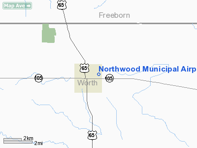
Northwood Municipal Airport |
|
|
Location &
QuickFacts
|
FAA
Information Effective: |
2007-07-05 |
|
Airport
Identifier: |
5D2 |
|
Airport
Status: |
Operational |
|
Longitude/Latitude: |
093-12-06.7312W/43-26-53.8414N
-93.201870/43.448289 (Estimated) |
|
Elevation: |
1224 ft / 373.08 m (Surveyed) |
|
Land: |
28 acres |
|
From
nearest city: |
1 nautical miles E of Northwood, IA |
|
Location: |
Worth County, IA |
|
Magnetic Variation: |
03E (1985) |
Owner & Manager
|
Ownership: |
Publicly owned |
|
Owner: |
City Of Northwood |
|
Address: |
Central Ave.
Northwood, IA 50459 |
|
Phone number: |
641-324-1075 |
|
Manager: |
Dr Mike Dierenfeld |
|
Address: |
Central Ave
Northwood, IA 50459 |
|
Phone number: |
641-324-1084 |
Airport
Operations and Facilities
|
Airport
Use: |
Open to public |
|
Wind
indicator: |
Yes |
|
Segmented Circle: |
No |
|
Control
Tower: |
No |
|
Lighting
Schedule: |
DUSK-DAWN |
|
Landing
fee charge: |
No |
|
Sectional chart: |
Omaha |
|
Region: |
ACE - Central |
|
Boundary
ARTCC: |
ZMP - Minneapolis |
|
Tie-in
FSS: |
FOD - Fort Dodge |
|
FSS on
Airport: |
No |
|
FSS
Phone: |
515-955-8114 |
|
FSS Toll
Free: |
1-800-WX-BRIEF |
|
NOTAMs
Facility: |
FOD (NOTAM-d service avaliable) |
Airport Communications
|
Runway Information
Runway 17/35
|
Dimension: |
3300 x 100 ft / 1005.8 x 30.5 m |
|
Surface: |
TURF, Good Condition |
|
Edge Lights: |
Low |
|
|
Runway 17
|
Runway 35
|
|
Traffic
Pattern: |
Left |
Left |
|
Obstruction: |
75 ft tree, 1700.0 ft from runway, 50 ft left of
centerline, 22:1 slope to clear |
35 ft trees, 635.0 ft from runway, 110 ft right of
centerline, 18:1 slope to clear |
|
Radio Navigation Aids
|
ID |
Type |
Name |
Ch |
Freq |
Var |
Dist |
|
FXY |
NDB |
Forest City |
|
359.00 |
05E |
22.4 nm |
|
IY |
NDB |
Chukk |
|
417.00 |
03E |
28.0 nm |
|
CCY |
NDB |
Charles City |
|
375.00 |
03E |
34.6 nm |
|
SBU |
NDB |
Blue Earth |
|
332.00 |
04E |
40.0 nm |
|
ACQ |
NDB |
Waseca |
|
371.00 |
02E |
40.4 nm |
|
HPT |
NDB |
Hampton |
|
230.00 |
03E |
43.5 nm |
|
CJJ |
NDB |
Cresco |
|
293.00 |
02E |
47.0 nm |
|
CAV |
NDB |
Clarion |
|
387.00 |
03E |
48.8 nm |
|
JAY |
VOR/DME |
Austin |
019X |
108.20 |
03E |
14.5 nm |
|
AEL |
VOR/DME |
Albert Lea |
035X |
109.80 |
05E |
15.8 nm |
|
RST |
VOR/DME |
Rochester |
057X |
112.00 |
05E |
33.1 nm |
|
FOW |
VOR/DME |
Halfway |
049X |
111.20 |
02E |
46.0 nm |
|
MCW |
VORTAC |
Mason City |
096X |
114.90 |
06E |
22.0 nm |
Remarks
-
CROP DUSTING &
SKYDIVING PLANES ON & INVOF ARPT.
-
RY 17/35 +18 FT
BIT RD 100 FT E & PARALLEL CNTRLN.
-
RY 35 HAS 80 FT
ANT AT 595 FT FM THLD 245 FT L.
Based Aircraft
|
Aircraft based
on field: |
7 |
|
Single Engine
Airplanes: |
6 |
|
Ultralights: |
1 |
Operational Statistics
Time Period:
2005-09-08 -
2006-09-07
|
Aircraft
Operations: |
49/Week |
|
General
Aviation Local: |
40.0% |
|
General
Aviation Itinerant: |
60.0% |
Northwood Municipal Airport
Address:
Worth County, IA
Tel:
641-324-1075, 641-324-1084
Images
and information placed above are from
http://www.airport-data.com/airport/5D2/
We
thank them for the data!
|
General Info |
| Country |
United
States |
| State |
IOWA
|
| FAA ID |
5D2
|
| Latitude |
43-27-04.851N |
|
Longitude |
093-11-25.729W |
|
Elevation |
1224
feet |
| Near
City |
NORTHWOOD |
We don't guarantee the information is fresh and accurate. The data may
be wrong or outdated.
For more up-to-date information please refer to other sources.
|
|


