 |
|
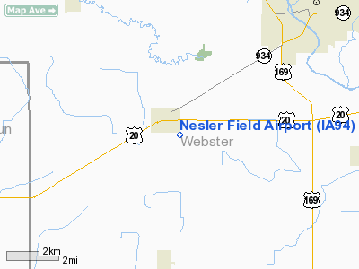
Location &
QuickFacts
|
FAA
Information Effective: |
2007-07-05 |
|
Airport
Identifier: |
IA94 |
|
Airport
Status: |
Closed Indefinitely |
|
Longitude/Latitude: |
094-17-00.8760W/42-25-59.8990N
-94.283577/42.433305 (Estimated) |
|
Elevation: |
1147 ft / 349.61 m (Estimated) |
|
Land: |
8 acres |
|
From
nearest city: |
0 nautical miles E of Moorland, IA |
|
Location: |
Webster County, IA |
|
Magnetic Variation: |
04E (1985) |
Owner & Manager
|
Ownership: |
Privately owned |
|
Owner: |
Jerry Dischler |
|
Address: |
Rfd
Moorland, IA 50566 |
|
Phone number: |
515-549-3325 |
|
Manager: |
Jerry Dischler |
|
Address: |
Rfd 1
Moorland, IA 50566 |
|
Phone number: |
515-549-3325 |
Airport Operations and Facilities
|
Airport Use: |
Private |
|
Wind indicator: |
Yes |
|
Segmented Circle: |
No |
|
Control Tower: |
No |
|
Landing fee charge: |
No |
|
Sectional chart: |
Omaha |
|
Region: |
ACE - Central |
|
Boundary ARTCC: |
ZMP - Minneapolis |
|
Tie-in FSS: |
FOD - Fort Dodge |
|
FSS on Airport: |
No |
|
FSS Phone: |
515-955-8114 |
|
FSS Toll Free: |
1-800-WX-BRIEF |
Airport Services
|
Airframe
Repair: |
NONE |
|
Power
Plant Repair: |
NONE |
|
Runway Information
Runway 17/35
|
Dimension: |
2185 x 90 ft / 666.0 x 27.4 m |
|
Surface: |
TURF, Poor Condition
GOPHERHOLES IN RY WITH SMALL MOUNDS OF LOOSE DIRT. |
|
|
Runway 17
|
Runway 35
|
|
Traffic
Pattern: |
Left |
Left |
|
Obstruction: |
18 ft road, 415.0 ft from runway, 23:1 slope to clear |
4 ft fence, 0.0 ft from runway |
|
Radio Navigation Aids
|
ID |
Type |
Name |
Ch |
Freq |
Var |
Dist |
|
EBS |
NDB |
Webster City |
|
323.00 |
03E |
18.4 nm |
|
EAG |
NDB |
Eagle Grove |
|
302.00 |
03E |
23.4 nm |
|
POH |
NDB |
Pocahontas |
|
428.00 |
06E |
24.8 nm |
|
EFW |
NDB |
Jefferson |
|
391.00 |
03E |
25.4 nm |
|
BNW |
NDB |
Boone |
|
407.00 |
03E |
29.8 nm |
|
CAV |
NDB |
Clarion |
|
387.00 |
03E |
29.9 nm |
|
SKI |
NDB |
Sac City |
|
356.00 |
04E |
31.2 nm |
|
CIN |
NDB |
Carroll |
|
397.00 |
04E |
32.3 nm |
|
PRO |
NDB |
Perry |
|
251.00 |
06E |
36.6 nm |
|
AXA |
NDB |
Algona |
|
403.00 |
03E |
39.0 nm |
|
SLB |
NDB |
Storm Lake |
|
434.00 |
04E |
43.7 nm |
|
EGQ |
NDB |
Emmetsburg |
|
410.00 |
04E |
44.3 nm |
|
IFA |
NDB |
Iowa Falls |
|
368.00 |
03E |
45.2 nm |
|
GCT |
NDB |
Guthrie Center |
|
518.00 |
05E |
45.7 nm |
|
FOD |
VORTAC |
Fort Dodge |
082X |
113.50 |
07E |
10.7 nm |
Remarks
-
(ARPT STATUS)
ARPT CLSD INDEFLY.
Based
Aircraft
|
Aircraft based
on field: |
1 |
|
Single Engine
Airplanes: |
1 |
Operational Statistics
Time Period: 1992-04-28 - 1993-04-27
|
Aircraft
Operations: |
9/Month |
|
General
Aviation Itinerant: |
100.0% |
Nesler Field Airport
Address:
Webster County, IA
Tel:
515-549-3325
Images
and information placed above are from
http://www.airport-data.com/airport/IA94/
We
thank them for the data!
|
General Info |
| Country |
United
States |
| State |
IOWA
|
| FAA ID |
IA94
|
| Latitude |
42-25-59.899N |
|
Longitude |
094-17-00.876W |
|
Elevation |
1147
feet |
| Near
City |
MOORLAND
|
We don't guarantee the information is fresh and accurate. The data may
be wrong or outdated.
For more up-to-date information please refer to other sources.
|
|


