 |
|
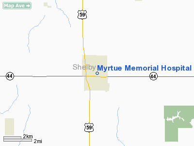
Myrtue Memorial Hospital Heliport |
Location &
QuickFacts
|
FAA
Information Effective: |
2007-07-05 |
|
Airport
Identifier: |
IA55 |
|
Airport
Status: |
Operational |
|
Longitude/Latitude: |
095-19-26.9940W/41-38-56.9580N
-95.324165/41.649155 (Estimated) |
|
Elevation: |
1231 ft / 375.21 m (Estimated) |
|
Land: |
0 acres |
|
From
nearest city: |
0 nautical miles N of Harlan, IA |
|
Location: |
Shelby County, IA |
|
Magnetic Variation: |
06E (1990) |
Owner & Manager
|
Ownership: |
Publicly owned |
|
Owner: |
Shelby Co Myrtue Mem Hospital |
|
Address: |
1213 Garfield Avenue
Harlan, IA 51537 |
|
Phone number: |
712-755-5161 |
|
Manager: |
Richard Daberkow |
|
Address: |
1213 Garfield Avenue
Harlan, IA 51537 |
|
Phone number: |
712-755-5161 |
Airport
Operations and Facilities
|
Airport
Use: |
Private
MEDICAL USE. |
|
Wind
indicator: |
Yes |
|
Segmented Circle: |
No |
|
Control
Tower: |
No |
|
Sectional chart: |
Omaha |
|
Region: |
ACE - Central |
|
Boundary
ARTCC: |
ZMP - Minneapolis |
|
Tie-in
FSS: |
FOD - Fort Dodge |
|
FSS on
Airport: |
No |
|
FSS
Phone: |
515-955-8114 |
|
FSS Toll
Free: |
1-800-WX-BRIEF |
|
Runway Information
Helipad H1
|
Dimension: |
25 x 25 ft / 7.6 x 7.6 m |
|
Surface: |
CONC, |
|
|
Runway H1
|
Runway
|
|
Traffic
Pattern: |
Left |
Left |
|
Radio Navigation Aids
|
ID |
Type |
Name |
Ch |
Freq |
Var |
Dist |
|
HNR |
NDB |
Harlan |
|
272.00 |
05E |
4.3 nm |
|
ADU |
NDB |
Audubon |
|
266.00 |
04E |
18.8 nm |
|
AIO |
NDB |
Atlantic |
|
365.00 |
04E |
19.3 nm |
|
DNS |
NDB |
Denison |
|
350.00 |
04E |
20.3 nm |
|
OM |
NDB |
Gerfi |
|
320.00 |
05E |
33.1 nm |
|
CIN |
NDB |
Carroll |
|
397.00 |
04E |
33.9 nm |
|
RDK |
NDB |
Red Oak |
|
230.00 |
04E |
38.2 nm |
|
MEY |
NDB |
Mapleton |
|
335.00 |
05E |
38.3 nm |
|
GCT |
NDB |
Guthrie Center |
|
518.00 |
05E |
40.1 nm |
|
GFZ |
NDB |
Greenfield |
|
338.00 |
04E |
44.1 nm |
|
MLE |
NDB |
Millard |
|
371.00 |
06E |
44.9 nm |
|
SKI |
NDB |
Sac City |
|
356.00 |
04E |
46.5 nm |
|
CRZ |
NDB |
Corning |
|
278.00 |
04E |
46.9 nm |
|
EFW |
NDB |
Jefferson |
|
391.00 |
03E |
49.1 nm |
|
OFF |
TACAN |
Offutt |
054X |
|
05E |
41.2 nm |
|
TQE |
VOR |
Tekamah |
|
108.40 |
07E |
38.9 nm |
|
OVR |
VORTAC |
Omaha |
110X |
116.30 |
08E |
34.4 nm |
|
OMA |
VOT |
Omaha |
|
109.00 |
|
33.1 nm |
Remarks
-
PROVIDED PLINE
EAST OF PAD BE REMOVED; REMOVE TREE NE; REMOVE/RELOCATE LIGHT STANDARD NORTH
OF PAD.
Myrtue Memorial Hospital Heliport
Address:
Shelby County, IA
Tel:
712-755-5161
Images
and information placed above are from
http://www.airport-data.com/airport/IA55/
We
thank them for the data!
|
General Info |
| Country |
United
States |
| State |
IOWA
|
| FAA ID |
IA55
|
| Latitude |
41-38-56.958N |
|
Longitude |
095-19-26.994W |
|
Elevation |
1231
feet |
| Near
City |
HARLAN
|
We don't guarantee the information is fresh and accurate. The data may
be wrong or outdated.
For more up-to-date information please refer to other sources.
|
|


