 |
|
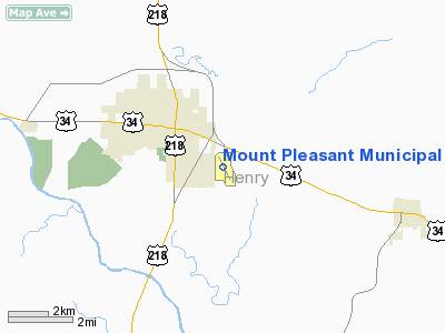
Mount Pleasant Municipal Airport |
|
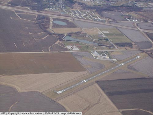 |
(Click on the photo to enlarge) |
Location &
QuickFacts
|
FAA
Information Effective: |
2007-07-05 |
|
Airport
Identifier: |
MPZ |
|
Airport
Status: |
Operational |
|
Longitude/Latitude: |
091-30-39.8700W/40-56-47.8100N
-91.511075/40.946614 (Estimated) |
|
Elevation: |
734 ft / 223.72 m (Surveyed) |
|
Land: |
124 acres |
|
From
nearest city: |
3 nautical miles SE of Mount Pleasant, IA |
|
Location: |
Henry County, IA |
|
Magnetic Variation: |
02E (1995) |
Owner & Manager
|
Ownership: |
Publicly owned |
|
Owner: |
City Of Mt Pleasant |
|
Address: |
220 West Monroe
Mt Pleasant, IA 52641 |
|
Phone
number: |
319-385-1470 |
|
Manager: |
Steve Hohl, Air Advantage Inc |
|
Address: |
1720 South Lexington Ave
Mt Pleasant, IA 52641 |
|
Phone number: |
319-385-8122
OR 319-385-1487. |
Airport Operations and Facilities
|
Airport
Use: |
Open to public |
|
Wind
indicator: |
Yes |
|
Segmented Circle: |
No |
|
Control
Tower: |
No |
|
Lighting
Schedule: |
DUSK-DAWN
MIRL RY 15/33 PRESET ON LOW INTS ONLY. ACTIVATE REIL RY 33 ONLY WHEN
MIRL OPNL - CTAF. |
|
Beacon
Color: |
Clear-Green (lighted land airport) |
|
Landing
fee charge: |
No |
|
Sectional chart: |
Chicago |
|
Region: |
ACE - Central |
|
Boundary
ARTCC: |
ZAU - Chicago |
|
Tie-in
FSS: |
FOD - Fort Dodge |
|
FSS on
Airport: |
No |
|
FSS
Phone: |
515-955-8114 |
|
FSS Toll
Free: |
1-800-WX-BRIEF |
|
NOTAMs
Facility: |
MPZ (NOTAM-d service avaliable) |
|
Federal Agreements: |
NGY |
Airport Communications
|
CTAF: |
123.050 |
|
Unicom: |
123.050 |
Airport Services
|
Fuel
available: |
100LLA |
|
Airframe
Repair: |
MINOR |
|
Power
Plant Repair: |
MINOR |
|
Bottled
Oxygen: |
NONE |
|
Bulk
Oxygen: |
HIGH/LOW |
|
Runway Information
Runway 03/21
|
Dimension: |
1965 x 120 ft / 598.9 x 36.6 m |
|
Surface: |
TURF, Fair Condition |
|
|
Runway 03
|
Runway 21
|
|
Longitude: |
091-30-48.5710W |
091-30-35.1710W |
|
Latitude: |
40-56-42.6100N |
40-56-59.5100N |
|
Traffic
Pattern: |
Left |
Left |
|
Obstruction: |
22 ft tree, 532.0 ft from runway, 90 ft left of
centerline, 24:1 slope to clear |
22 ft tree, 395.0 ft from runway, 140 ft right of
centerline, 17:1 slope to clear |
|
Runway 15/33
|
Dimension: |
4001 x 75 ft / 1219.5 x 22.9 m |
|
Surface: |
ASPH, Fair Condition |
|
Weight Limit: |
Single wheel: 12000 lbs.
Dual wheel: 16000 lbs. |
|
Edge Lights: |
Medium |
|
|
Runway 15
|
Runway 33
|
|
Longitude: |
091-30-50.8860W |
091-30-26.7570W |
|
Latitude: |
40-57-03.6870N |
40-56-28.6500N |
|
Elevation: |
725.00 ft |
730.00 ft |
|
Alignment: |
127 |
127 |
|
Traffic
Pattern: |
Left |
Right |
|
Markings: |
Non-precision instrument, Fair Condition |
Non-precision instrument, Fair Condition |
|
Crossing
Height: |
35.00 ft |
29.00 ft |
|
VASI: |
2-light PAPI on left side |
2-light PAPI on left side |
|
Visual
Glide Angle: |
3.00° |
3.00° |
|
Runway End
Identifier: |
|
Yes |
|
Obstruction: |
23 ft tree, 515.0 ft from runway, 153 ft right of
centerline, 13:1 slope to clear |
4 ft fence, 295.0 ft from runway, 23:1 slope to clear |
|
Radio Navigation Aids
|
ID |
Type |
Name |
Ch |
Freq |
Var |
Dist |
|
MPZ |
NDB |
Mount Pleasant |
|
212.00 |
02E |
0.2 nm |
|
AWG |
NDB |
Washington |
|
219.00 |
02E |
21.3 nm |
|
FFL |
NDB |
Fairfield |
|
332.00 |
03E |
22.0 nm |
|
EOK |
NDB |
Keokuk |
|
366.00 |
02E |
29.2 nm |
|
BEX |
NDB |
Bloomfield |
|
269.00 |
02E |
43.5 nm |
|
OOA |
NDB |
Oskaloosa |
|
414.00 |
03E |
47.3 nm |
|
DDD |
VOR/DME |
Port City |
112X |
116.50 |
01E |
30.1 nm |
|
OTM |
VOR/DME |
Ottumwa |
053X |
111.60 |
06E |
37.3 nm |
|
GBG |
VOR/DME |
Galesburg |
035X |
109.80 |
03E |
48.9 nm |
|
BRL |
VORTAC |
Burlington |
051X |
111.40 |
05E |
29.8 nm |
|
IOW |
VORTAC |
Iowa City |
109X |
116.20 |
05E |
34.7 nm |
|
MZV |
VORTAC |
Moline |
091X |
114.40 |
05E |
45.5 nm |
Remarks
-
PRVDD VISUAL
INDICATORS PER AC 150/5340-5 ARE USED & IF NIGHTTIME OPNS ARE
CONDUCTED/PLANNED, FLOODLIGHTING OF SEGMENTED CIRCLE NECESSARY.
Based
Aircraft
|
Aircraft based
on field: |
20 |
|
Single Engine
Airplanes: |
10 |
|
Multi Engine
Airplanes: |
9 |
|
Ultralights: |
1 |
Operational Statistics
Time Period:
2005-05-18 -
2006-05-17
|
Aircraft
Operations: |
147/Week |
|
Air Taxi: |
3.9% |
|
General
Aviation Local: |
41.5% |
|
General
Aviation Itinerant: |
54.6% |
Mount Pleasant Municipal Airport
Address:
Henry County, IA
Tel:
319-385-1470,
319-385-8122
Images
and information placed above are from
http://www.airport-data.com/airport/MPZ/
We
thank them for the data!
|
General Info |
| Country |
United
States |
| State |
IOWA
|
| FAA ID |
MPZ
|
| Latitude |
40-56-47.810N |
|
Longitude |
091-30-39.870W |
|
Elevation |
734 feet
|
| Near
City |
MOUNT
PLEASANT |
We don't guarantee the information is fresh and accurate. The data may
be wrong or outdated.
For more up-to-date information please refer to other sources.
|
|


