 |
|
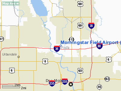
Morningstar Field Airport |
|
|
Location &
QuickFacts
|
FAA
Information Effective: |
2007-07-05 |
|
Airport
Identifier: |
Y76 |
|
Airport
Status: |
Operational |
|
Longitude/Latitude: |
093-38-38.7880W/41-39-19.9590N
-93.644108/41.655544 (Estimated) |
|
Elevation: |
805 ft / 245.36 m (Estimated) |
|
Land: |
15 acres |
|
From
nearest city: |
3 nautical miles N of Des Moines, IA |
|
Location: |
Polk County, IA |
|
Magnetic Variation: |
04E (1985) |
Owner & Manager
|
Ownership: |
Privately owned |
|
Owner: |
Leora Morningstar |
|
Address: |
4785 Nw Morningstar Drive
Des Moines, IA 50313 |
|
Phone
number: |
515-280-8615 |
|
Manager: |
Don Lundeen
ARPT BOARD MEMBER. |
|
Address: |
3504 1st Street
Des Moines, IA 50313 |
|
Phone number: |
515-244-6075 |
Airport Operations and Facilities
|
Airport
Use: |
Open to public |
|
Wind
indicator: |
Yes |
|
Segmented Circle: |
No |
|
Control
Tower: |
No |
|
Lighting
Schedule: |
DUSK-2200
ACTVT LIRL RY 17/35 - CTAF. |
|
Landing
fee charge: |
No |
|
Sectional chart: |
Omaha |
|
Region: |
ACE - Central |
|
Boundary
ARTCC: |
ZMP - Minneapolis |
|
Tie-in
FSS: |
FOD - Fort Dodge |
|
FSS on
Airport: |
No |
|
FSS
Phone: |
515-955-8114 |
|
FSS Toll
Free: |
1-800-WX-BRIEF |
|
NOTAMs
Facility: |
FOD (NOTAM-d service avaliable) |
Airport Communications
Airport Services
|
Fuel
available: |
100LLMOGAS
FOR FUEL CALL (515) 289-1652/244-2881. |
|
Airframe
Repair: |
MINOR
MINOR AIRFRAME & PWR PLANT REPAIRS BY PRIOR REQUEST CALL 515-243-2490. |
|
Power
Plant Repair: |
MINOR |
|
Bottled
Oxygen: |
NONE |
|
Bulk
Oxygen: |
NONE |
|
Runway Information
Runway 17/35
|
Dimension: |
2065 x 180 ft / 629.4 x 54.9 m |
|
Surface: |
TURF, Fair Condition |
|
Edge Lights: |
Low |
|
|
Runway 17
|
Runway 35
|
|
Traffic
Pattern: |
Left |
Left |
|
Obstruction: |
26 ft pole, 276.0 ft from runway, 118 ft left of
centerline, 10:1 slope to clear |
46 ft tree, 930.0 ft from runway, 90 ft left of
centerline, 20:1 slope to clear |
|
Radio Navigation Aids
|
ID |
Type |
Name |
Ch |
Freq |
Var |
Dist |
|
IKV |
NDB |
Ankeny |
|
275.00 |
03E |
4.5 nm |
|
PRO |
NDB |
Perry |
|
251.00 |
06E |
25.4 nm |
|
BNW |
NDB |
Boone |
|
407.00 |
03E |
25.7 nm |
|
OXV |
NDB |
Knoxville |
|
284.00 |
03E |
32.2 nm |
|
PEA |
NDB |
Pella |
|
257.00 |
02E |
34.9 nm |
|
GCT |
NDB |
Guthrie Center |
|
518.00 |
05E |
35.5 nm |
|
EFW |
NDB |
Jefferson |
|
391.00 |
03E |
38.0 nm |
|
CNC |
NDB |
Chariton |
|
335.00 |
05E |
40.5 nm |
|
GFZ |
NDB |
Greenfield |
|
338.00 |
04E |
41.1 nm |
|
GGI |
NDB |
Grinnell |
|
248.00 |
02E |
41.2 nm |
|
MIW |
NDB |
Marshalltown |
|
239.00 |
03E |
42.5 nm |
|
EBS |
NDB |
Webster City |
|
323.00 |
03E |
48.3 nm |
|
TNU |
VOR/DME |
Newton |
072X |
112.50 |
03E |
25.2 nm |
|
JWJ |
VOR/DME |
Elmwood |
031X |
109.40 |
03E |
42.8 nm |
|
DSM |
VORTAC |
Des Moines |
122X |
117.50 |
07E |
13.1 nm |
|
DSM |
VOT |
Des Moines |
|
109.20 |
|
7.1 nm |
Remarks
-
PRVDD RY 17
DSPLCD TO PROVIDE CLEAR 20:1 APCH; RELOCATE THR LGTS TO DISPLACE RY 17; REMOVE
POLES AT RY 17 THR; INSTALL OBSTN LGTS ON OFFICE & HANGAR.
Based
Aircraft
|
Aircraft based
on field: |
56 |
|
Single Engine
Airplanes: |
56 |
Operational Statistics
Time Period:
2003-12-22 -
2004-12-20
|
Aircraft
Operations: |
63/Day |
|
General
Aviation Local: |
93.9% |
|
General
Aviation Itinerant: |
6.1% |
Morningstar Field Airport
Address:
Polk County, IA
Tel:
515-280-8615,
515-244-6075
Images
and information placed above are from
http://www.airport-data.com/airport/Y76/
We
thank them for the data!
|
General Info |
| Country |
United
States |
| State |
IOWA
|
| FAA ID |
Y76
|
| Latitude |
41-39-19.959N |
|
Longitude |
093-38-38.788W |
|
Elevation |
805 feet
|
| Near
City |
DES
MOINES |
We don't guarantee the information is fresh and accurate. The data may
be wrong or outdated.
For more up-to-date information please refer to other sources.
|
|


