 |
|
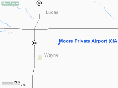
Location &
QuickFacts
|
FAA
Information Effective: |
2007-07-05 |
|
Airport
Identifier: |
0IA5 |
|
Airport
Status: |
Operational |
|
Longitude/Latitude: |
093-15-45.7540W/40-52-20.0100N
-93.262709/40.872225 (Estimated) |
|
Elevation: |
1060 ft / 323.09 m (Estimated) |
|
Land: |
0 acres |
|
From
nearest city: |
2 nautical miles NE of Millerton, IA |
|
Location: |
Wayne County, IA |
|
Magnetic Variation: |
04E (1985) |
Owner & Manager
|
Ownership: |
Privately owned |
|
Owner: |
Max D Moore |
|
Address: |
Route 2
Russell, IA 50238 |
|
Phone number: |
515-897-5142 |
|
Manager: |
Max D Moore |
|
Address: |
Route 2
Russell, IA 50238 |
|
Phone number: |
515-897-5142 |
Airport
Operations and Facilities
|
Airport
Use: |
Private |
|
Wind
indicator: |
Yes |
|
Segmented Circle: |
No |
|
Control
Tower: |
No |
|
Lighting
Schedule: |
PHONE REQ
FOR LIRL 17/35 CALL 515-897-5142. |
|
Landing
fee charge: |
No |
|
Sectional chart: |
Omaha |
|
Region: |
ACE - Central |
|
Boundary
ARTCC: |
ZAU - Chicago |
|
Tie-in
FSS: |
FOD - Fort Dodge |
|
FSS on
Airport: |
No |
|
FSS
Phone: |
515-955-8114 |
|
FSS Toll
Free: |
1-800-WX-BRIEF |
|
Runway Information
Runway 17/35
|
Dimension: |
2000 x 60 ft / 609.6 x 18.3 m |
|
Surface: |
TURF, |
|
Edge Lights: |
Low
LIRL OTS INDEFLY. |
|
|
Runway 17
|
Runway 35
|
|
Traffic
Pattern: |
Left |
Left |
|
Obstruction: |
50 ft trees, 365.0 ft from runway |
|
|
Radio Navigation Aids
|
ID |
Type |
Name |
Ch |
Freq |
Var |
Dist |
|
CNC |
NDB |
Chariton |
|
335.00 |
05E |
9.8 nm |
|
TVK |
NDB |
Centerville |
|
290.00 |
04E |
19.9 nm |
|
OXV |
NDB |
Knoxville |
|
284.00 |
03E |
26.3 nm |
|
PEA |
NDB |
Pella |
|
257.00 |
02E |
35.2 nm |
|
BEX |
NDB |
Bloomfield |
|
269.00 |
02E |
38.6 nm |
|
OOA |
NDB |
Oskaloosa |
|
414.00 |
03E |
41.1 nm |
|
UNE |
NDB |
Union County |
|
379.00 |
04E |
49.5 nm |
|
TRX |
NDB |
Trenton |
|
400.00 |
03E |
49.9 nm |
|
OTM |
VOR/DME |
Ottumwa |
053X |
111.60 |
06E |
43.6 nm |
|
LMN |
VORTAC |
Lamoni |
114X |
116.70 |
07E |
36.1 nm |
|
DSM |
VORTAC |
Des Moines |
122X |
117.50 |
07E |
38.2 nm |
|
DSM |
VOT |
Des Moines |
|
109.20 |
|
44.2 nm |
Remarks
-
PROVIDED THAT THE
APPROACH TO EACH RWY IS MAINTAINED FOR A MINIMUM 20:1 GLIDE SLOPE AND THAT THE
TRANSITIONAL SURFACE BE MAINTAINED FOR A 7:1 SLOPE.
Based
Aircraft
|
Aircraft based
on field: |
1 |
|
Single Engine
Airplanes: |
1 |
Moore Private Airport
Address:
Wayne County, IA
Tel:
515-897-5142
Images
and information placed above are from
http://www.airport-data.com/airport/0IA5/
We
thank them for the data!
|
General Info |
| Country |
United
States |
| State |
IOWA
|
| FAA ID |
0IA5
|
| Latitude |
40-52-20.010N |
|
Longitude |
093-15-45.754W |
|
Elevation |
1060
feet |
| Near
City |
MILLERTON |
We don't guarantee the information is fresh and accurate. The data may
be wrong or outdated.
For more up-to-date information please refer to other sources.
|
|


