 |
|
Monticello Regional Airport |
Coordinates: 42°13′13″N 091°09′48″W / 42.22028°N 91.16333°W / 42.22028; -91.16333
| Monticello Regional Airport |
| IATA: MXO – ICAO: KMXO – FAA LID: MXO |
| Summary |
| Airport type |
Public |
| Owner |
City of Monticello |
| Serves |
Monticello, Iowa |
| Elevation AMSL |
833 ft / 254 m |
| Runways |
| Direction |
Length |
Surface |
| ft |
m |
| 15/33 |
4,400 |
1,341 |
Concrete |
| 9/27 |
2,275 |
693 |
Turf |
| Statistics (2007) |
| Aircraft operations |
10,850 |
| Based aircraft |
33 |
| Source: Federal Aviation Administration |
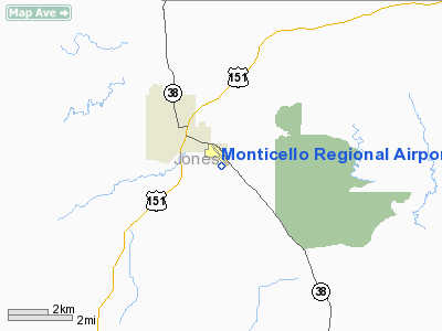
Monticello Regional Airport (IATA: MXO, ICAO: KMXO, FAA LID: MXO), formerly known as Monticello Municipal Airport, is a public airport located two miles (3 km) southeast of the central business district of Monticello, a city in Jones County, Iowa, United States. It is owned by the City of Monticello.
Facilities and aircraft
Monticello Regional Airport covers an area of 300 acres (121 ha) which contains two runways: 15/33 with a concrete pavement measuring 4,400 x 75 ft (1,341 x 23 m) and 9/27 with a turf surface measuring 2,275 x 90 ft (693 x 27 m). For the 12-month period ending August 1, 2007, the airport had 10,850 general aviation aircraft operations, an average of 29 per day.
The above content comes from Wikipedia and is published under free licenses – click here to read more.
Location &
QuickFacts
|
FAA
Information Effective: |
2007-07-05 |
|
Airport
Identifier: |
MXO |
|
Airport
Status: |
Operational |
|
Longitude/Latitude: |
091-09-47.8770W/42-13-13.3070N
-91.163299/42.220363 (Estimated) |
|
Elevation: |
833 ft / 253.90 m (Surveyed) |
|
Land: |
300 acres |
|
From
nearest city: |
2 nautical miles SE of Monticello, IA |
|
Location: |
Jones County, IA |
|
Magnetic Variation: |
01E (2000) |
Owner & Manager
|
Ownership: |
Publicly owned |
|
Owner: |
City Of Monticello |
|
Address: |
102 W. 1st St.
Monticello, IA 52310 |
|
Phone
number: |
319-465-3525 |
|
Manager: |
Paul Elmegreen...fbo |
|
Address: |
Box 168 20373 Hwy 38 S
Monticello, IA 52310 |
|
Phone number: |
319-465-5488
HOME PHONE 316-465-4901. |
Airport Operations and Facilities
|
Airport
Use: |
Open to public |
|
Wind
indicator: |
Yes |
|
Segmented Circle: |
No |
|
Control
Tower: |
No |
|
Lighting
Schedule: |
DUSK-DAWN |
|
Beacon
Color: |
Clear-Green (lighted land airport) |
|
Landing
fee charge: |
No |
|
Sectional chart: |
Chicago |
|
Region: |
ACE - Central |
|
Boundary
ARTCC: |
ZAU - Chicago |
|
Tie-in
FSS: |
FOD - Fort Dodge |
|
FSS on
Airport: |
No |
|
FSS
Phone: |
515-955-8114 |
|
FSS Toll
Free: |
1-800-WX-BRIEF |
|
NOTAMs
Facility: |
MXO (NOTAM-d service avaliable) |
|
Federal Agreements: |
NY1 |
Airport Communications
|
CTAF: |
122.800 |
|
Unicom: |
122.800 |
Airport Services
|
Fuel
available: |
100LLA |
|
Airframe
Repair: |
MAJOR |
|
Power
Plant Repair: |
MAJOR |
|
Bottled
Oxygen: |
LOW |
|
Bulk
Oxygen: |
NONE |
|
Runway Information
Runway 09/27
|
Dimension: |
2275 x 90 ft / 693.4 x 27.4 m |
|
Surface: |
TURF, Fair Condition |
|
|
Runway 09
|
Runway 27
|
|
Longitude: |
091-09-57.2740W |
091-09-26.8300W |
|
Latitude: |
42-13-08.1290N |
42-13-08.1290N |
|
Elevation: |
822.00 ft |
833.00 ft |
|
Alignment: |
90 |
127 |
|
Traffic
Pattern: |
Left |
Left |
|
Obstruction: |
, 50:1 slope to clear |
23 ft road, 513.0 ft from runway, 22:1 slope to clear |
|
Runway 15/33
|
Dimension: |
4400 x 75 ft / 1341.1 x 22.9 m |
|
Surface: |
CONC, Good Condition |
|
Weight Limit: |
Single wheel: 12500 lbs. |
|
Edge Lights: |
Medium
ACTVT MIRL RY 15/33 - CTAF. |
|
|
Runway 15
|
Runway 33
|
|
Longitude: |
091-10-03.8000W |
091-09-38.0000W |
|
Latitude: |
42-13-35.5000N |
42-12-56.5000N |
|
Elevation: |
825.00 ft |
829.00 ft |
|
Alignment: |
127 |
127 |
|
Traffic
Pattern: |
Left |
Left |
|
Markings: |
Non-precision instrument, Good Condition |
Non-precision instrument, Good Condition |
|
VASI: |
2-light PAPI on left side |
2-light PAPI on left side |
|
Obstruction: |
61 ft road, 1601.0 ft from runway, 171 ft right of
centerline, 22:1 slope to clear |
97 ft trees, 3000.0 ft from runway, 137 ft right of
centerline, 28:1 slope to clear |
|
Radio Navigation Aids
|
ID |
Type |
Name |
Ch |
Freq |
Var |
Dist |
|
MXO |
NDB |
Monticello |
|
397.00 |
01E |
1.7 nm |
|
OQW |
NDB |
Maquoketa |
|
386.00 |
02E |
21.4 nm |
|
IIB |
NDB |
Wapsie |
|
206.00 |
02E |
37.7 nm |
|
VTI |
NDB |
Garrison |
|
338.00 |
03E |
38.1 nm |
|
PVB |
NDB |
Platteville |
|
203.00 |
01E |
42.8 nm |
|
CWI |
NDB |
Clinton |
|
377.00 |
01E |
44.1 nm |
|
OLZ |
NDB |
Oelwein |
|
260.00 |
02E |
45.6 nm |
|
CID |
VOR/DME |
Cedar Rapids |
088X |
114.10 |
05E |
34.2 nm |
|
DBQ |
VORTAC |
Dubuque |
105X |
115.80 |
04E |
22.9 nm |
|
CVA |
VORTAC |
Davenport |
085X |
113.80 |
04E |
43.2 nm |
|
IOW |
VORTAC |
Iowa City |
109X |
116.20 |
05E |
46.7 nm |
|
DVN |
VOT |
Davenport Municipal |
|
111.80 |
|
44.8 nm |
Remarks
-
RY 33 IS CALM
WIND RY.
-
MAINTAIN CLEAR
APCH TO EACH RY FOR A 20:1 GLIDE SLOPE AND CLEAR TRANSITIONAL SFCS FOR A 7:1
SLOPE.
Based
Aircraft
|
Aircraft based
on field: |
33 |
|
Single Engine
Airplanes: |
24 |
|
Multi Engine
Airplanes: |
5 |
|
Jet Engine
Airplanes: |
1 |
|
Ultralights: |
3 |
Operational Statistics
Time Period:
2003-06-23 -
2004-06-21
|
Aircraft
Operations: |
178/Week |
|
General
Aviation Local: |
54.6% |
|
General
Aviation Itinerant: |
45.4% |
Monticello Regional Airport
Address:
Jones County, IA
Tel:
319-465-3525,
319-465-5488
Images
and information placed above are from
http://www.airport-data.com/airport/MXO/
We
thank them for the data!
|
General Info |
| Country |
United
States |
| State |
IOWA
|
| FAA ID |
MXO
|
| Latitude |
42-13-13.307N |
|
Longitude |
091-09-47.877W |
|
Elevation |
833 feet
|
| Near
City |
MONTICELLO |
We don't guarantee the information is fresh and accurate. The data may
be wrong or outdated.
For more up-to-date information please refer to other sources.
|
|


