 |
|
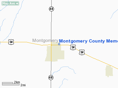
Montgomery County Memorial Heliport |
Location &
QuickFacts
|
FAA
Information Effective: |
2007-07-05 |
|
Airport
Identifier: |
IA91 |
|
Airport
Status: |
Operational |
|
Longitude/Latitude: |
095-12-53.1670W/41-01-37.7730N
-95.214769/41.027159 (Estimated) |
|
Elevation: |
1181 ft / 359.97 m (Estimated) |
|
Land: |
0 acres |
|
From
nearest city: |
3 nautical miles NE of Red Oak, IA |
|
Location: |
Montgomery County, IA |
|
Magnetic Variation: |
06E (1990) |
Owner & Manager
|
Ownership: |
Publicly owned |
|
Owner: |
Montgomery Co Memorial Hosp |
|
Address: |
2301 Eastern Avenue
Red Oak, IA 51566 |
|
Phone
number: |
712-623-7000 |
|
Manager: |
Roger L Hansen Facility Mgr |
|
Address: |
2301 Eastern Avenue
Red Oak, IA 51566 |
|
Phone number: |
712-623-7176 |
Airport Operations and Facilities
|
Airport
Use: |
Private
MEDICAL USE. |
|
Wind
indicator: |
Yes |
|
Segmented Circle: |
No |
|
Control
Tower: |
No |
|
Sectional chart: |
Omaha |
|
Region: |
ACE - Central |
|
Boundary
ARTCC: |
ZMP - Minneapolis |
|
Tie-in
FSS: |
FOD - Fort Dodge |
|
FSS on
Airport: |
No |
|
FSS
Phone: |
515-955-8114 |
|
FSS Toll
Free: |
1-800-WX-BRIEF |
|
Runway Information
Helipad H1
|
Dimension: |
50 x 50 ft / 15.2 x 15.2 m |
|
Surface: |
CONC, |
|
|
Runway H1
|
Runway
|
|
Traffic
Pattern: |
Left |
Left |
|
Radio Navigation Aids
|
ID |
Type |
Name |
Ch |
Freq |
Var |
Dist |
|
RDK |
NDB |
Red Oak |
|
230.00 |
04E |
1.9 nm |
|
SDA |
NDB |
Shenandoah |
|
411.00 |
05E |
18.7 nm |
|
ICL |
NDB |
Clarinda |
|
353.00 |
04E |
20.0 nm |
|
CRZ |
NDB |
Corning |
|
278.00 |
04E |
20.8 nm |
|
AIO |
NDB |
Atlantic |
|
365.00 |
04E |
23.9 nm |
|
PMV |
NDB |
Plattsmouth |
|
329.00 |
06E |
32.1 nm |
|
HNR |
NDB |
Harlan |
|
272.00 |
05E |
33.7 nm |
|
AFK |
NDB |
Nebraska City |
|
347.00 |
05E |
38.8 nm |
|
GFZ |
NDB |
Greenfield |
|
338.00 |
04E |
39.2 nm |
|
OM |
NDB |
Gerfi |
|
320.00 |
05E |
39.3 nm |
|
UNE |
NDB |
Union County |
|
379.00 |
04E |
39.6 nm |
|
MLE |
NDB |
Millard |
|
371.00 |
06E |
42.0 nm |
|
ADU |
NDB |
Audubon |
|
266.00 |
04E |
42.2 nm |
|
EVU |
NDB |
Emville |
|
317.00 |
05E |
43.0 nm |
|
AYB |
NDB |
Auburn |
|
430.00 |
05E |
44.6 nm |
|
OFF |
TACAN |
Offutt |
054X |
|
05E |
31.5 nm |
|
OVR |
VORTAC |
Omaha |
110X |
116.30 |
08E |
25.1 nm |
|
OMA |
VOT |
Omaha |
|
109.00 |
|
34.4 nm |
Remarks
-
CLEAR
APPROACH/DEPARTURE PATHS FOR AN 8:1 GLIDE SLOPE AND CLEAR TRANSITIONAL SURFACE
FOR A 2:1 SLOPE ARE MAINTAINED.
Montgomery County Memorial Heliport
Address:
Montgomery County, IA
Tel:
712-623-7000,
712-623-7176
Images
and information placed above are from
http://www.airport-data.com/airport/IA91/
We
thank them for the data!
|
General Info |
| Country |
United
States |
| State |
IOWA
|
| FAA ID |
IA91
|
| Latitude |
41-01-37.773N |
|
Longitude |
095-12-53.167W |
|
Elevation |
1181
feet |
| Near
City |
RED OAK
|
We don't guarantee the information is fresh and accurate. The data may
be wrong or outdated.
For more up-to-date information please refer to other sources.
|
|


