 |
|
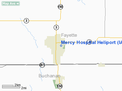
Mercy Hospital Fayette Heliport |
Location &
QuickFacts
|
FAA
Information Effective: |
2007-07-05 |
|
Airport
Identifier: |
IA57 |
|
Airport
Status: |
Operational |
|
Longitude/Latitude: |
091-54-06.6110W/42-40-25.9410N
-91.901836/42.673872 (Estimated) |
|
Elevation: |
1119 ft / 341.07 m (Estimated) |
|
Land: |
0 acres |
|
From
nearest city: |
0 nautical miles W of Oelwein, IA |
|
Location: |
Fayette County, IA |
|
Magnetic Variation: |
03E (1985) |
Owner & Manager
|
Ownership: |
Privately owned |
|
Owner: |
Mercy Hosp-franciscan Sisters |
|
Address: |
201 8th Ave Se
Oelwein, IA 50662 |
|
Phone
number: |
319-283-2314 |
|
Manager: |
Ed Lindon, Chief Engr |
|
Address: |
201 8th Ave Se
Oelwein, IA 50662 |
|
Phone number: |
319-283-2314 |
Airport Operations and Facilities
|
Airport
Use: |
Private
MEDICAL USE. |
|
Segmented Circle: |
No |
|
Control
Tower: |
No |
|
Lighting
Schedule: |
PHONE REQ
FOR PERIMETER LGTS CALL 319-283-2314. |
|
Sectional chart: |
Chicago |
|
Region: |
ACE - Central |
|
Boundary
ARTCC: |
ZAU - Chicago |
|
Tie-in
FSS: |
FOD - Fort Dodge |
|
FSS on
Airport: |
No |
|
FSS
Phone: |
515-955-8114 |
|
FSS Toll
Free: |
1-800-WX-BRIEF |
|
Runway Information
Helipad H1
|
Dimension: |
30 x 30 ft / 9.1 x 9.1 m |
|
Surface: |
CONC, |
|
|
Runway H1
|
Runway
|
|
Traffic
Pattern: |
Left |
Left |
|
Radio Navigation Aids
|
ID |
Type |
Name |
Ch |
Freq |
Var |
Dist |
|
OLZ |
NDB |
Oelwein |
|
260.00 |
02E |
3.3 nm |
|
IIB |
NDB |
Wapsie |
|
206.00 |
02E |
13.5 nm |
|
XWY |
NDB |
West Union |
|
278.00 |
02E |
17.1 nm |
|
VTI |
NDB |
Garrison |
|
338.00 |
03E |
27.7 nm |
|
DEH |
NDB |
Decorah |
|
236.00 |
01E |
36.9 nm |
|
CCY |
NDB |
Charles City |
|
375.00 |
03E |
39.1 nm |
|
CJJ |
NDB |
Cresco |
|
293.00 |
02E |
42.8 nm |
|
MXO |
NDB |
Monticello |
|
397.00 |
01E |
44.3 nm |
|
IY |
NDB |
Chukk |
|
417.00 |
03E |
45.7 nm |
|
CID |
VOR/DME |
Cedar Rapids |
088X |
114.10 |
05E |
47.5 nm |
|
ALO |
VORTAC |
Waterloo |
059X |
112.20 |
06E |
23.1 nm |
|
UKN |
VORTAC |
Waukon |
113X |
116.60 |
05E |
39.8 nm |
Remarks
-
PRVDD CLEAR 8:1
SLOPE FOR APCH/DEP PATHS AND 2:1 SLOPE FOR TRANSITIONAL SFC; BOILER HOUSE
CHIMNEY IS OBSTR LGTD AND PLINES MKD WITH DAY-GLO SPHERICAL MARKERS.
Mercy Hospital Fayette Heliport
Address:
Fayette County, IA
Tel:
319-283-2314
Images
and information placed above are from
http://www.airport-data.com/airport/IA57/
We
thank them for the data!
|
General Info |
| Country |
United
States |
| State |
IOWA
|
| FAA ID |
IA57
|
| Latitude |
42-40-25.941N |
|
Longitude |
091-54-06.611W |
|
Elevation |
1119
feet |
| Near
City |
OELWEIN
|
We don't guarantee the information is fresh and accurate. The data may
be wrong or outdated.
For more up-to-date information please refer to other sources.
|
|


