 |
|
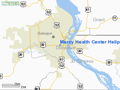
Mercy Health Center Heliport |
|
|
Location &
QuickFacts
|
FAA
Information Effective: |
2007-07-05 |
|
Airport
Identifier: |
IA10 |
|
Airport
Status: |
Operational |
|
Longitude/Latitude: |
090-40-22.4590W/42-29-30.0110N
-90.672905/42.491670 (Estimated) |
|
Elevation: |
1050 ft / 320.04 m (Estimated) |
|
Land: |
0 acres |
|
From
nearest city: |
6 nautical miles W of Dubuque, IA |
|
Location: |
Dubuque County, IA |
|
Magnetic Variation: |
01E (1985) |
Owner & Manager
|
Ownership: |
Privately owned |
|
Owner: |
Mercy Health Center |
|
Address: |
Dubuque, IA 52001 |
|
Phone
number: |
319-589-9698 |
|
Manager: |
Toby Wisecup |
|
Address: |
Mercy Health Center
Dubuque, IA 52001 |
|
Phone number: |
319-589-9698 |
Airport Operations and Facilities
|
Airport
Use: |
Private
MEDICAL. |
|
Wind
indicator: |
Yes |
|
Segmented Circle: |
Yes |
|
Control
Tower: |
No |
|
Lighting
Schedule: |
DUSK-DAWN |
|
Beacon
Color: |
Clear-Green-Yellow (heliport) |
|
Landing
fee charge: |
No |
|
Sectional chart: |
Chicago |
|
Region: |
ACE - Central |
|
Boundary
ARTCC: |
ZAU - Chicago |
|
Tie-in
FSS: |
FOD - Fort Dodge |
|
FSS on
Airport: |
No |
|
FSS
Phone: |
515-955-8114 |
|
FSS Toll
Free: |
1-800-WX-BRIEF |
|
Runway Information
Helipad H1
|
Dimension: |
70 x 70 ft / 21.3 x 21.3 m |
|
Surface: |
ASPH, |
|
|
Runway H1
|
Runway
|
|
Traffic
Pattern: |
Left |
Left |
|
Radio Navigation Aids
|
ID |
Type |
Name |
Ch |
Freq |
Var |
Dist |
|
PVB |
NDB |
Platteville |
|
203.00 |
01E |
15.8 nm |
|
OQW |
NDB |
Maquoketa |
|
386.00 |
02E |
26.6 nm |
|
MXO |
NDB |
Monticello |
|
397.00 |
01E |
27.0 nm |
|
MRJ |
NDB |
Mineral Point |
|
365.00 |
00W |
30.9 nm |
|
CWI |
NDB |
Clinton |
|
377.00 |
01E |
42.7 nm |
|
DBQ |
VORTAC |
Dubuque |
105X |
115.80 |
04E |
5.7 nm |
|
CVA |
VORTAC |
Davenport |
085X |
113.80 |
04E |
47.8 nm |
Remarks
-
PROVIDED
INGRESS/EGRESS ROUTES BE RESTRICTED TO 100 DEG TO 250 DEG.
Mercy Health Center Heliport
Address:
Dubuque County, IA
Tel:
319-589-9698
Images
and information placed above are from
http://www.airport-data.com/airport/IA10/
We
thank them for the data!
|
General Info |
| Country |
United
States |
| State |
IOWA
|
| FAA ID |
IA10
|
| Latitude |
42-29-30.011N |
|
Longitude |
090-40-22.459W |
|
Elevation |
1050
feet |
| Near
City |
DUBUQUE
|
We don't guarantee the information is fresh and accurate. The data may
be wrong or outdated.
For more up-to-date information please refer to other sources.
|
|


