 |
|
|
|
Location &
QuickFacts
|
FAA
Information Effective: |
2007-07-05 |
|
Airport
Identifier: |
7IA3 |
|
Airport
Status: |
Operational |
|
Longitude/Latitude: |
091-38-03.6370W/42-03-49.9920N
-91.634344/42.063887 (Estimated) |
|
Elevation: |
881 ft / 268.53 m (Surveyed) |
|
Land: |
80 acres |
|
From
nearest city: |
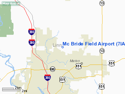
3 nautical miles NW of Marion, IA |
|
Location: |
Linn County, IA |
|
Magnetic Variation: |
02E (1985) |
Owner & Manager
|
Ownership: |
Privately owned |
|
Owner: |
Ivan Mc Bride |
|
Address: |
30 North Haven Dr.
Robins, IA 52328 |
|
Phone
number: |
319-393-8668 |
|
Manager: |
Linn Aviation |
|
Address: |
3423 Feather Bridge Road
Toddville, IA 52341 |
|
Phone number: |
319-377-9790 |
Airport Operations and Facilities
|
Airport Use: |
Private |
|
Wind indicator: |
Yes |
|
Segmented Circle: |
No |
|
Control Tower: |
No |
|
Lighting Schedule: |
DUSK-DAWN |
|
Landing fee charge: |
No |
|
Sectional chart: |
Chicago |
|
Region: |
ACE - Central |
|
Boundary ARTCC: |
ZAU - Chicago |
|
Tie-in FSS: |
FOD - Fort Dodge |
|
FSS on Airport: |
No |
|
FSS Phone: |
515-955-8114 |
|
FSS Toll Free: |
1-800-WX-BRIEF |
Airport
Communications
Airport Services
|
Runway Information
Runway 12/30
|
Dimension: |
2120 x 150 ft / 646.2 x 45.7 m |
|
Surface: |
TURF, Good Condition |
|
Edge Lights: |
Low |
|
|
Runway 12
|
Runway 30
|
|
Traffic
Pattern: |
Left |
Left |
|
Obstruction: |
15 ft road, 265.0 ft from runway, 17:1 slope to clear |
58 ft trees, 375.0 ft from runway, 125 ft right of
centerline, 6:1 slope to clear |
|
Radio Navigation Aids
|
ID |
Type |
Name |
Ch |
Freq |
Var |
Dist |
|
VTI |
NDB |
Garrison |
|
338.00 |
03E |
19.6 nm |
|
MXO |
NDB |
Monticello |
|
397.00 |
01E |
23.6 nm |
|
IIB |
NDB |
Wapsie |
|
206.00 |
02E |
27.3 nm |
|
TZT |
NDB |
Belle Plaine |
|
371.00 |
02E |
30.9 nm |
|
OQW |
NDB |
Maquoketa |
|
386.00 |
02E |
39.9 nm |
|
OLZ |
NDB |
Oelwein |
|
260.00 |
02E |
40.3 nm |
|
AWG |
NDB |
Washington |
|
219.00 |
02E |
47.2 nm |
|
CID |
VOR/DME |
Cedar Rapids |
088X |
114.10 |
05E |
12.6 nm |
|
DDD |
VOR/DME |
Port City |
112X |
116.50 |
01E |
47.2 nm |
|
IOW |
VORTAC |
Iowa City |
109X |
116.20 |
05E |
32.8 nm |
|
ALO |
VORTAC |
Waterloo |
059X |
112.20 |
06E |
45.1 nm |
|
DBQ |
VORTAC |
Dubuque |
105X |
115.80 |
04E |
45.9 nm |
Remarks
-
PROVIDED APCH TO
EACH RWY IS MAINTAINED FOR A MINIMUM 20:1 GLIDE SLOPE AND TRANSITIONAL SURFACE
BE MAINTAINED FOR A 7:1 SLOPE.
Based
Aircraft
|
Aircraft based
on field: |
10 |
|
Single Engine
Airplanes: |
10 |
Operational Statistics
Time Period:
1988-11-02 -
1989-11-01
|
Aircraft
Operations: |
31/Week |
|
General
Aviation Local: |
93.8% |
|
General
Aviation Itinerant: |
6.3% |
Mc Bride Field Airport
Address:
Linn County, IA
Tel:
319-393-8668,
319-377-9790
Images
and information placed above are from
http://www.airport-data.com/airport/7IA3/
We
thank them for the data!
|
General Info |
| Country |
United
States |
| State |
IOWA
|
| FAA ID |
7IA3
|
| Latitude |
42-03-49.992N |
|
Longitude |
091-38-03.637W |
|
Elevation |
881 feet
|
| Near
City |
MARION
|
We don't guarantee the information is fresh and accurate. The data may
be wrong or outdated.
For more up-to-date information please refer to other sources.
|
|


