 |
|
|
|
|
|
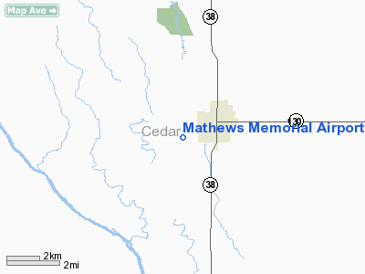
Location &
QuickFacts
|
FAA
Information Effective: |
2007-07-05 |
|
Airport
Identifier: |
8C4 |
|
Airport
Status: |
Operational |
|
Longitude/Latitude: |
091-09-10.5690W/41-45-48.0750N
-91.152936/41.763354 (Estimated) |
|
Elevation: |
840 ft / 256.03 m (Estimated) |
|
Land: |
68 acres |
|
From
nearest city: |
2 nautical miles SW of Tipton, IA |
|
Location: |
Cedar County, IA |
|
Magnetic Variation: |
02E (1985) |
Owner & Manager
|
Ownership: |
Publicly owned |
|
Owner: |
City Of Tipton
DOUG BOLDT CITY ADMIN. |
|
Address: |
407 Lynn St.
Tipton, IA 52772 |
|
Phone number: |
563-886-6187 |
|
Manager: |
Michael Moes |
|
Address: |
945 King Ave
Tipton, IA 52772 |
|
Phone number: |
563-886-6527
OR 563-357-0430 |
Airport
Operations and Facilities
|
Airport
Use: |
Open to public |
|
Wind
indicator: |
Yes |
|
Segmented Circle: |
No |
|
Control
Tower: |
No |
|
Lighting
Schedule: |
DUSK-DAWN |
|
Landing
fee charge: |
No |
|
Sectional chart: |
Chicago |
|
Region: |
ACE - Central |
|
Boundary
ARTCC: |
ZAU - Chicago |
|
Tie-in
FSS: |
FOD - Fort Dodge |
|
FSS on
Airport: |
No |
|
FSS
Phone: |
515-955-8114 |
|
FSS Toll
Free: |
1-800-WX-BRIEF |
|
NOTAMs
Facility: |
FOD (NOTAM-d service avaliable) |
Airport Communications
Airport Services
|
Fuel
available: |
100LL |
|
Airframe
Repair: |
NONE |
|
Power
Plant Repair: |
NONE |
|
Bottled
Oxygen: |
NONE |
|
Bulk
Oxygen: |
NONE |
|
Runway Information
Runway 11/29
|
Dimension: |
3000 x 60 ft / 914.4 x 18.3 m |
|
Surface: |
CONC, Good Condition |
|
Edge Lights: |
Non-standard lighting system
NSTD MIRL; 20 FT FM PAVEMENT EDGES. |
|
|
Runway 11
|
Runway 29
|
|
Longitude: |
091-09-29.1300W |
091-08-52.0100W |
|
Latitude: |
41-45-53.2300N |
41-45-42.9300N |
|
Elevation: |
840.00 ft |
840.00 ft |
|
Alignment: |
110 |
127 |
|
Traffic
Pattern: |
Left |
Left |
|
Markings: |
Basic, Fair Condition |
Basic, Fair Condition |
|
Obstruction: |
33 ft trees, 950.0 ft from runway, 75 ft right of
centerline, 22:1 slope to clear |
20 ft road, 450.0 ft from runway, 150 ft right of
centerline, 12:1 slope to clear |
|
Radio Navigation Aids
|
ID |
Type |
Name |
Ch |
Freq |
Var |
Dist |
|
OQW |
NDB |
Maquoketa |
|
386.00 |
02E |
25.3 nm |
|
MXO |
NDB |
Monticello |
|
397.00 |
01E |
26.3 nm |
|
CWI |
NDB |
Clinton |
|
377.00 |
01E |
37.2 nm |
|
AWG |
NDB |
Washington |
|
219.00 |
02E |
37.3 nm |
|
VTI |
NDB |
Garrison |
|
338.00 |
03E |
47.5 nm |
|
DDD |
VOR/DME |
Port City |
112X |
116.50 |
01E |
23.9 nm |
|
CID |
VOR/DME |
Cedar Rapids |
088X |
114.10 |
05E |
29.3 nm |
|
IOW |
VORTAC |
Iowa City |
109X |
116.20 |
05E |
25.4 nm |
|
CVA |
VORTAC |
Davenport |
085X |
113.80 |
04E |
30.2 nm |
|
MZV |
VORTAC |
Moline |
091X |
114.40 |
05E |
35.3 nm |
|
DBQ |
VORTAC |
Dubuque |
105X |
115.80 |
04E |
43.2 nm |
|
DVN |
VOT |
Davenport Municipal |
|
111.80 |
|
27.1 nm |
Remarks
Based
Aircraft
|
Aircraft based
on field: |
8 |
|
Single Engine
Airplanes: |
8 |
Operational Statistics
Time Period:
2004-08-20 -
2005-08-19
|
Aircraft
Operations: |
39/Week |
|
General
Aviation Local: |
59.4% |
|
General
Aviation Itinerant: |
39.6% |
|
Military: |
1.0% |
Mathews Memorial Airport
Address:
Cedar County, IA
Tel:
563-886-6187, 563-886-6527
Images
and information placed above are from
http://www.airport-data.com/airport/8C4/
We
thank them for the data!
|
General Info |
| Country |
United
States |
| State |
IOWA
|
| FAA ID |
8C4
|
| Latitude |
41-45-48.075N |
|
Longitude |
091-09-10.569W |
|
Elevation |
840 feet
|
| Near
City |
TIPTON
|
We don't guarantee the information is fresh and accurate. The data may
be wrong or outdated.
For more up-to-date information please refer to other sources.
|
|


