 |
|
Mason City Municipal Airport |
| Mason City Municipal Airport |
 |
| IATA: MCW â ICAO: KMCW
Location of Mason City Municipal Airport
|
| Summary |
| Airport type |
Public |
| Operator |
Mason City |
| Location |
Mason City, Iowa |
| Elevation AMSL |
1213 ft / 369.7 m |
| Coordinates |
43°09â²28â³N 93°19â²53â³W / 43.15778°N 93.33139°W / 43.15778; -93.33139Coordinates: 43°09â²28â³N 93°19â²53â³W / 43.15778°N 93.33139°W / 43.15778; -93.33139 |
| Runways |
| Direction |
Length |
Surface |
| ft |
m |
| 12/30 |
5,502 |
1,677 |
Asphalt |
| 18/36 |
6,501 |
1,982 |
Asphalt |
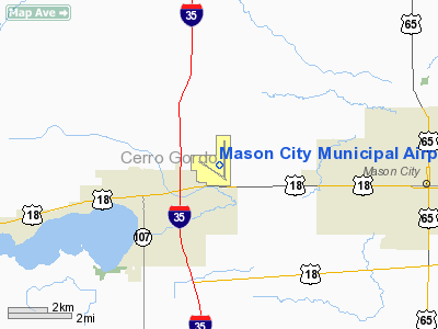
Mason City Municipal Airport (IATA: MCW, ICAO: KMCW) is a public airport located in the northern part of Lake Township, five miles (8 km) west of the central business district (CBD) of Mason City and just northeast of Clear Lake, both cities in Cerro Gordo County, Iowa, USA. The airport covers 1,102 acres (446 ha) and has two runways. It is mostly used for general aviation, but is also served by one commercial airline, Delta Connection (operated by Mesaba Airlines) providing service from Mason City to Minneapolis/St. Paul. Service is subsidized by the Essential Air Service program.
The airport was founded in 1927 by the Mason City Chamber of Commerce and the Clausen-Worden Post of the American Legion, hence its airport code "MCW".
In the early morning hours of February 3, 1959, following a concert at the Surf Ballroom in nearby Clear Lake, musicians Buddy Holly, Ritchie Valens and J.P. "The Big Bopper" Richardson, along with pilot Roger Peterson, died in a plane crash after taking off from the Mason City Municipal Airport. This event is not commemorated anywhere on the airport grounds.
Airlines and destinations
| Airlines |
Destinations |
| Delta Connection operated by Mesaba Airlines |
Minneapolis/St. Paul |
The above content comes from Wikipedia and is published under free licenses – click here to read more.
Location &
QuickFacts
|
FAA
Information Effective: |
2007-07-05 |
|
Airport
Identifier: |
MCW |
|
Airport
Status: |
Operational |
|
Longitude/Latitude: |
093-19-52.5380W/43-09-28.0530N
-93.331261/43.157793 (Estimated) |
|
Elevation: |
1213 ft / 369.72 m (Surveyed) |
|
Land: |
1062 acres |
|
From
nearest city: |
5 nautical miles W of Mason City, IA |
|
Location: |
Cerro Gordo County, IA |
|
Magnetic Variation: |
05E (1980) |
Owner & Manager
|
Ownership: |
Publicly owned |
|
Owner: |
City Of Mason City |
|
Address: |
Airport Commission
Mason City, IA 50402-1484 |
|
Phone number: |
641-421-3397 |
|
Manager: |
Pamela Osgood |
|
Address: |
Box 1484
Mason City, IA 50402-1484 |
|
Phone number: |
641-421-3397 |
Airport
Operations and Facilities
|
Airport
Use: |
Open to public |
|
Wind
indicator: |
Yes |
|
Segmented Circle: |
Yes |
|
Control
Tower: |
No |
|
Lighting
Schedule: |
DUSK-DAWN
ACTVT HIRL RY 18/36; MIRL RY 12/30; REIL RY 12; MALS RY 18; MALSR RY
36; VASI RY 18; PAPI RYS 12; 30; & 36 - CTAF.
ALL
PAPIS ON DURG DALGT HRS. |
|
Beacon
Color: |
Clear-Green (lighted land airport) |
|
Landing
fee charge: |
No |
|
Sectional chart: |
Omaha |
|
Region: |
ACE - Central |
|
Traffic
Pattern Alt: |
800 ft |
|
Boundary
ARTCC: |
ZMP - Minneapolis |
|
Tie-in
FSS: |
FOD - Fort Dodge |
|
FSS on
Airport: |
No |
|
FSS
Phone: |
515-955-8114 |
|
FSS Toll
Free: |
1-800-WX-BRIEF |
|
NOTAMs
Facility: |
MCW (NOTAM-d service avaliable) |
|
Certification type/date: |
I A S 05/1973
CLSD TO ACR OPNS WITH MORE THAN 30 PSGR SEATS EXCP 24 HRS PPR CALL
AMGR 641-421-3397.AIR CARRIER OPS IN EXCESS OF 15 MINUTES OUTSIDE
SCHEDULED ARRIVAL/DEPARTURE TIMES NOT AUTHORIZED EXCEPT WITH PRIOR
COORDINATION WITH AMGR. |
|
Federal Agreements: |
NGY3 |
Airport Communications
|
CTAF: |
123.000 |
|
Unicom: |
123.000 |
Airport Services
|
Fuel
available: |
100LLA |
|
Airframe
Repair: |
MAJOR |
|
Power
Plant Repair: |
MAJOR |
|
Runway Information
Runway 12/30
|
Dimension: |
5502 x 150 ft / 1677.0 x 45.7 m |
|
Surface: |
ASPH, |
|
Surface
Treatment: |
Saw-cut or plastic Grooved |
|
Weight Limit: |
Single wheel: 80000 lbs.
Dual wheel: 110000 lbs.
Dual tandem wheel: 180000 lbs. |
|
Edge Lights: |
Medium |
|
|
Runway 12
|
Runway 30
|
|
Longitude: |
093-20-38.0920W |
093-19-37.2390W |
|
Latitude: |
43-09-35.4250N |
43-09-04.3140N |
|
Elevation: |
1209.00 ft |
1192.00 ft |
|
Alignment: |
125 |
127 |
|
Traffic
Pattern: |
Left |
Left |
|
Markings: |
Non-precision instrument, Good Condition |
Non-precision instrument, Good Condition |
|
Crossing
Height: |
39.00 ft |
32.00 ft |
|
VASI: |
4-light PAPI on left side |
4-light PAPI on left side |
|
Visual
Glide Angle: |
3.00° |
3.00° |
|
Runway End
Identifier: |
Yes |
|
|
Obstruction: |
63 ft tree, 1700.0 ft from runway, 150 ft left of
centerline, 23:1 slope to clear |
41 ft bldg, 1650.0 ft from runway, 450 ft right of
centerline, 35:1 slope to clear |
|
Runway 18/36
|
Dimension: |
6501 x 150 ft / 1981.5 x 45.7 m |
|
Surface: |
ASPH, |
|
Surface
Treatment: |
Saw-cut or plastic Grooved |
|
Weight Limit: |
Single wheel: 80000 lbs.
Dual wheel: 110000 lbs.
Dual tandem wheel: 180000 lbs. |
|
Edge Lights: |
High |
|
|
Runway 18
|
Runway 36
|
|
Longitude: |
093-19-39.7450W |
093-19-39.6330W |
|
Latitude: |
43-10-07.0840N |
43-09-02.8750N |
|
Elevation: |
1213.00 ft |
1193.00 ft |
|
Alignment: |
127 |
127 |
|
ILS Type: |
|
ILS |
|
Traffic
Pattern: |
Left |
Left |
|
Markings: |
Non-precision instrument, Fair Condition |
Precision instrument, Fair Condition |
|
Crossing
Height: |
39.00 ft |
62.00 ft |
|
VASI: |
4-box on left side |
4-light PAPI on left side |
|
Visual
Glide Angle: |
3.00° |
2.90° |
|
Approach
lights: |
MALS |
MALSR |
|
Radio Navigation Aids
|
ID |
Type |
Name |
Ch |
Freq |
Var |
Dist |
|
FXY |
NDB |
Forest City |
|
359.00 |
05E |
13.5 nm |
|
HPT |
NDB |
Hampton |
|
230.00 |
03E |
26.4 nm |
|
IY |
NDB |
Chukk |
|
417.00 |
03E |
26.5 nm |
|
CAV |
NDB |
Clarion |
|
387.00 |
03E |
31.1 nm |
|
CCY |
NDB |
Charles City |
|
375.00 |
03E |
32.2 nm |
|
EAG |
NDB |
Eagle Grove |
|
302.00 |
03E |
37.1 nm |
|
IFA |
NDB |
Iowa Falls |
|
368.00 |
03E |
41.0 nm |
|
AXA |
NDB |
Algona |
|
403.00 |
03E |
41.5 nm |
|
SBU |
NDB |
Blue Earth |
|
332.00 |
04E |
42.6 nm |
|
EBS |
NDB |
Webster City |
|
323.00 |
03E |
49.2 nm |
|
JAY |
VOR/DME |
Austin |
019X |
108.20 |
03E |
30.9 nm |
|
AEL |
VOR/DME |
Albert Lea |
035X |
109.80 |
05E |
31.5 nm |
|
RST |
VOR/DME |
Rochester |
057X |
112.00 |
05E |
49.4 nm |
|
MCW |
VORTAC |
Mason City |
096X |
114.90 |
06E |
3.8 nm |
Remarks
-
BIRD AND DEER
ACTVTY ON & INVOF ARPT.
-
LANDING FEE FOR
ALL COMMERCIAL OPERATED ACFT.
-
DUE TO RY & TWY
END ELEV DIFFERENTIALS & ACFT HEIGHT; PILOTS MAY LOSE LINE OF SIGHT OF OTHER
ACFT ON OPPOSING RY & TWY ENDS.
ALL DEP/ARR ACFT USE CTAF.
-
RY 30 IS CALM
WIND RY.
-
ALL GA TRAFFIC
REMAIN CLEAR OF AIR CARRIER RAMP DURING AIR CARRIER OPERATIONS.
AIR CARRIER RAMP DEFINED BY
RED LINE.
-
AIRPORT OPERATIONS
641-421-3696.
-
ACFT OPNS 9 PSGR
SEATS OF MORE NOT AUTHORIZED IN EXCESS OF 15 MINS BEFORE/AFTER SCHEDULED ARR/DEP
TIME WITHOUT PPR, CALL 641-430-0980.
Based
Aircraft
|
Aircraft based
on field: |
55 |
|
Single Engine
Airplanes: |
45 |
|
Multi Engine
Airplanes: |
9 |
|
Jet Engine
Airplanes: |
1 |
Operational Statistics
Time Period:
2005-08-01 -
2006-07-31
|
Aircraft
Operations: |
96/Day |
|
Commerical: |
9.5% |
|
Air Taxi: |
4.3% |
|
General
Aviation Local: |
34.4% |
|
General
Aviation Itinerant: |
51.6% |
|
Military: |
0.2% |
Mason City Municipal Airport
Address:
Cerro Gordo County, IA
Tel:
641-421-3397
Images
and information placed above are from
http://www.airport-data.com/airport/MCW/
We
thank them for the data!
|
General Info |
| Country |
United
States |
| State |
IOWA
|
| FAA ID |
MCW
|
| Latitude |
43-09-28.053N |
|
Longitude |
093-19-52.538W |
|
Elevation |
1213
feet |
| Near
City |
MASON
CITY |
We don't guarantee the information is fresh and accurate. The data may
be wrong or outdated.
For more up-to-date information please refer to other sources.
|
|


