 |
|
|
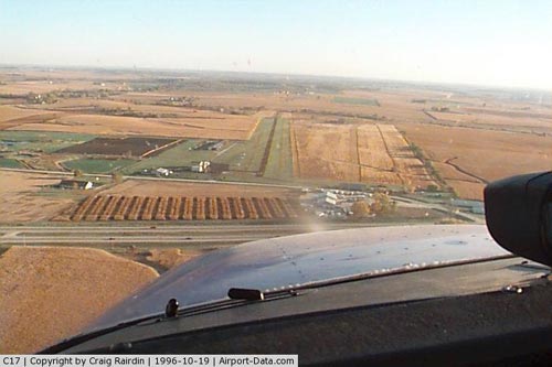 |
(Click on the photo to enlarge) |
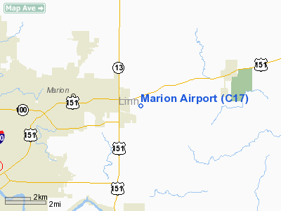
Location &
QuickFacts
|
FAA
Information Effective: |
2007-07-05 |
|
Airport
Identifier: |
C17 |
|
Airport
Status: |
Operational |
|
Longitude/Latitude: |
091-31-45.6320W/42-01-51.9990N
-91.529342/42.031111 (Estimated) |
|
Elevation: |
862 ft / 262.74 m (Estimated) |
|
Land: |
28 acres |
|
From
nearest city: |
3 nautical miles E of Marion, IA |
|
Location: |
Linn County, IA |
|
Magnetic Variation: |
02E (1985) |
Owner & Manager
|
Ownership: |
Privately owned |
|
Owner: |
Perry & Jan Walton |
|
Address: |
1710 Marion Airport Road
Marion, IA 52303 |
|
Phone
number: |
319-377-0457 |
|
Manager: |
Perry Walton |
|
Address: |
1710 Marion Airport Road
Marion, IA 52302 |
|
Phone number: |
319-377-0457
OR 319-377-9437 OR CELL 319-721-3990. |
Airport
Operations and Facilities
|
Airport
Use: |
Open to public |
|
Wind
indicator: |
Yes |
|
Segmented Circle: |
No |
|
Control
Tower: |
No |
|
Lighting
Schedule: |
DUSK-DAWN |
|
Beacon
Color: |
Clear-Green (lighted land airport) |
|
Landing
fee charge: |
No |
|
Sectional chart: |
Chicago |
|
Region: |
ACE - Central |
|
Boundary
ARTCC: |
ZAU - Chicago |
|
Tie-in
FSS: |
FOD - Fort Dodge |
|
FSS on
Airport: |
No |
|
FSS
Phone: |
515-955-8114 |
|
FSS Toll
Free: |
1-800-WX-BRIEF |
|
NOTAMs
Facility: |
FOD (NOTAM-d service avaliable) |
|
Federal Agreements: |
N |
Airport Communications
|
CTAF: |
122.700 |
|
Unicom: |
122.700 |
Airport Services
|
Fuel
available: |
100LLMOGAS |
|
Airframe
Repair: |
MAJOR |
|
Power
Plant Repair: |
MAJOR |
|
Bottled
Oxygen: |
NONE |
|
Bulk
Oxygen: |
NONE |
|
Runway Information
Runway 17/35
|
Dimension: |
3775 x 100 ft / 1150.6 x 30.5 m
EXTDD ON SOUTH END. |
|
Surface: |
ASPH-TURF, Good Condition
RY 17/35 CENTER 26 FT OF RY IS ASPH; REMAINDER IS TURF. ROUGH TRANSITION
FROM ASPH TO TURF FIRST 1000' ON RY 35. |
|
Edge Lights: |
Non-standard lighting system
LGTS 37' FROM RWY EDGE |
|
|
Runway 17
|
Runway 35
|
|
Traffic
Pattern: |
Left |
Left |
|
Displaced
threshold: |
260.00 ft |
100.00 ft |
|
Obstruction: |
18 ft road, 200.0 ft from runway
RWY 17 APCH SLOPE 25:1 TO DSPLCD THLD. |
, 0.0 ft from runway, 50:1 slope to clear
RWY 35 APCH SLOPE 50:1 TO DSPLCD THLD. |
|
Radio Navigation Aids
|
ID |
Type |
Name |
Ch |
Freq |
Var |
Dist |
|
MXO |
NDB |
Monticello |
|
397.00 |
01E |
20.2 nm |
|
VTI |
NDB |
Garrison |
|
338.00 |
03E |
24.7 nm |
|
IIB |
NDB |
Wapsie |
|
206.00 |
02E |
31.5 nm |
|
TZT |
NDB |
Belle Plaine |
|
371.00 |
02E |
34.8 nm |
|
OQW |
NDB |
Maquoketa |
|
386.00 |
02E |
35.2 nm |
|
OLZ |
NDB |
Oelwein |
|
260.00 |
02E |
44.0 nm |
|
AWG |
NDB |
Washington |
|
219.00 |
02E |
45.6 nm |
|
CID |
VOR/DME |
Cedar Rapids |
088X |
114.10 |
05E |
14.3 nm |
|
DDD |
VOR/DME |
Port City |
112X |
116.50 |
01E |
43.4 nm |
|
IOW |
VORTAC |
Iowa City |
109X |
116.20 |
05E |
31.0 nm |
|
DBQ |
VORTAC |
Dubuque |
105X |
115.80 |
04E |
42.8 nm |
|
ALO |
VORTAC |
Waterloo |
059X |
112.20 |
06E |
49.9 nm |
|
DVN |
VOT |
Davenport Municipal |
|
111.80 |
|
49.2 nm |
Remarks
-
DEER & WATERFOWL
ON & INVOF ARPT.
Based
Aircraft
|
Aircraft based
on field: |
29 |
|
Single Engine
Airplanes: |
21 |
|
Multi Engine
Airplanes: |
3 |
|
Helicopters: |
4 |
|
Ultralights: |
1 |
Operational Statistics
Time Period:
2003-10-18 -
2004-10-16
|
Aircraft
Operations: |
59/Day |
|
Air Taxi: |
0.9% |
|
General
Aviation Local: |
77.7% |
|
General
Aviation Itinerant: |
21.4% |
Marion Airport
Address:
Linn County, IA
Tel:
319-377-0457,
319-377-9437
Images
and information placed above are from
http://www.airport-data.com/airport/C17/
We
thank them for the data!
|
General Info |
| Country |
United
States |
| State |
IOWA
|
| FAA ID |
C17
|
| Latitude |
42-01-51.999N |
|
Longitude |
091-31-45.632W |
|
Elevation |
862 feet
|
| Near
City |
MARION
|
We don't guarantee the information is fresh and accurate. The data may
be wrong or outdated.
For more up-to-date information please refer to other sources.
|
|


