 |
|
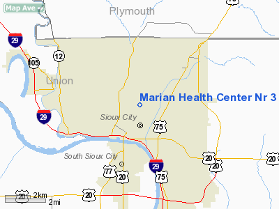
Marian Health Center Nr 3 Heliport |
Location &
QuickFacts
|
FAA
Information Effective: |
2007-07-05 |
|
Airport
Identifier: |
5IA4 |
|
Airport
Status: |
Operational |
|
Longitude/Latitude: |
096-23-51.1040W/42-30-50.9780N
-96.397529/42.514161 (Estimated) |
|
Elevation: |
1250 ft / 381.00 m (Estimated) |
|
Land: |
0 acres |
|
From
nearest city: |
3 nautical miles NE of Sioux City, IA |
|
Location: |
Woodbury County, IA |
|
Magnetic Variation: |
06E (1985) |
Owner & Manager
|
Ownership: |
Privately owned |
|
Owner: |
Sisters Of Mercy Health Corp. |
|
Address: |
801 5th St.
Sioux City, IA 51101 |
|
Phone
number: |
712-279-2010 |
|
Manager: |
Randy Ross |
|
Address: |
801 5th St.
Sioux City, IA 51101 |
|
Phone number: |
712-279-2010 |
Airport Operations and Facilities
|
Airport Use: |
Private
MEDICAL. |
|
Wind indicator: |
Yes |
|
Segmented Circle: |
No |
|
Control Tower: |
No |
|
Lighting Schedule: |
DUSK-DAWN |
|
Sectional chart: |
Omaha |
|
Region: |
ACE - Central |
|
Boundary ARTCC: |
ZMP - Minneapolis |
|
Tie-in FSS: |
FOD - Fort Dodge |
|
FSS Phone: |
515-955-8114 |
|
FSS Toll Free: |
1-800-WX-BRIEF |
Airport
Communications
|
Runway Information
Helipad H1
|
Dimension: |
60 x 60 ft / 18.3 x 18.3 m |
|
Surface: |
CONC, |
|
|
Runway H1
|
Runway
|
|
Traffic
Pattern: |
Left |
Left |
|
Radio Navigation Aids
|
ID |
Type |
Name |
Ch |
Freq |
Var |
Dist |
|
OI |
NDB |
Tommi |
|
305.00 |
07E |
4.3 nm |
|
GAK |
NDB |
Sioux Gateway |
|
233.00 |
06E |
6.4 nm |
|
SU |
NDB |
Salix |
|
414.00 |
07E |
12.2 nm |
|
VMR |
NDB |
Vermillion |
|
375.00 |
06E |
28.1 nm |
|
LCG |
NDB |
Wayne |
|
389.00 |
06E |
30.7 nm |
|
ORC |
NDB |
Orange City |
|
521.00 |
05E |
32.3 nm |
|
MEY |
NDB |
Mapleton |
|
335.00 |
05E |
33.5 nm |
|
SOY |
NDB |
Sioux Center |
|
368.00 |
06E |
38.3 nm |
|
CKP |
NDB |
Pilot Rock |
|
423.00 |
05E |
39.6 nm |
|
SHL |
NDB |
Sheldon |
|
338.00 |
05E |
48.9 nm |
|
TQE |
VOR |
Tekamah |
|
108.40 |
07E |
46.4 nm |
|
DDL |
VOR/DME |
Sheldon |
023X |
108.60 |
05E |
48.8 nm |
|
YKN |
VOR/DME |
Yankton |
051X |
111.40 |
07E |
49.9 nm |
|
SUX |
VORTAC |
Sioux City |
112X |
116.50 |
09E |
10.7 nm |
Remarks
-
PRVDD CLEAR APCH/DEP
PATHS TO LDG AREA FOR A MIN 8:1 GLIDE SLOPE AND TRANSITIONAL SFC FOR A MIN 2:1
SLOPE.
Based
Aircraft
|
Aircraft based
on field: |
1 |
|
Helicopters: |
1 |
Marian Health Center Nr 3 Heliport
Address:
Woodbury County, IA
Tel:
712-279-2010
Images
and information placed above are from
http://www.airport-data.com/airport/5IA4/
We
thank them for the data!
|
General Info |
| Country |
United
States |
| State |
IOWA
|
| FAA ID |
5IA4
|
| Latitude |
42-30-50.978N |
|
Longitude |
096-23-51.104W |
|
Elevation |
1250
feet |
| Near
City |
SIOUX
CITY |
We don't guarantee the information is fresh and accurate. The data may
be wrong or outdated.
For more up-to-date information please refer to other sources.
|
|


