 |
|
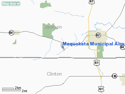
Maquoketa Municipal Airport |
|
|
Location &
QuickFacts
|
FAA
Information Effective: |
2007-07-05 |
|
Airport
Identifier: |
OQW |
|
Airport
Status: |
Operational |
|
Longitude/Latitude: |
090-44-19.6970W/42-03-00.2700N
-90.738805/42.050075 (Estimated) |
|
Elevation: |
769 ft / 234.39 m (Surveyed) |
|
Land: |
28 acres |
|
From
nearest city: |
3 nautical miles W of Maquoketa, IA |
|
Location: |
Jackson County, IA |
|
Magnetic Variation: |
00E (2000) |
Owner & Manager
|
Ownership: |
Publicly owned |
|
Owner: |
City Of Maquoketa |
|
Address: |
201 East Pleasant Street
Maquoketa, IA 52060 |
|
Phone
number: |
563-652-2484 |
|
Manager: |
Brian Wagner |
|
Address: |
201 East Pleasant Street
Maquoketa, IA 52060-9671 |
|
Phone number: |
563-652-6517 |
Airport Operations and Facilities
|
Airport
Use: |
Open to public |
|
Wind
indicator: |
Yes |
|
Segmented Circle: |
No |
|
Control
Tower: |
No |
|
Lighting
Schedule: |
DUSK-DAWN
ACTVT MIRL RY 15/33 5 TIMES ON; 7 TIMES OFF - CTAF. |
|
Beacon
Color: |
Clear-Green (lighted land airport) |
|
Landing
fee charge: |
No |
|
Sectional chart: |
Chicago |
|
Region: |
ACE - Central |
|
Boundary
ARTCC: |
ZAU - Chicago |
|
Tie-in
FSS: |
FOD - Fort Dodge |
|
FSS on
Airport: |
No |
|
FSS
Phone: |
515-955-8114 |
|
FSS Toll
Free: |
1-800-WX-BRIEF |
|
NOTAMs
Facility: |
FOD (NOTAM-d service avaliable) |
|
Federal Agreements: |
N |
Airport Communications
|
CTAF: |
122.800 |
|
Unicom: |
122.800 |
Airport Services
|
Fuel
available: |
100LL |
|
Airframe
Repair: |
NONE |
|
Power
Plant Repair: |
NONE |
|
Bottled
Oxygen: |
NONE |
|
Bulk
Oxygen: |
NONE |
|
Runway Information
Runway 15/33
|
Dimension: |
3300 x 60 ft / 1005.8 x 18.3 m |
|
Surface: |
CONC, Good Condition |
|
Edge Lights: |
Medium |
|
|
Runway 15
|
Runway 33
|
|
Longitude: |
090-44-29.0280W |
090-44-10.3680W |
|
Latitude: |
42-03-15.0300N |
42-02-45.5430N |
|
Elevation: |
769.00 ft |
738.00 ft |
|
Alignment: |
127 |
127 |
|
Traffic
Pattern: |
Left |
Left |
|
Markings: |
Non-precision instrument, Fair Condition |
Non-precision instrument, Fair Condition |
|
VASI: |
pulsating/steady burning on left side |
pulsating/steady burning on left side |
|
Runway End
Identifier: |
Yes |
Yes |
|
Obstruction: |
70 ft trees, 1550.0 ft from runway, 220 ft left of
centerline, 19:1 slope to clear |
100 ft pline, 2160.0 ft from runway, 410 ft left of
centerline, 19:1 slope to clear |
|
Radio Navigation Aids
|
ID |
Type |
Name |
Ch |
Freq |
Var |
Dist |
|
OQW |
NDB |
Maquoketa |
|
386.00 |
02E |
0.1 nm |
|
MXO |
NDB |
Monticello |
|
397.00 |
01E |
19.9 nm |
|
CWI |
NDB |
Clinton |
|
377.00 |
01E |
22.7 nm |
|
PVB |
NDB |
Platteville |
|
203.00 |
01E |
40.6 nm |
|
BOZ |
NDB |
Whiteside |
|
254.00 |
01E |
47.3 nm |
|
DDD |
VOR/DME |
Port City |
112X |
116.50 |
01E |
45.0 nm |
|
CID |
VOR/DME |
Cedar Rapids |
088X |
114.10 |
05E |
47.8 nm |
|
DBQ |
VORTAC |
Dubuque |
105X |
115.80 |
04E |
21.2 nm |
|
CVA |
VORTAC |
Davenport |
085X |
113.80 |
04E |
23.5 nm |
|
MZV |
VORTAC |
Moline |
091X |
114.40 |
05E |
44.1 nm |
|
DVN |
VOT |
Davenport Municipal |
|
111.80 |
|
27.3 nm |
Remarks
-
CTN: ULTRALIGHT
ACTVTY ON & INVOF ARPT.
-
RY 33 IS CALM
WIND RY.
Based
Aircraft
|
Aircraft based
on field: |
11 |
|
Single Engine
Airplanes: |
8 |
|
Multi Engine
Airplanes: |
3 |
Operational Statistics
Time Period:
2004-08-20 -
2005-08-19
|
Aircraft
Operations: |
106/Week |
|
General
Aviation Local: |
45.5% |
|
General
Aviation Itinerant: |
54.5% |
Maquoketa Municipal Airport
Address:
Jackson County, IA
Tel:
563-652-2484,
563-652-6517
Images
and information placed above are from
http://www.airport-data.com/airport/OQW/
We
thank them for the data!
|
General Info |
| Country |
United
States |
| State |
IOWA
|
| FAA ID |
OQW
|
| Latitude |
42-03-00.270N |
|
Longitude |
090-44-19.697W |
|
Elevation |
769 feet
|
| Near
City |
MAQUOKETA |
We don't guarantee the information is fresh and accurate. The data may
be wrong or outdated.
For more up-to-date information please refer to other sources.
|
|


