 |
|
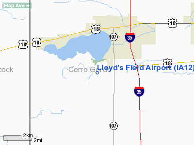
Location & QuickFacts
|
FAA Information Effective: |
2007-07-05 |
|
Airport Identifier: |
IA12 |
|
Airport Status: |
Operational |
|
Longitude/Latitude: |
093-24-07.7410W/43-05-49.8570N
-93.402150/43.097182 (Estimated) |
|
Elevation: |
1220 ft / 371.86 m (Estimated) |
|
Land: |
0 acres |
|
From nearest city: |
4 nautical miles S of Clear Lake, IA |
|
Location: |
Cerro Gordo County, IA |
|
Magnetic Variation: |
03E (1995) |
Owner & Manager
|
Ownership: |
Privately owned |
|
Owner: |
Lloyd Wreghitt |
|
Address: |
Rt 1, Box 134
Clear Lake, IA 50428 |
|
Phone
number: |
515-357-4050 |
|
Manager: |
Lloyd Wreghitt |
|
Address: |
Rt 1, Box 134
Clear Lake, IA 50428 |
|
Phone number: |
515-357-4050 |
Airport Operations and Facilities
|
Airport
Use: |
Private |
|
Wind
indicator: |
Yes |
|
Segmented Circle: |
No |
|
Control
Tower: |
No |
|
Region: |
ACE - Central |
|
Boundary
ARTCC: |
ZMP - Minneapolis |
|
Tie-in
FSS: |
FOD - Fort Dodge |
|
FSS
Phone: |
515-955-8114 |
|
FSS Toll
Free: |
1-800-WX-BRIEF |
|
Runway Information
Runway 18/36
|
Dimension: |
2500 x 70 ft / 762.0 x 21.3 m |
|
Surface: |
TURF, |
|
|
Runway 18
|
Runway 36
|
|
Traffic
Pattern: |
Right |
Left |
|
Obstruction: |
20 ft bldg, 100.0 ft from runway |
60 ft trees, 200.0 ft from runway |
|
Radio Navigation Aids
|
ID |
Type |
Name |
Ch |
Freq |
Var |
Dist |
|
FXY |
NDB |
Forest City |
|
359.00 |
05E |
12.7 nm |
|
HPT |
NDB |
Hampton |
|
230.00 |
03E |
23.7 nm |
|
CAV |
NDB |
Clarion |
|
387.00 |
03E |
26.3 nm |
|
IY |
NDB |
Chukk |
|
417.00 |
03E |
29.7 nm |
|
EAG |
NDB |
Eagle Grove |
|
302.00 |
03E |
32.4 nm |
|
CCY |
NDB |
Charles City |
|
375.00 |
03E |
34.9 nm |
|
IFA |
NDB |
Iowa Falls |
|
368.00 |
03E |
37.8 nm |
|
AXA |
NDB |
Algona |
|
403.00 |
03E |
38.2 nm |
|
SBU |
NDB |
Blue Earth |
|
332.00 |
04E |
42.7 nm |
|
EBS |
NDB |
Webster City |
|
323.00 |
03E |
44.5 nm |
|
AEL |
VOR/DME |
Albert Lea |
035X |
109.80 |
05E |
35.2 nm |
|
JAY |
VOR/DME |
Austin |
019X |
108.20 |
03E |
35.7 nm |
|
MCW |
VORTAC |
Mason City |
096X |
114.90 |
06E |
3.2 nm |
|
FOD |
VORTAC |
Fort Dodge |
082X |
113.50 |
07E |
49.0 nm |
Remarks
-
ARPT CLSD WINTER MONTHS.
-
PRVDD A CLEAR
APCH TO EACH RY FOR A 20:1 GLIDE SLOPE; A CLEAR TRANSITIONAL SFC FOR A 7:1
SLOPE; AND ALL TFC PATTERNS REMAIN WEST OF THE ARPT.
Based
Aircraft
|
Aircraft based
on field: |
3 |
|
Single Engine
Airplanes: |
3 |
Lloyd's Field Airport
Address:
Cerro Gordo County, IA
Tel:
515-357-4050
Images
and information placed above are from
http://www.airport-data.com/airport/IA12/
We
thank them for the data!
|
General Info |
| Country |
United
States |
| State |
IOWA
|
| FAA ID |
IA12
|
| Latitude |
43-05-49.857N |
|
Longitude |
093-24-07.741W |
|
Elevation |
1220
feet |
| Near
City |
CLEAR
LAKE |
We don't guarantee the information is fresh and accurate. The data may
be wrong or outdated.
For more up-to-date information please refer to other sources.
|
|


