 |
|
|
|
|
|
Location &
QuickFacts
|
FAA
Information Effective: |
2007-07-05 |
|
Airport
Identifier: |
62IA |
|
Airport
Status: |
Operational |
|
Longitude/Latitude: |
091-22-00.5960W/42-04-00.0100N
-91.366832/42.066669 (Estimated) |
|
Elevation: |
941 ft / 286.82 m (Surveyed) |
|
Land: |
7 acres |
|
From
nearest city: |
3 nautical miles N of Martelle, IA |
|
Location: |
Jones County, IA |
|
Magnetic Variation: |
02E (1985) |
Owner & Manager
|
Ownership: |
Privately owned |
|
Owner: |
Mrs. Darrell Lerch |
|
Address: |
9524 Hwy 151
Anamosa, IA 52205 |
|
Phone number: |
319-482-7341 |
|
Manager: |
Phyllis Lerch |
|
Address: |
9524 Hwy 151
Anamosa, IA 52205 |
|
Phone number: |
319-482-7341 |
Airport
Operations and Facilities
|
Airport
Use: |
Private |
|
Wind
indicator: |
Yes |
|
Segmented Circle: |
No |
|
Control
Tower: |
No |
|
Lighting
Schedule: |
PHONE REQ
FOR RWY LGTS 17/35 CALL 319-482-7341. |
|
Landing fee charge: |
No |
|
Sectional chart: |
Chicago |
|
Region: |
ACE - Central |
|
Boundary ARTCC: |
ZAU - Chicago |
|
Tie-in FSS: |
FOD - Fort Dodge |
|
FSS on Airport: |
No |
|
FSS Phone: |
515-955-8114 |
|
FSS Toll Free: |
1-800-WX-BRIEF |
Airport Services
|
Airframe
Repair: |
MAJOR |
|
Power
Plant Repair: |
MAJOR |
|
Runway Information
Runway 17/35
|
Dimension: |
2200 x 100 ft / 670.6 x 30.5 m |
|
Surface: |
TURF, |
|
|
Runway 17
|
Runway 35
|
|
Traffic
Pattern: |
Left |
Left |
|
Radio Navigation Aids
|
ID |
Type |
Name |
Ch |
Freq |
Var |
Dist |
|
MXO |
NDB |
Monticello |
|
397.00 |
01E |
13.0 nm |
|
OQW |
NDB |
Maquoketa |
|
386.00 |
02E |
27.9 nm |
|
VTI |
NDB |
Garrison |
|
338.00 |
03E |
30.6 nm |
|
IIB |
NDB |
Wapsie |
|
206.00 |
02E |
34.8 nm |
|
TZT |
NDB |
Belle Plaine |
|
371.00 |
02E |
42.4 nm |
|
OLZ |
NDB |
Oelwein |
|
260.00 |
02E |
45.9 nm |
|
CWI |
NDB |
Clinton |
|
377.00 |
01E |
48.6 nm |
|
AWG |
NDB |
Washington |
|
219.00 |
02E |
49.3 nm |
|
CID |
VOR/DME |
Cedar Rapids |
088X |
114.10 |
05E |
21.6 nm |
|
DDD |
VOR/DME |
Port City |
112X |
116.50 |
01E |
43.2 nm |
|
IOW |
VORTAC |
Iowa City |
109X |
116.20 |
05E |
34.7 nm |
|
DBQ |
VORTAC |
Dubuque |
105X |
115.80 |
04E |
35.5 nm |
|
CVA |
VORTAC |
Davenport |
085X |
113.80 |
04E |
45.0 nm |
|
DVN |
VOT |
Davenport Municipal |
|
111.80 |
|
44.4 nm |
Remarks
-
RWY 17-35 SOFT
DURING SPRING THAW, OPEN TO SNOW REMOVAL ONLY DURING WINTER MONTHS.
-
FENCE LINE
RUNNING PARALLEL ON E SIDE RWY 17-35 50' FM CNTRLN.
Based Aircraft
|
Aircraft based
on field: |
10 |
|
Single Engine
Airplanes: |
3 |
|
Ultralights: |
7 |
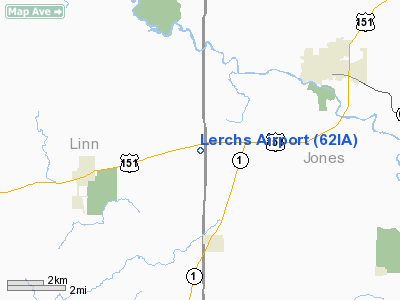
Lerchs Airport
Address:
Jones County, IA
Tel:
319-482-7341
Images
and information placed above are from
http://www.airport-data.com/airport/62IA/
We
thank them for the data!
|
General Info |
| Country |
United
States |
| State |
IOWA
|
| FAA ID |
62IA
|
| Latitude |
42-04-00.010N |
|
Longitude |
091-22-00.596W |
|
Elevation |
941 feet
|
| Near
City |
MARTELLE
|
We don't guarantee the information is fresh and accurate. The data may
be wrong or outdated.
For more up-to-date information please refer to other sources.
|
|


