 |
|
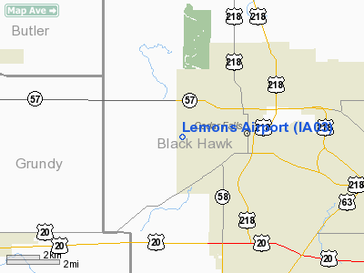
Location &
QuickFacts
|
FAA
Information Effective: |
2007-07-05 |
|
Airport
Identifier: |
IA03 |
|
Airport
Status: |
Operational |
|
Longitude/Latitude: |
092-29-40.6800W/42-31-19.9410N
-92.494633/42.522206 (Estimated) |
|
Elevation: |
970 ft / 295.66 m (Estimated) |
|
Land: |
0 acres |
|
From
nearest city: |
1 nautical miles W of Cedar Falls, IA |
|
Location: |
Black Hawk County, IA |
|
Magnetic Variation: |
03E (1985) |
Owner & Manager
|
Ownership: |
Privately owned |
|
Owner: |
David F Lemons |
|
Address: |
1824 Union Rd
Cedar Falls, IA 50613 |
|
Phone number: |
319-266-1894 |
|
Address: |
|
Airport Operations and Facilities
|
Airport Use: |
Private |
|
Wind indicator: |
No |
|
Segmented Circle: |
No |
|
Control Tower: |
No |
|
Sectional chart: |
Chicago |
|
Region: |
ACE - Central |
|
Boundary ARTCC: |
ZAU - Chicago |
|
Tie-in FSS: |
FOD - Fort Dodge |
|
FSS on Airport: |
No |
|
FSS Phone: |
515-955-8114 |
|
FSS Toll Free: |
1-800-WX-BRIEF |
Airport Services
|
Airframe
Repair: |
NONE |
|
Power
Plant Repair: |
NONE |
|
Runway Information
Runway 09/27
|
Dimension: |
1300 x 50 ft / 396.2 x 15.2 m |
|
Surface: |
TURF, |
|
|
Runway 09
|
Runway 27
|
|
Traffic
Pattern: |
Left |
Right |
|
Radio Navigation Aids
|
ID |
Type |
Name |
Ch |
Freq |
Var |
Dist |
|
IIB |
NDB |
Wapsie |
|
206.00 |
02E |
24.5 nm |
|
OLZ |
NDB |
Oelwein |
|
260.00 |
02E |
24.9 nm |
|
VTI |
NDB |
Garrison |
|
338.00 |
03E |
27.8 nm |
|
MIW |
NDB |
Marshalltown |
|
239.00 |
03E |
31.1 nm |
|
CCY |
NDB |
Charles City |
|
375.00 |
03E |
33.2 nm |
|
IFA |
NDB |
Iowa Falls |
|
368.00 |
03E |
34.3 nm |
|
HPT |
NDB |
Hampton |
|
230.00 |
03E |
34.5 nm |
|
IY |
NDB |
Chukk |
|
417.00 |
03E |
38.2 nm |
|
TZT |
NDB |
Belle Plaine |
|
371.00 |
02E |
39.4 nm |
|
XWY |
NDB |
West Union |
|
278.00 |
02E |
40.4 nm |
|
GGI |
NDB |
Grinnell |
|
248.00 |
02E |
49.9 nm |
|
JWJ |
VOR/DME |
Elmwood |
031X |
109.40 |
03E |
30.8 nm |
|
CID |
VOR/DME |
Cedar Rapids |
088X |
114.10 |
05E |
49.5 nm |
|
ALO |
VORTAC |
Waterloo |
059X |
112.20 |
06E |
4.7 nm |
Remarks
Lemons Airport
Address:
Black Hawk County, IA
Tel:
319-266-1894
Images
and information placed above are from
http://www.airport-data.com/airport/IA03/
We
thank them for the data!
|
General Info |
| Country |
United
States |
| State |
IOWA
|
| FAA ID |
IA03
|
| Latitude |
42-31-19.941N |
|
Longitude |
092-29-40.680W |
|
Elevation |
970 feet
|
| Near
City |
CEDAR
FALLS |
We don't guarantee the information is fresh and accurate. The data may
be wrong or outdated.
For more up-to-date information please refer to other sources.
|
|


