 |
|
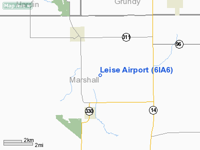
Location &
QuickFacts
|
FAA
Information Effective: |
2007-07-05 |
|
Airport
Identifier: |
6IA6 |
|
Airport
Status: |
Operational |
|
Longitude/Latitude: |
092-58-30.7230W/42-08-59.9500N
-92.975201/42.149986 (Estimated) |
|
Elevation: |
1000 ft / 304.80 m (Estimated) |
|
Land: |
6 acres |
|
From
nearest city: |
3 nautical miles NE of Albion, IA |
|
Location: |
Marshall County, IA |
|
Magnetic Variation: |
03E (1985) |
Owner & Manager
|
Ownership: |
Privately owned |
|
Owner: |
Merle Leise |
|
Address: |
2311 140th St
Albion, IA 50005 |
|
Phone number: |
515-496-5281 |
|
Manager: |
Merle Leise |
|
Address: |
2311 140th St
Albion, IA 50005 |
|
Phone number: |
515-496-5281 |
Airport Operations and Facilities
|
Airport Use: |
Private |
|
Wind indicator: |
No |
|
Segmented Circle: |
No |
|
Control Tower: |
No |
|
Landing fee charge: |
No |
|
Sectional chart: |
Chicago |
|
Region: |
ACE - Central |
|
Boundary ARTCC: |
ZAU - Chicago |
|
Tie-in FSS: |
FOD - Fort Dodge |
|
FSS on Airport: |
No |
|
FSS Phone: |
515-955-8114 |
|
FSS Toll Free: |
1-800-WX-BRIEF |
Airport Services
|
Airframe
Repair: |
NONE |
|
Power
Plant Repair: |
NONE |
|
Runway Information
Runway 17/35
|
Dimension: |
2400 x 60 ft / 731.5 x 18.3 m |
|
Surface: |
TURF, |
|
|
Runway 17
|
Runway 35
|
|
Traffic
Pattern: |
Left |
Left |
|
Radio Navigation Aids
|
ID |
Type |
Name |
Ch |
Freq |
Var |
Dist |
|
MIW |
NDB |
Marshalltown |
|
239.00 |
03E |
3.5 nm |
|
IFA |
NDB |
Iowa Falls |
|
368.00 |
03E |
23.5 nm |
|
GGI |
NDB |
Grinnell |
|
248.00 |
02E |
28.7 nm |
|
TZT |
NDB |
Belle Plaine |
|
371.00 |
02E |
34.8 nm |
|
HPT |
NDB |
Hampton |
|
230.00 |
03E |
36.3 nm |
|
IKV |
NDB |
Ankeny |
|
275.00 |
03E |
37.8 nm |
|
BNW |
NDB |
Boone |
|
407.00 |
03E |
39.6 nm |
|
VTI |
NDB |
Garrison |
|
338.00 |
03E |
42.8 nm |
|
EBS |
NDB |
Webster City |
|
323.00 |
03E |
43.4 nm |
|
PEA |
NDB |
Pella |
|
257.00 |
02E |
44.8 nm |
|
IIB |
NDB |
Wapsie |
|
206.00 |
02E |
49.0 nm |
|
CAV |
NDB |
Clarion |
|
387.00 |
03E |
49.9 nm |
|
JWJ |
VOR/DME |
Elmwood |
031X |
109.40 |
03E |
3.8 nm |
|
TNU |
VOR/DME |
Newton |
072X |
112.50 |
03E |
22.8 nm |
|
ALO |
VORTAC |
Waterloo |
059X |
112.20 |
06E |
35.4 nm |
|
DSM |
VOT |
Des Moines |
|
109.20 |
|
48.2 nm |
Based Aircraft
|
Aircraft based
on field: |
1 |
|
Single Engine
Airplanes: |
1 |
Leise Airport
Address:
Marshall County, IA
Tel:
515-496-5281
Images
and information placed above are from
http://www.airport-data.com/airport/6IA6/
We
thank them for the data!
|
General Info |
| Country |
United
States |
| State |
IOWA
|
| FAA ID |
6IA6
|
| Latitude |
42-08-59.950N |
|
Longitude |
092-58-30.723W |
|
Elevation |
1000
feet |
| Near
City |
ALBION
|
We don't guarantee the information is fresh and accurate. The data may
be wrong or outdated.
For more up-to-date information please refer to other sources.
|
|


