 |
|
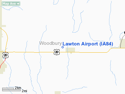
Location &
QuickFacts
|
FAA
Information Effective: |
2007-07-05 |
|
Airport
Identifier: |
IA84 |
|
Airport
Status: |
Operational |
|
Longitude/Latitude: |
096-12-01.0850W/42-28-59.9730N
-96.200301/42.483326 (Estimated) |
|
Elevation: |
1235 ft / 376.43 m (Estimated) |
|
Land: |
8 acres |
|
From
nearest city: |
1 nautical miles W of Lawton, IA |
|
Location: |
Woodbury County, IA |
|
Magnetic Variation: |
06E (1985) |
Owner & Manager
|
Ownership: |
Privately owned |
|
Owner: |
Ken Uhl |
|
Address: |
2025 Highway 20
Lawton, IA 51030 |
|
Phone number: |
712-944-5445 |
|
Manager: |
Ken Uhl |
|
Address: |
2025 Highway 20
Lawton, IA 51030 |
|
Phone number: |
712-944-5445 |
Airport Operations and Facilities
|
Airport Use: |
Private |
|
Wind indicator: |
Yes |
|
Segmented Circle: |
No |
|
Control Tower: |
No |
|
Landing fee charge: |
No |
|
Sectional chart: |
Omaha |
|
Region: |
ACE - Central |
|
Boundary ARTCC: |
ZMP - Minneapolis |
|
Tie-in FSS: |
FOD - Fort Dodge |
|
FSS on Airport: |
No |
|
FSS Phone: |
515-955-8114 |
|
FSS Toll Free: |
1-800-WX-BRIEF |
Airport Services
|
Bottled
Oxygen: |
NONE |
|
Bulk
Oxygen: |
NONE |
|
Runway Information
Runway 17/35
|
Dimension: |
2320 x 90 ft / 707.1 x 27.4 m |
|
Surface: |
TURF, Poor Condition |
|
|
Runway 17
|
Runway 35
|
|
Traffic
Pattern: |
Left |
Left |
|
Obstruction: |
4 ft fence, 82.0 ft from runway, 20:1 slope to clear |
39 ft trees, 935.0 ft from runway, 55 ft left of
centerline, 23:1 slope to clear |
|
Radio Navigation Aids
|
ID |
Type |
Name |
Ch |
Freq |
Var |
Dist |
|
GAK |
NDB |
Sioux Gateway |
|
233.00 |
06E |
9.4 nm |
|
SU |
NDB |
Salix |
|
414.00 |
07E |
10.2 nm |
|
OI |
NDB |
Tommi |
|
305.00 |
07E |
11.7 nm |
|
MEY |
NDB |
Mapleton |
|
335.00 |
05E |
25.6 nm |
|
ORC |
NDB |
Orange City |
|
521.00 |
05E |
31.2 nm |
|
CKP |
NDB |
Pilot Rock |
|
423.00 |
05E |
32.3 nm |
|
VMR |
NDB |
Vermillion |
|
375.00 |
06E |
36.6 nm |
|
LCG |
NDB |
Wayne |
|
389.00 |
06E |
37.7 nm |
|
SOY |
NDB |
Sioux Center |
|
368.00 |
06E |
39.1 nm |
|
SLB |
NDB |
Storm Lake |
|
434.00 |
04E |
42.9 nm |
|
SHL |
NDB |
Sheldon |
|
338.00 |
05E |
46.8 nm |
|
DNS |
NDB |
Denison |
|
350.00 |
04E |
47.3 nm |
|
TQE |
VOR |
Tekamah |
|
108.40 |
07E |
43.5 nm |
|
DDL |
VOR/DME |
Sheldon |
023X |
108.60 |
05E |
46.7 nm |
|
SUX |
VORTAC |
Sioux City |
112X |
116.50 |
09E |
10.0 nm |
Remarks
-
ARPT CLSD DURING
PERIODS OF SNOW.
-
PROVIDED APCHS TO
EACH END OF RWY ARE CLEARED FOR UNOBSTRUCTED 20:1 GLIDE SLOPE & THE
TRANSITIONAL SFC CLEARED TO A MINIMUM 7:1.
Based Aircraft
|
Aircraft based
on field: |
2 |
|
Single Engine
Airplanes: |
2 |
Operational Statistics
Time Period:
1992-06-22 -
1993-06-21
|
Aircraft
Operations: |
28/Month |
|
General
Aviation Local: |
92.3% |
|
General
Aviation Itinerant: |
7.7% |
Lawton Airport
Address:
Woodbury County, IA
Tel:
712-944-5445
Images
and information placed above are from
http://www.airport-data.com/airport/IA84/
We
thank them for the data!
|
General Info |
| Country |
United
States |
| State |
IOWA
|
| FAA ID |
IA84
|
| Latitude |
42-28-59.973N |
|
Longitude |
096-12-01.085W |
|
Elevation |
1235
feet |
| Near
City |
LAWTON
|
We don't guarantee the information is fresh and accurate. The data may
be wrong or outdated.
For more up-to-date information please refer to other sources.
|
|


