 |
|
|
|
|
|
Location &
QuickFacts
|
FAA
Information Effective: |
2007-07-05 |
|
Airport
Identifier: |
LWD |
|
Airport
Status: |
Operational |
|
Longitude/Latitude: |
093-54-07.8130W/40-37-59.9990N
-93.902170/40.633333 (Estimated) |
|
Elevation: |
1131 ft / 344.73 m (Estimated) |
|
Land: |
60 acres |
|
From
nearest city: |
2 nautical miles NE of Lamoni, IA |
|
Location: |
Decatur County, IA |
|
Magnetic Variation: |
03E (2000) |
Owner & Manager
|
Ownership: |
Publicly owned |
|
Owner: |
City Of Lamoni |
|
Address: |
190 S. Chestnut
Lamoni, IA 50140 |
|
Phone number: |
641-784-6311 |
|
Manager: |
Royce Dively |
|
Address: |
15550 - 280th Street
Lamoni, IA 50140 |
|
Phone number: |
641-784-6149
CELL PHONE 641-442-5324 |
Airport
Operations and Facilities
|
Airport
Use: |
Open to public |
|
Wind
indicator: |
Yes |
|
Segmented Circle: |
No |
|
Control
Tower: |
No |
|
Lighting
Schedule: |
DUSK-DAWN
ACTVT MIRL RY 18/36 - 122.8. |
|
Beacon
Color: |
Clear-Green (lighted land airport) |
|
Landing
fee charge: |
No |
|
Sectional chart: |
Chicago |
|
Region: |
ACE - Central |
|
Boundary
ARTCC: |
ZMP - Minneapolis |
|
Tie-in
FSS: |
FOD - Fort Dodge |
|
FSS on
Airport: |
No |
|
FSS
Phone: |
515-955-8114 |
|
FSS Toll
Free: |
1-800-WX-BRIEF |
|
NOTAMs
Facility: |
LWD (NOTAM-d service avaliable) |
|
Federal Agreements: |
N |
Airport Communications
Airport Services
|
Fuel
available: |
100LL
SELF SERVICE FUEL 24 HRS.
CREDIT
CARD |
|
Airframe
Repair: |
NONE |
|
Power
Plant Repair: |
NONE |
|
Bottled
Oxygen: |
NONE |
|
Bulk
Oxygen: |
NONE |
|
Runway Information
Runway 18/36
|
Dimension: |
2900 x 60 ft / 883.9 x 18.3 m |
|
Surface: |
CONC, Good Condition |
|
Edge Lights: |
Medium |
|
|
Runway 18
|
Runway 36
|
|
Longitude: |
093-54-07.5100W |
093-54-08.3100W |
|
Latitude: |
40-38-13.4700N |
40-37-44.8200N |
|
Elevation: |
1129.00 ft |
1130.00 ft |
|
Alignment: |
127 |
1 |
|
Traffic
Pattern: |
Left |
Left |
|
Markings: |
Basic, Good Condition |
Basic, Good Condition |
|
Obstruction: |
36 ft tree, 775.0 ft from runway, 280 ft left of
centerline, 15:1 slope to clear |
, 50:1 slope to clear |
|
Radio Navigation Aids
|
ID |
Type |
Name |
Ch |
Freq |
Var |
Dist |
|
UNE |
NDB |
Union County |
|
379.00 |
04E |
28.1 nm |
|
CNC |
NDB |
Chariton |
|
335.00 |
05E |
33.7 nm |
|
TRX |
NDB |
Trenton |
|
400.00 |
03E |
36.1 nm |
|
CRZ |
NDB |
Corning |
|
278.00 |
04E |
44.6 nm |
|
TVK |
NDB |
Centerville |
|
290.00 |
04E |
45.8 nm |
|
GFZ |
NDB |
Greenfield |
|
338.00 |
04E |
48.3 nm |
|
EVU |
NDB |
Emville |
|
317.00 |
05E |
49.4 nm |
|
LMN |
VORTAC |
Lamoni |
114X |
116.70 |
07E |
3.7 nm |
|
DSM |
VORTAC |
Des Moines |
122X |
117.50 |
07E |
49.7 nm |
Remarks
-
ULTRALIGHTS ON & INVOF ARPT.
Based Aircraft
|
Aircraft based
on field: |
9 |
|
Single Engine
Airplanes: |
8 |
|
Ultralights: |
1 |
Operational Statistics
Time Period:
2004-11-15 -
2005-11-14
|
Aircraft
Operations: |
37/Week |
|
General
Aviation Local: |
26.0% |
|
General
Aviation Itinerant: |
74.0% |
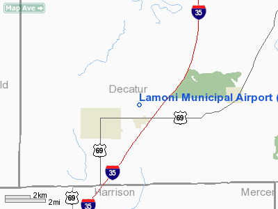
Lamoni Municipal Airport
Address:
Decatur County, IA
Tel:
641-784-6311, 641-784-6149
Images
and information placed above are from
http://www.airport-data.com/airport/LWD/
We
thank them for the data!
|
General Info |
| Country |
United
States |
| State |
IOWA
|
| FAA ID |
LWD
|
| Latitude |
40-37-59.999N |
|
Longitude |
093-54-07.813W |
|
Elevation |
1131
feet |
| Near
City |
LAMONI
|
We don't guarantee the information is fresh and accurate. The data may
be wrong or outdated.
For more up-to-date information please refer to other sources.
|
|


