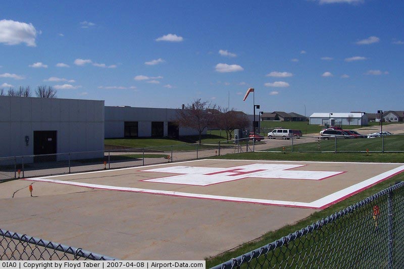
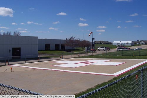
Knoxville Area Community Hospital Heliport |
|
 |
(Click on the photo to enlarge) |
Location &
QuickFacts
|
FAA
Information Effective: |
2007-07-05 |
|
Airport
Identifier: |
0IA0 |
|
Airport
Status: |
Operational |
|
Longitude/Latitude: |
093-05-45.7330W/41-19-00.9880N
-93.096037/41.316941 (Estimated) |
|
Elevation: |
927 ft / 282.55 m (Estimated) |
|
Land: |
0 acres |
|
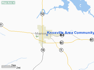
From
nearest city: |
0 nautical miles SW of Knoxville, IA |
|
Location: |
Marion County, IA |
|
Magnetic Variation: |
04E (1985) |
Owner & Manager
|
Ownership: |
Privately owned |
|
Owner: |
Knoxville Area Community Hosp |
|
Address: |
1002 South Lincoln
Knoxville, IA 50138 |
|
Phone number: |
515-842-2151 |
|
Manager: |
Hospital Administrator |
|
Address: |
1002 South Lincoln
Knoxville, IA 50138 |
|
Phone number: |
515-842-2151 |
Airport
Operations and Facilities
|
Airport
Use: |
Private
MEDICAL. |
|
Wind
indicator: |
Yes |
|
Segmented Circle: |
No |
|
Control
Tower: |
No |
|
Lighting
Schedule: |
PHONE REQ
FOR PERIMETER LGTS CALL 515-842-2151. |
|
Landing
fee charge: |
No |
|
Sectional chart: |
Chicago |
|
Region: |
ACE - Central |
|
Boundary
ARTCC: |
ZAU - Chicago |
|
Tie-in
FSS: |
FOD - Fort Dodge |
|
FSS on
Airport: |
No |
|
FSS
Phone: |
515-955-8114 |
|
FSS Toll
Free: |
1-800-WX-BRIEF |
|
Runway Information
Helipad H1
|
Dimension: |
65 x 65 ft / 19.8 x 19.8 m |
|
Surface: |
CONC, |
|
|
Runway H1
|
Runway
|
|
Traffic
Pattern: |
Left |
Left |
|
Radio Navigation Aids
|
ID |
Type |
Name |
Ch |
Freq |
Var |
Dist |
|
OXV |
NDB |
Knoxville |
|
284.00 |
03E |
1.5 nm |
|
PEA |
NDB |
Pella |
|
257.00 |
02E |
8.7 nm |
|
CNC |
NDB |
Chariton |
|
335.00 |
05E |
21.7 nm |
|
OOA |
NDB |
Oskaloosa |
|
414.00 |
03E |
28.0 nm |
|
GGI |
NDB |
Grinnell |
|
248.00 |
02E |
28.8 nm |
|
IKV |
NDB |
Ankeny |
|
275.00 |
03E |
31.1 nm |
|
TVK |
NDB |
Centerville |
|
290.00 |
04E |
38.9 nm |
|
BEX |
NDB |
Bloomfield |
|
269.00 |
02E |
45.7 nm |
|
MIW |
NDB |
Marshalltown |
|
239.00 |
03E |
48.3 nm |
|
TNU |
VOR/DME |
Newton |
072X |
112.50 |
03E |
28.1 nm |
|
OTM |
VOR/DME |
Ottumwa |
053X |
111.60 |
06E |
38.9 nm |
|
JWJ |
VOR/DME |
Elmwood |
031X |
109.40 |
03E |
48.5 nm |
|
DSM |
VORTAC |
Des Moines |
122X |
117.50 |
07E |
26.0 nm |
|
DSM |
VOT |
Des Moines |
|
109.20 |
|
29.2 nm |
Remarks
-
PRVDD HELIPORT IS
USED FOR EMERGENCY PURPOSES ONLY; INGRESS/EGRESS ROUTES SHALL BE ONLY TO THE
EAST & NORTHWEST & APCH/DEP PATHS TO THE. LNDG AREA ARE MAINTD FOR A MIN 8:1
GLIDE SLOPE & TRSNL SFC BE MAINTD FOR A MIN 2:1 GLIDE SLOPE.
Based
Aircraft
|
Aircraft based
on field: |
1 |
|
Helicopters: |
1 |
Knoxville Area Community Hospital
Heliport
Address:
Marion County, IA
Tel:
515-842-2151
Images
and information placed above are from
http://www.airport-data.com/airport/0IA0/
We
thank them for the data!
|
General Info |
| Country |
United
States |
| State |
IOWA
|
| FAA ID |
0IA0
|
| Latitude |
41-19-00.988N |
|
Longitude |
093-05-45.733W |
|
Elevation |
927 feet
|
| Near
City |
KNOXVILLE |
We don't guarantee the information is fresh and accurate. The data may
be wrong or outdated.
For more up-to-date information please refer to other sources.
|